Typhoon Krathon lingered off the coast of southwestern Taiwan in early October 2024 and is forecast to batter the idland’s populated west coast with torrential rain and damaging winds.
On its way to Taiwan, Krathon first thrashed northern parts of the Philippines, where the storm is known as Typhoon Julian. Its strong winds damaged roofs and toppled trees in the Philippine province of Batanes on September 29 and 30, according to news reports. The storm continued to strengthen as it moved northwest.
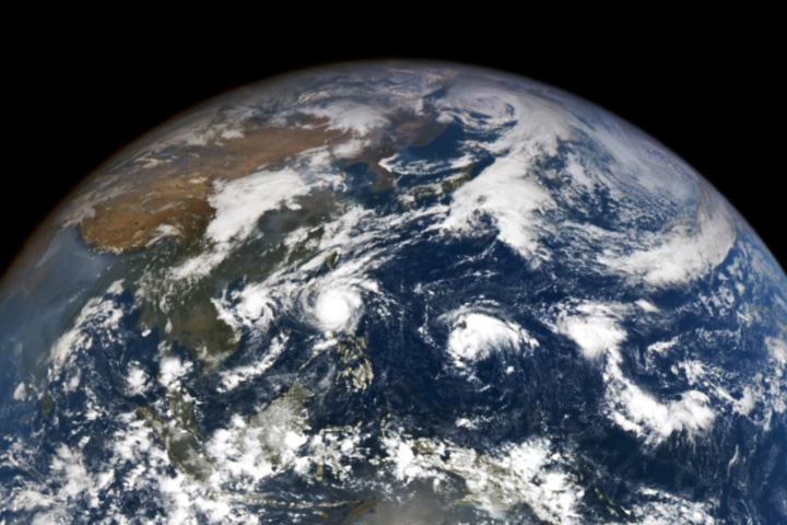
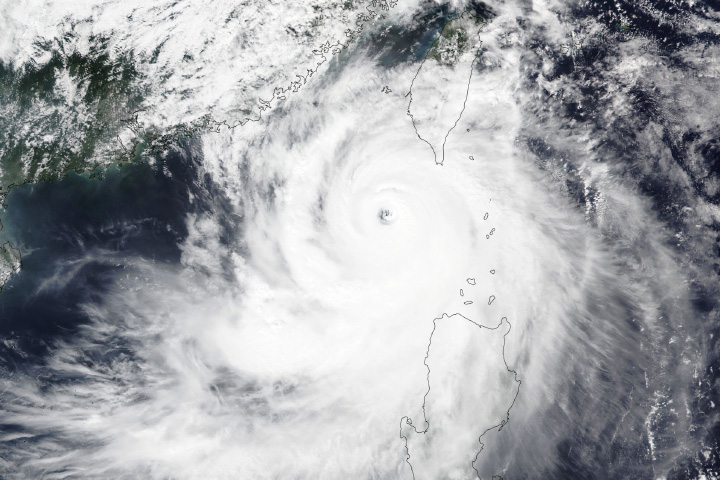
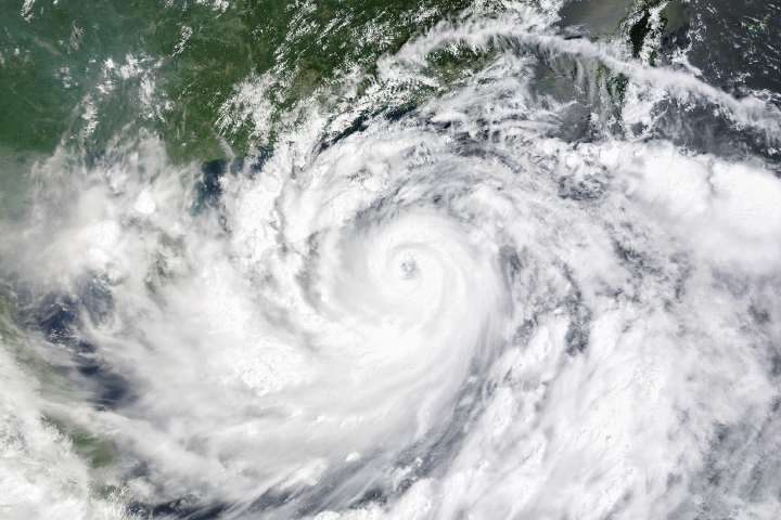
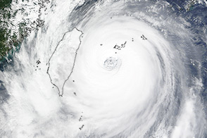
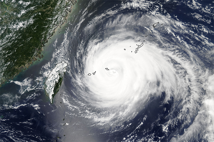
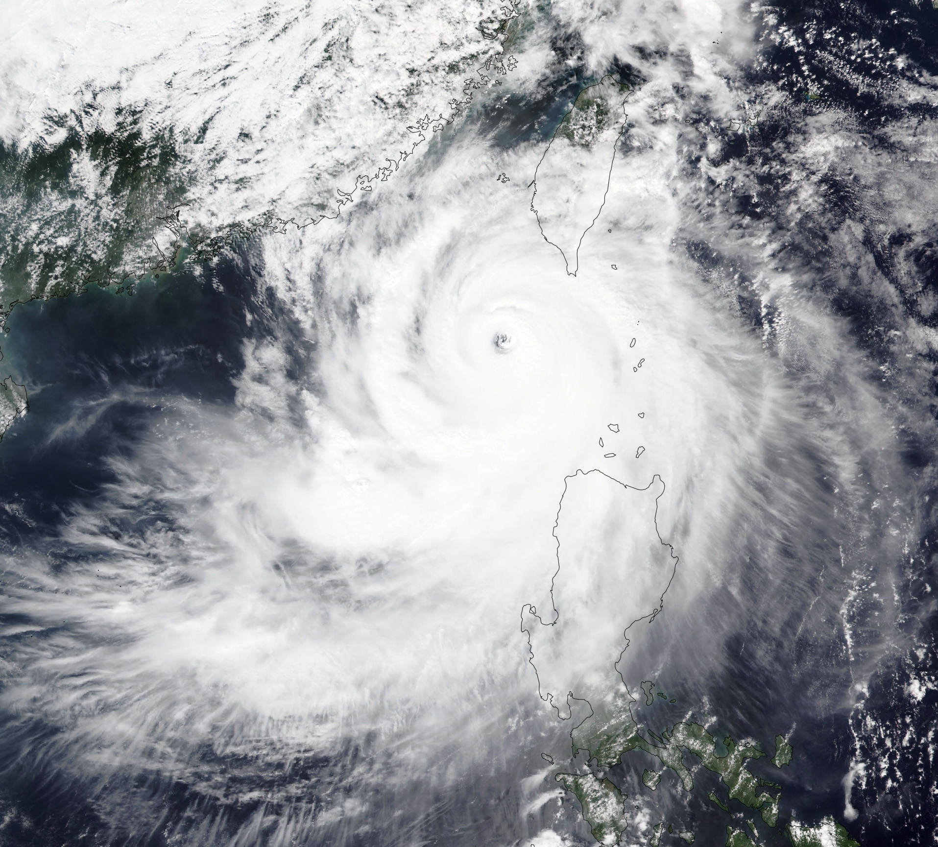
The image above, acquired by the VIIRS (Visible Infrared Imaging Radiometer Suite) on the NOAA-20 satellite, shows the typhoon at 1 p.m. local time (05:00 Universal Time) on September 30, when it was centered west of the Batanes Islands and about 155 kilometers (96 miles) southwest of Taiwan. The image below, captured at 10 a.m. local time (02:00 Universal Time) on September 30 by the OLI (Operational Land Imager) on Landsat 8, shows a closer view of the eye of Krathon.
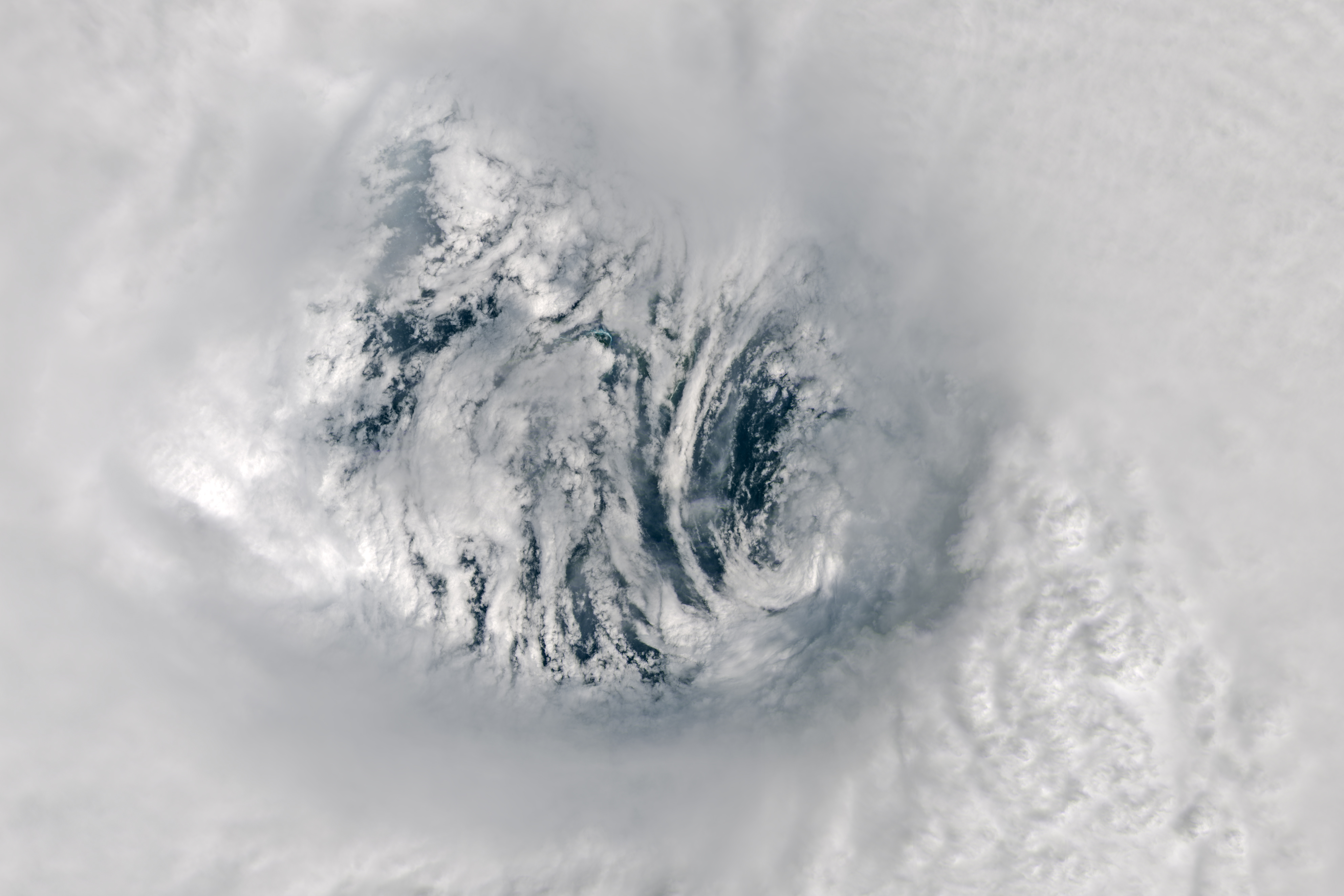
The eye of a hurricane is a circular zone of fair weather at the storm’s center. It is surrounded by a towering ring of extremely powerful thunderstorms called an eyewall, the part of the hurricane with the strongest winds.
About 19 hours after Landsat 8 acquired this image, the cyclone reached super typhoon status with sustained winds of 240 kilometers (150 miles) per hour—the equivalent of a Category 4 hurricane—according to the Joint Typhoon Warning Center (JTWC). At the time, JTWC noted that Krathon displayed a well-defined eyewall and estimated that the typhoon had likely peaked in intensity.
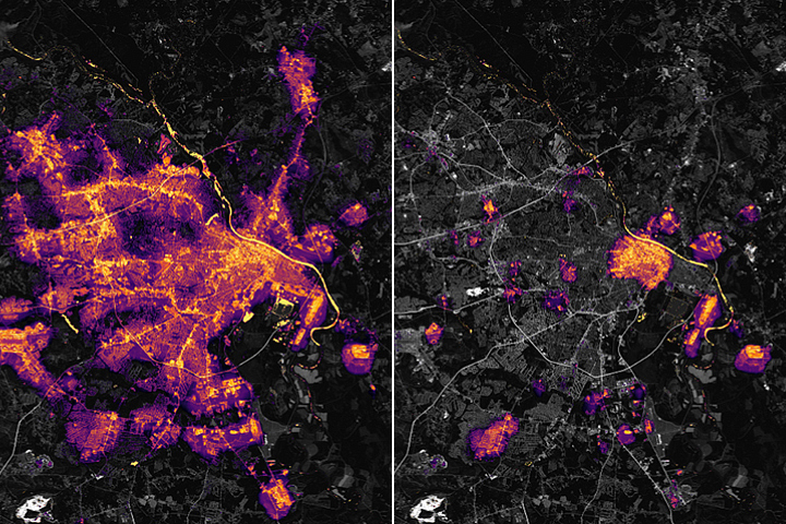
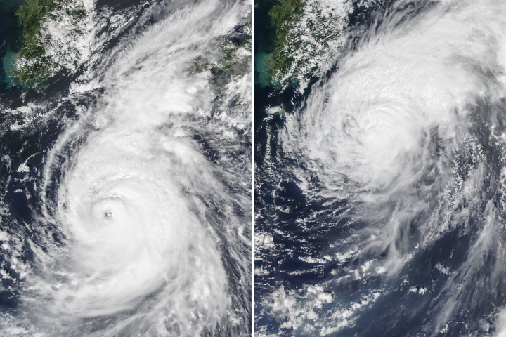
Krathon’s movement slowed and its intensity weakened on October 1 and 2 as it churned toward Taiwan’s southwest coast. Between September 30 and October 2, the storm had already brought 150 to 300 millimeters (6 to 12 inches) of rain to the east coast of Taiwan.
Typhoons in the Western Pacific often hit Taiwan’s mountainous and sparsely populated east coast, but Krathon is set to make landfall on its more populated western plain, near Kaohsiung. The typhoon season stretches across the entire year, but the majority of storms usually form between May and October.
NASA Earth Observatory image by Wanmei Liang and Lauren Dauphin, using VIIRS data from NASA EOSDIS LANCE, GIBS/Worldview, and the Joint Polar Satellite System (JPSS) and Landsat data from the U.S. Geological Survey. Story by Emily Cassidy.