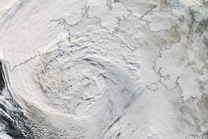
A powerful atmospheric river swept through the Gulf of Alaska in September 2024, bringing abundant rain to coastal British Columbia, Canada, and southeastern Alaska. Because of its duration and the concentration of moisture moving across the ocean, experts suspect this atmospheric river was among the most intense to transit the northeast Pacific in a satellite-based record going back to 2000.
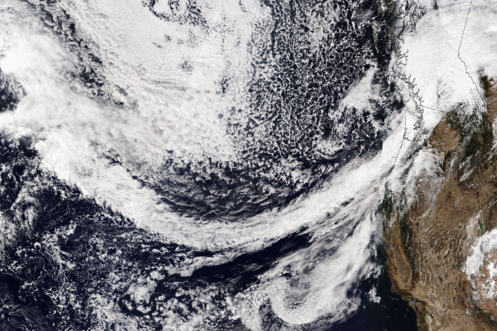
The potent storm is visible in this image, acquired by the VIIRS (Visible Infrared Imaging Radiometer Suite) on the Suomi NPP satellite on September 22. In this image, an elongated stream of water vapor—the hallmark of atmospheric rivers—had reached the west coast of North America after crossing the Pacific from Southeast Asia. When atmospheric rivers encounter land, they often release that water vapor in the form of rain or snow.
Areas along the coast of British Columbia and southeast Alaska saw days-long stretches of significant precipitation. In the town of Bella Bella, British Columbia, between 50 and 100 millimeters (2 and 4 inches) of rain fell each day from September 21 to 24. Rainfall totals in Yakutat, Alaska, topped 25 millimeters (1 inch) on September 23 and 24.
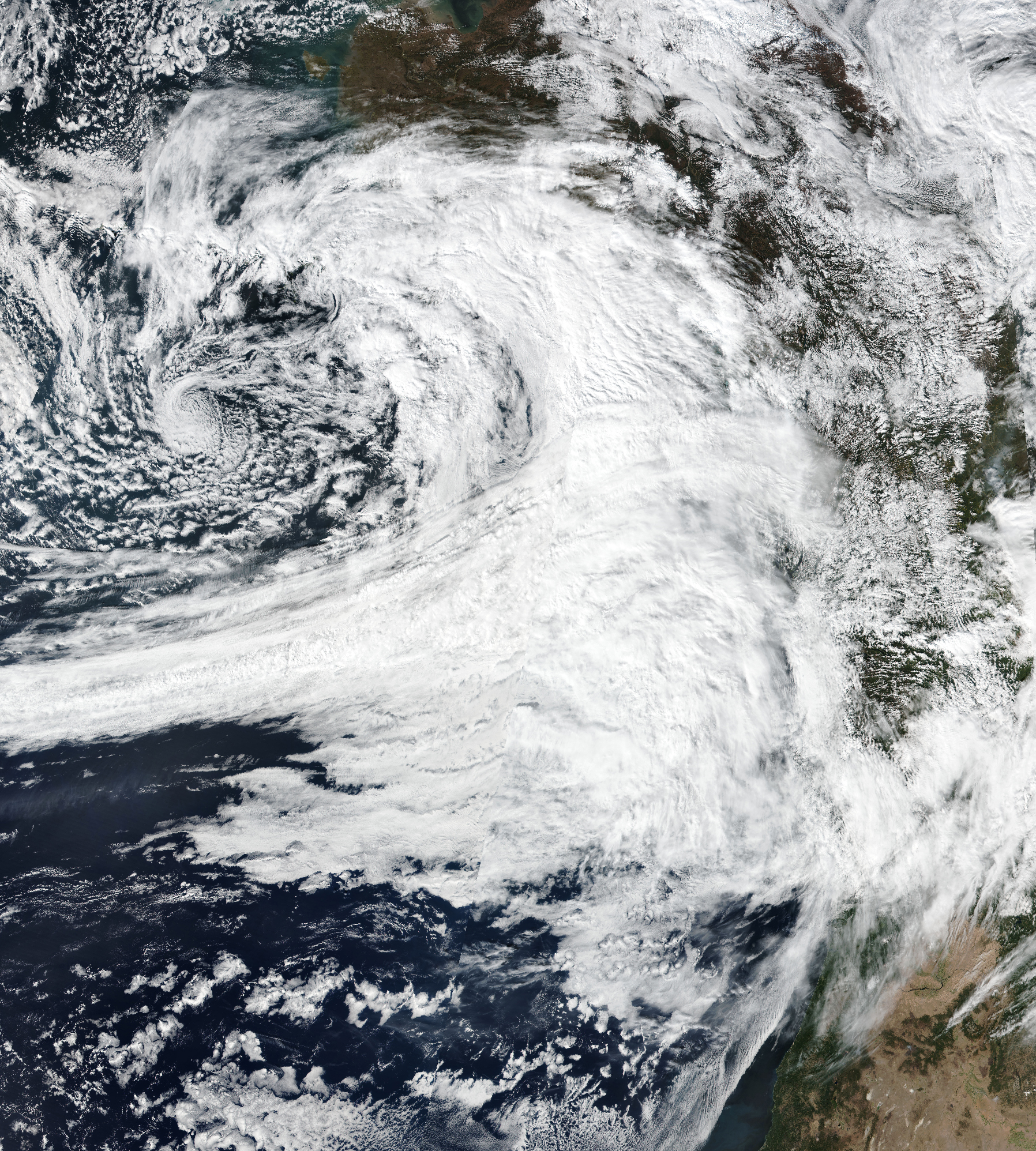
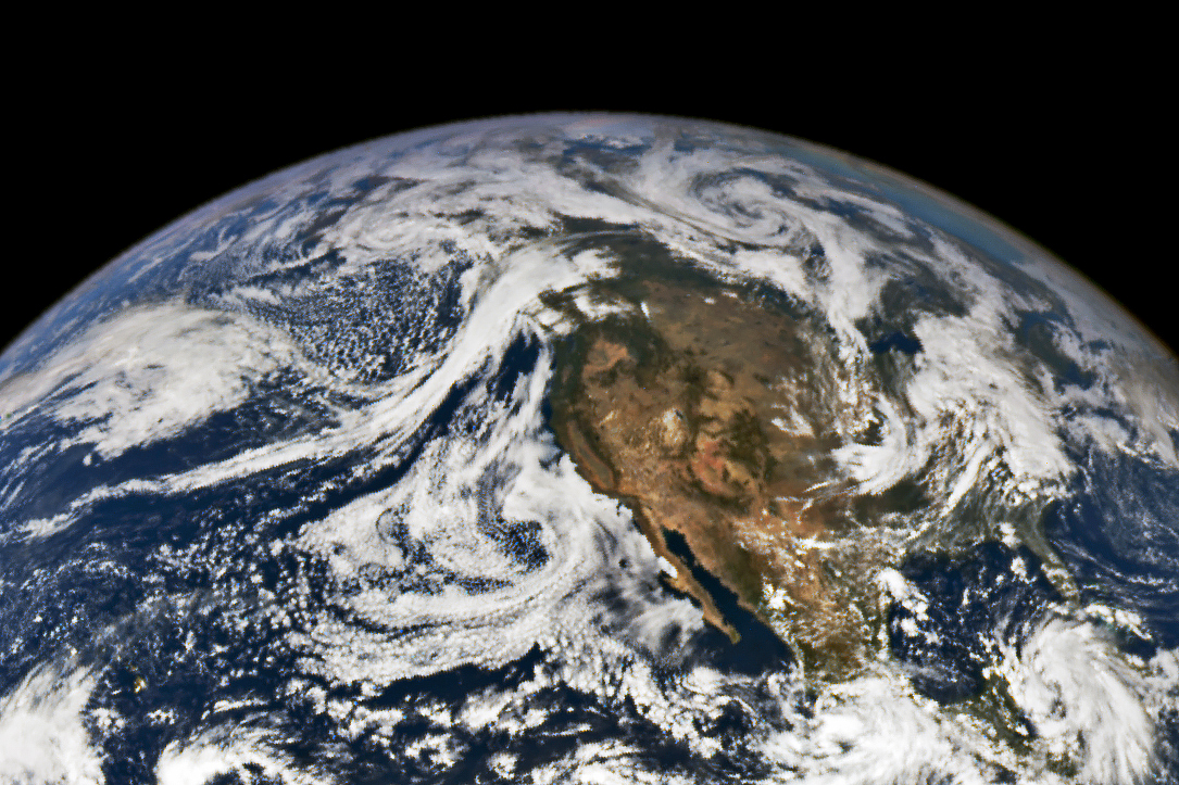
The ribbon of clouds delivering precipitation to the region was still visible on September 24, when NASA’s EPIC (Earth Polychromatic Imaging Camera) imager on the DSCOVR (Deep Space Climate Observatory) satellite captured an image (below) from about 1 million miles above Earth.
In 2019, scientists established a scale to classify atmospheric rivers based on their maximum intensity and duration. Similar to the Saffir-Simpson wind scale for hurricanes and the Enhanced Fujita scale for tornadoes, it is meant to help communicate potential storm effects to the public and distinguish between hazardous and more-beneficial events. (Atmospheric rivers bring replenishing rains and contribute to winter snowpack, particularly in the western United States.)
The storm shown here made landfall as a Category 5 atmospheric river—the highest tier on the scale—near Bella Bella and at progressively lower intensities to the north and south. Prior to making landfall, the system’s overall intensity was much higher.
Preliminary estimates indicate that this was an uncommonly strong event, said scientists affiliated with the Center for Western Weather and Water Extremes at the University of California, San Diego. An initial calculation of integrated water vapor transport (IVT)—a measure combining wind speed and moisture levels in the atmosphere—found anomalously high values in this system compared with other atmospheric rivers in the north Pacific in the past 23 years.
“The extremity of the Gulf of Alaska atmospheric river IVT is remarkable,” said Bin Guan, an atmospheric scientist at NASA’s Jet Propulsion Laboratory and the University of California, Los Angeles. The days leading up to the event saw the development of a strong Arctic Oscillation in its negative phase, he said. Such low values are extremely rare for September but can be conducive to atmospheric rivers in this region. “This could be one of the conditions that potentially contributed to this exceptionally strong atmospheric river event,” Guan said.
This storm system was expected to bend south late on September 24, according to news reports. However, more unsettled weather was forecast along the coast in the ensuing days, bringing less rain but high winds.
NASA Earth Observatory images by Michala Garrison, using VIIRS data from NASA EOSDIS LANCE, GIBS/Worldview, and the Suomi National Polar-orbiting Partnership and data from DSCOVR EPIC. Story by Lindsey Doermann.