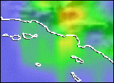
An unusually strong winter storm parked over California for several days in early February 2024, dropping a tremendous amount of rain that spurred widespread flash floods and hundreds of mudslides. Much of the rain fell on southern parts of the state, the product of a potent atmospheric river that delivered water vapor to the region from the tropical Pacific.
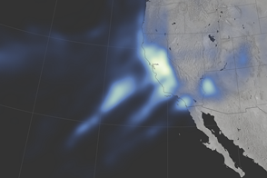
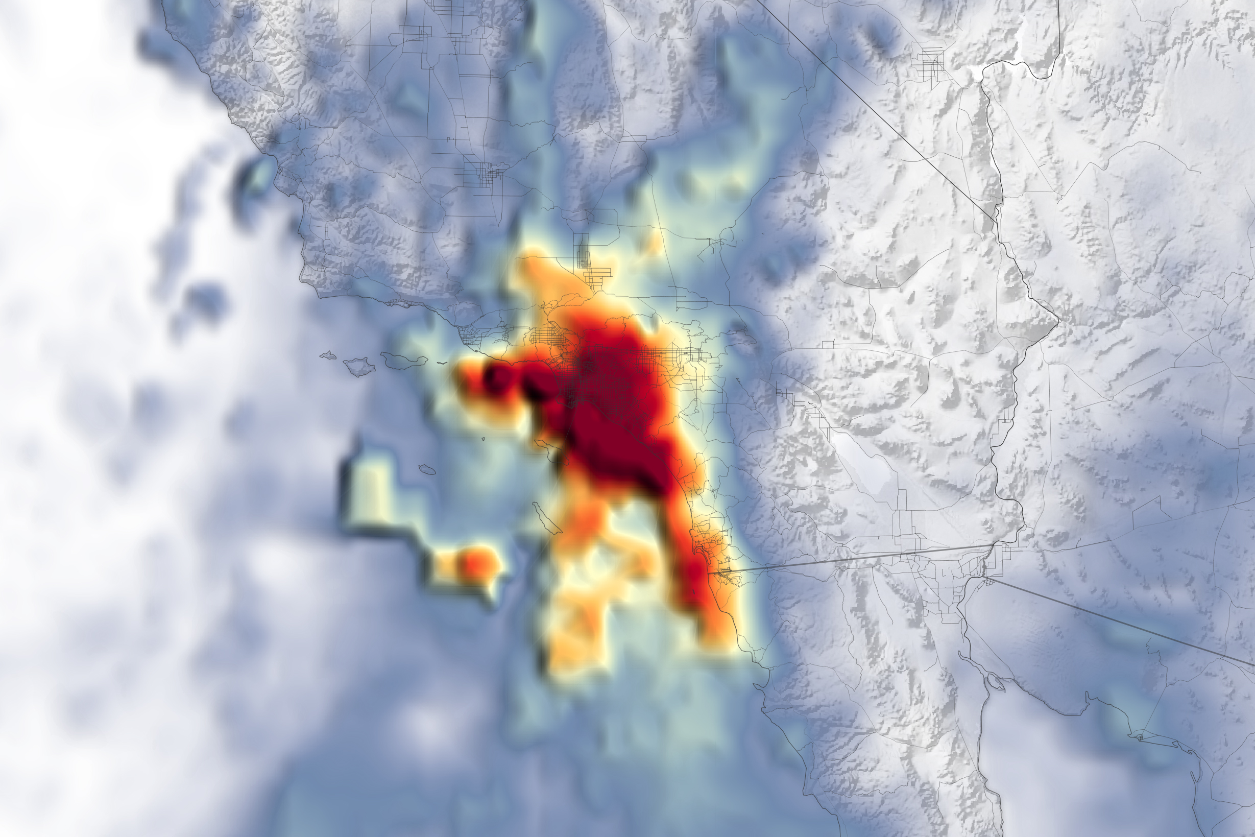
The map above shows a satellite-based estimate of the storm’s average rainfall rates. Data for the map were acquired between the afternoons (local time) of February 4 and February 6. The darkest reds reflect the highest rainfall rates, with the Los Angeles metropolitan area seeing the heaviest rains during this time.
Data for the map are remotely sensed estimates that come from IMERG (Integrated Multi-Satellite Retrievals for GPM), a product of the GPM (Global Precipitation Measurement) mission. Due to the averaging of the satellite data, local rainfall rates may be significantly higher when measured from the ground.
According to the National Weather Service, four-day rainfall totals as of February 6 exceeded 13 inches (330 millimeters) in parts of Los Angeles County. The neighborhood of Bel Air, for example, recorded 13.04 inches, and the area near Cogswell Dam recorded 13.86 inches. Los Angeles saw 7.03 inches of rain fall over the span of just two days, making February 5 and 6 the city’s wettest two-day stretch since January 1956, according to news reports.
The storm prompted state officials to declare a state of emergency for several counties in Southern California. While Southern California was battered by rainfall, floods, and mudslides, Northern California also saw its share of the storm. A steep pressure gradient caused raging winds, including gusts of 125 miles per hour at Mammoth Mountain and 77 miles per hour in San Francisco. Farther east, the system’s precipitation fell as snow, with several feet accumulating in the mountains.
During El Niño winters, atmospheric rivers—long, narrow bands of moisture running from the equator toward the poles—tend to carry more water vapor to California, leading to more intense precipitation. The current El Niño phase was declared in summer 2023 and is expected to dissipate in spring 2024.
NASA Earth Observatory image by Lauren Dauphin, using IMERG data from the Global Precipitation Mission (GPM) at NASA/GSFC. Story by Kathryn Hansen.