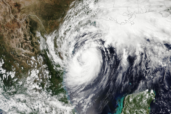
After forming in the warm waters of the Gulf of Mexico, Hurricane Francine set its sights on the coast of Louisiana in September 2024. Forecasters expected the storm to make landfall the evening of September 11, bringing dangerous storm surge to parts of the Louisiana coast and heavy rainfall along a large swath of the Gulf Coast, from western Louisiana to coastal Alabama. Francine will be the third hurricane to make landfall in the United States so far this season.
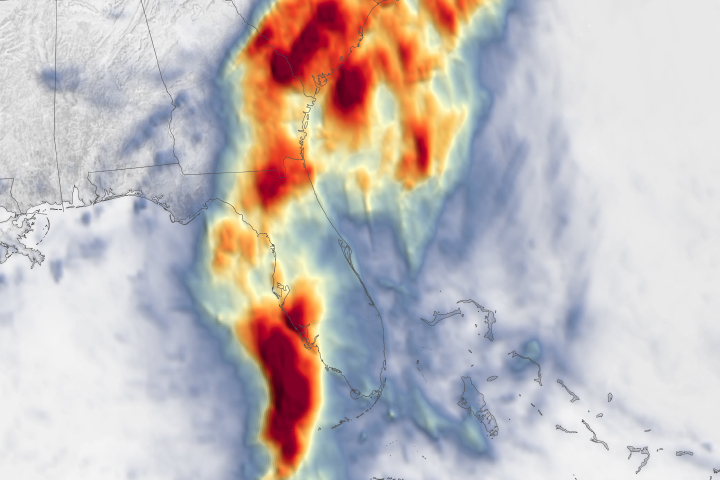
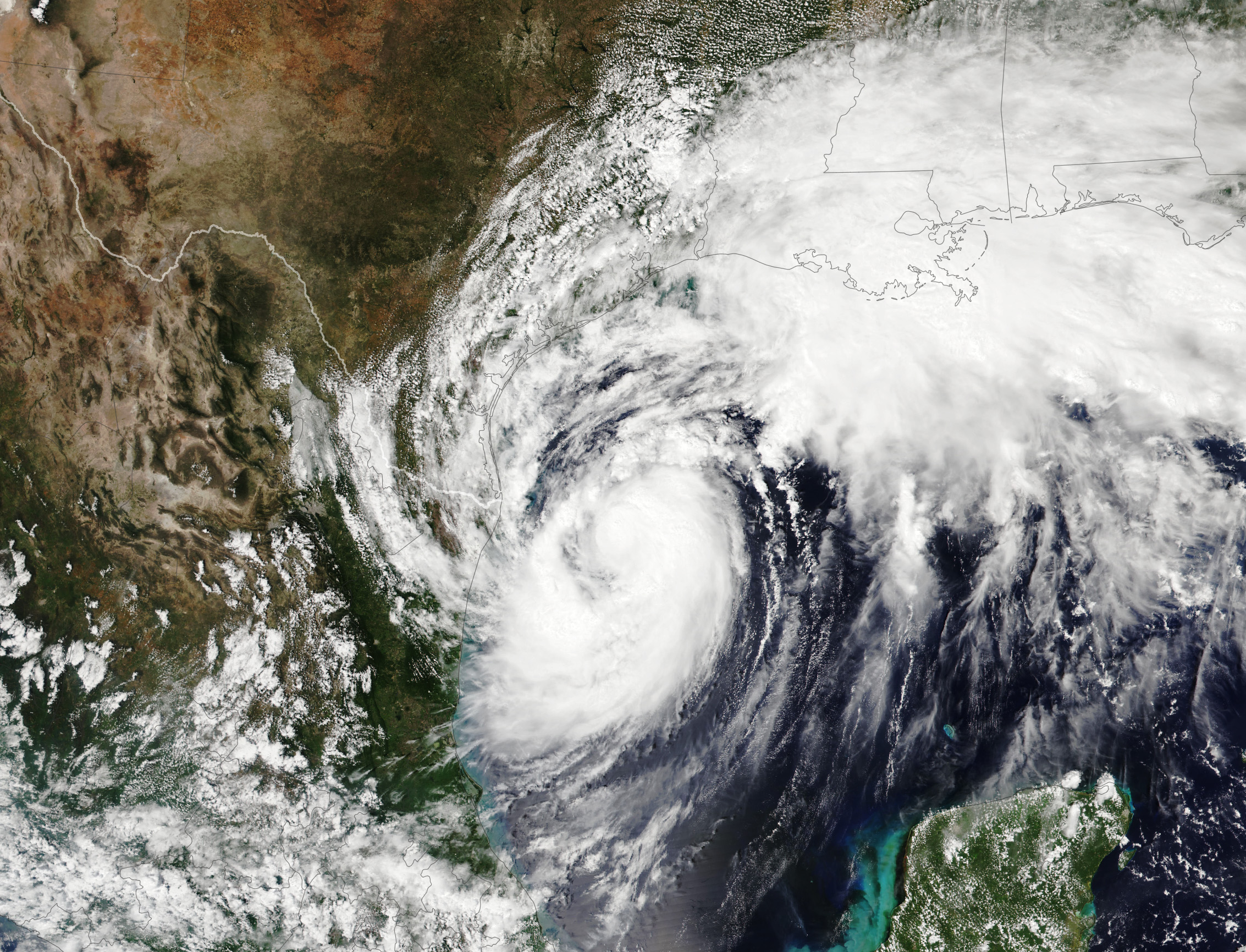
Francine developed into a tropical storm on September 9 off the eastern coast of Mexico. This image, acquired by the VIIRS (Visible Infrared Imaging Radiometer Suite) on the NOAA-21 satellite, shows the storm at 2:25 p.m. Central Time (19:25 Universal Time) on September 10. At the time, Francine remained a tropical storm with maximum sustained winds of about 65 miles (105 kilometers) per hour. Fueled by warm water in the Gulf, it strengthened to a Category 1 hurricane about five hours later.
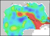
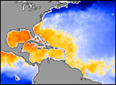
Sea surface temperatures (SSTs) are a fair predictor of the readiness of the ocean to fuel and sustain storms. Meteorologists generally agree that SSTs should be above 82 degrees Fahrenheit (27.8 degrees Celsius) to sustain and intensify hurricanes, cyclones, and typhoons. During the time of Francine’s development on September 8 to 10, temperatures in the southwestern Gulf were several degrees above that threshold and slightly above the 2003-2014 average for those dates, according to data from the Multiscale Ultrahigh Resolution Sea Surface Temperature (MUR SST) project. The MUR SST project is a NASA Jet Propulsion Laboratory effort that blends measurements of sea surface temperatures from multiple NASA, NOAA, and international satellites, as well as ship and buoy observations.
In preparation for the storm, authorities issued mandatory evacuation orders for all of Louisiana’s Cameron Parish, and urged residents outside the levee system in other southern parishes to evacuate. Forecasters expect a storm surge of 5 to 10 feet (1.5 to 3 meters) and major flooding along the Louisiana coast near Vermilion Bay. National Hurricane Center forecasts indicated a 36 percent chance of sustained hurricane-force winds of 74 miles (119 kilometers) per hour or higher in Morgan City. Heavy rains of 4 to 8 inches (100 to 200 millimeters) are expected along a large swath of the Gulf Coast.
NASA’s Disasters Program has been activated in response to Hurricane Francine, supporting stakeholders such as the Federal Emergency Management Agency (FEMA). As new information becomes available, the team will be posting maps and data products on its open-access mapping portal.
NASA Earth Observatory image by Wanmei Liang, using VIIRS data from NASA EOSDIS LANCE, GIBS/Worldview, and the Joint Polar Satellite System (JPSS). Story by Emily Cassidy.