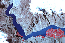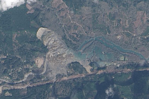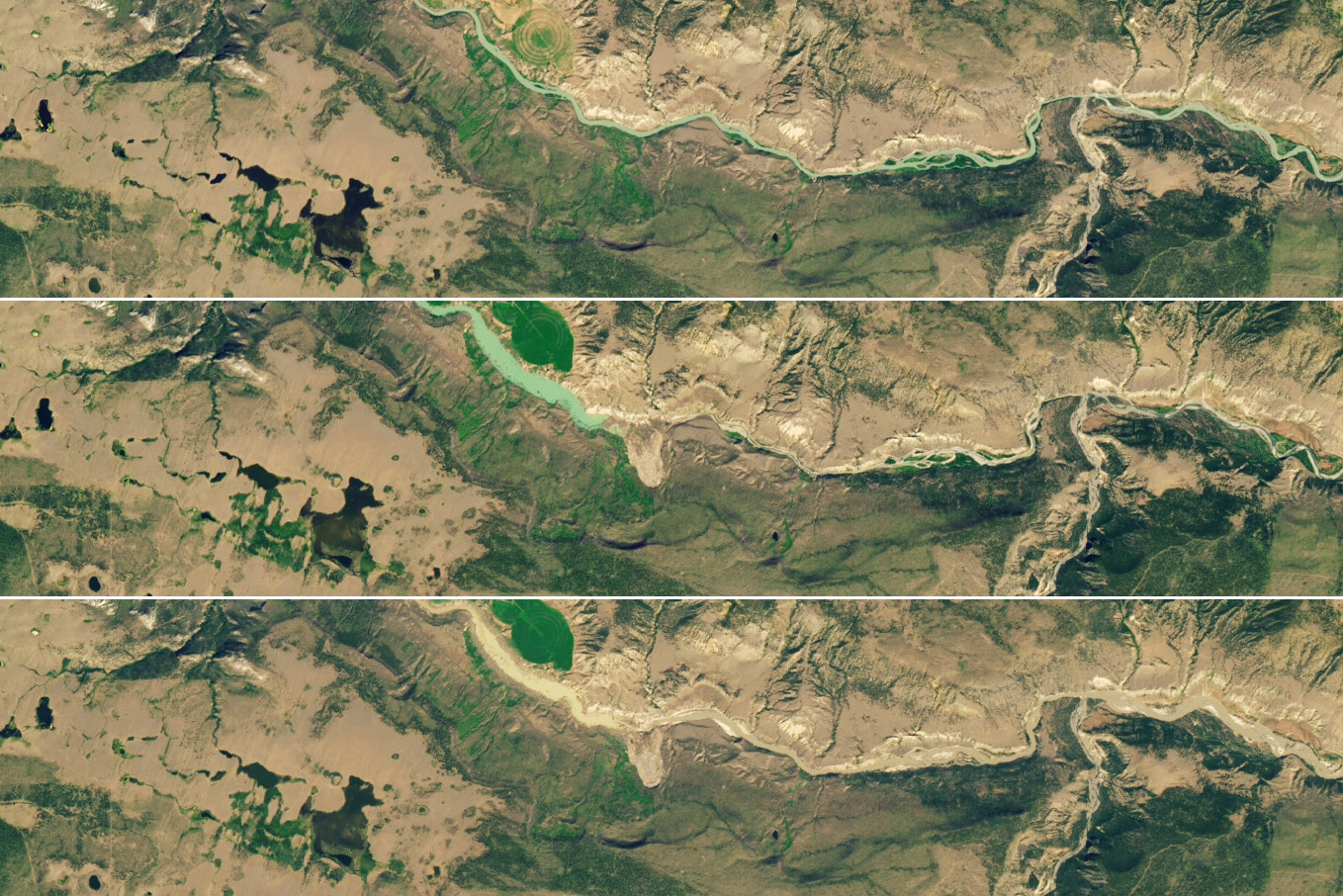
The threat of flash flooding on the Chilcotin River in British Columbia has subsided following a large landslide on July 30, 2024, that dammed the river. Water pooled and formed a lake behind the landslide deposit for several days until it began to find its way through on August 5, first as a trickle and then as a torrent.
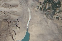
The images above show the river on July 16, before the landslide (top image); on August 1, while water was backing up (middle image); and on August 9, after floodwater breached the landslide dam (bottom image), cutting a channel across the debris. Since the breach, water has scoured the channel and the river edges downstream, rapidly eroding material and discoloring the river with fine-grained sediment. All three images were captured by the OLI (Operational Land Imager) on Landsat 8.
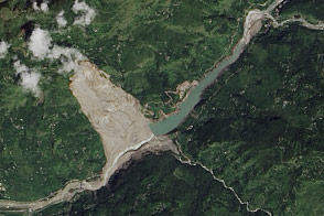
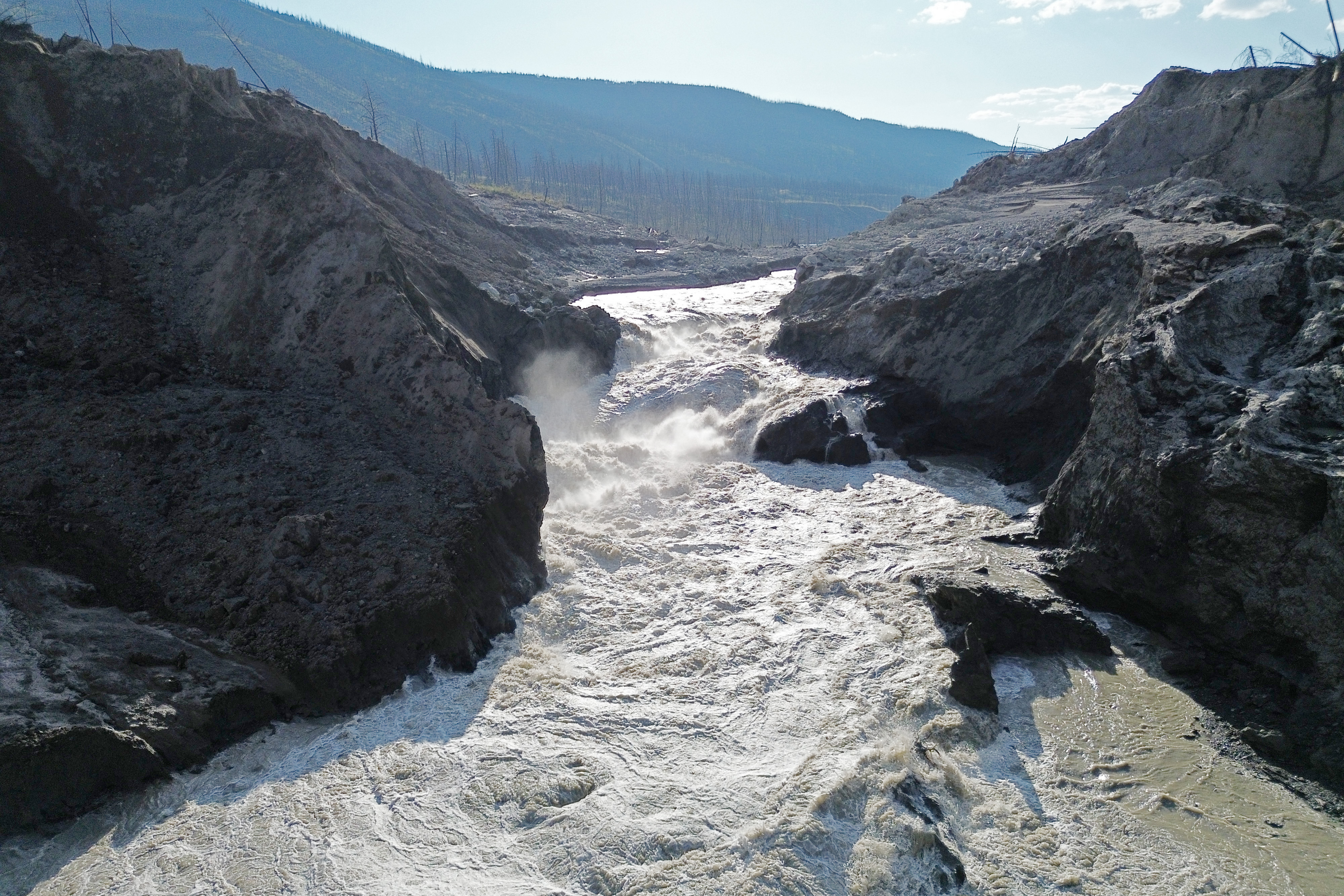
The aerial photograph below, captured by a drone and shared by the Province of British Columbia, shows water on August 7 as it churned through the new channel. The second image below, acquired by Landsat 8 on August 9, shows sediment-laden water from the Chilcotin meeting the clearer waters of the Fraser River downstream of the landslide.
Water breached the landslide debris gradually, over a span of about 20 hours. As a result, flooding downstream caused less damage than had the breach occurred over only a few hours, explained Brian Menounos, a remote sensing scientist at the University of Northern British Columbia. Menounos has been working with the Hakai Institute, using lidar to map how the landscape around the landslide site and downriver has changed.
“Parts of the landslide deposit were fine-grained silts and sands that eroded quickly, but there were also units of till—unsorted sediments deposited by glaciers—that were quite compact and resistant to erosion, almost like bedrock,” Menounos said. “The till really slowed the process down and prevented an abrupt failure.”
The flooding did cause some damage to a key bridge and indigenous cultural sites along the river. After the river returned to a more normal flow, Canadian authorities lifted flood warnings and watches and downgraded evacuation warnings.

Still, Menounos and other scientists continue to monitor the situation closely to assess how the increased loads of sediment and the new obstacle in the river might affect the ecosystem. “The lake isn’t entirely drained yet,” Menounos said. “There is still concern that some of the till piled in the river could make it difficult for salmon to get upstream to spawn.”
NASA Earth Observatory images by Wanmei Liang, using Landsat data from the U.S. Geological Survey. Photographs courtesy of the Province of British Columbia. Story by Adam Voiland.
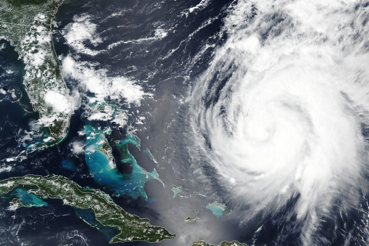
alert message