The Earth Observatory has published its last Image of the Day on this website. Please join us on our new home at science.nasa.gov/earth/earth-observatory.

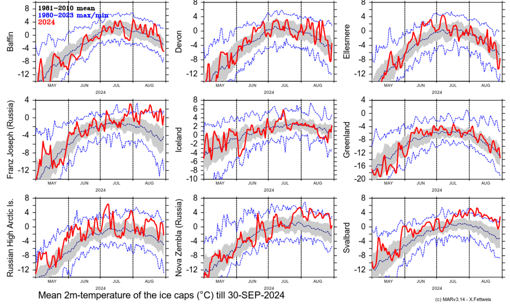
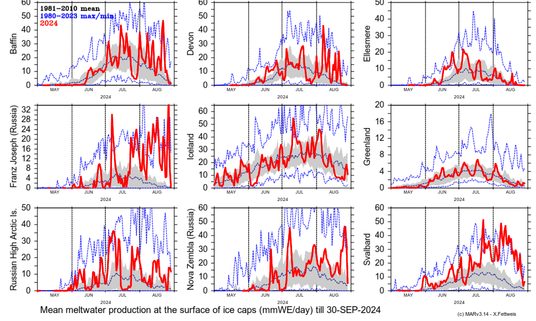
The Svalbard archipelago’s ice caps suffered extreme episodes of melting in summer 2024, brought on by exceptionally high air temperatures.
Situated between mainland Norway and the North Pole, Svalbard is one of the fastest-warming places on the planet. Over half of its land area is covered with ice, composing about 6 percent of the planet’s glaciated area outside of Greenland and Antarctica.
In late July and early August 2024, temperatures hovered around 4 degrees Celsius (7 degrees Fahrenheit) above average for this part of the Arctic Circle. The heat took its toll on Svalbard, home to some of Earth’s northernmost glaciers, causing snow and ice to rapidly melt.
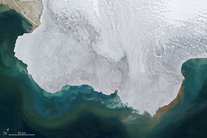
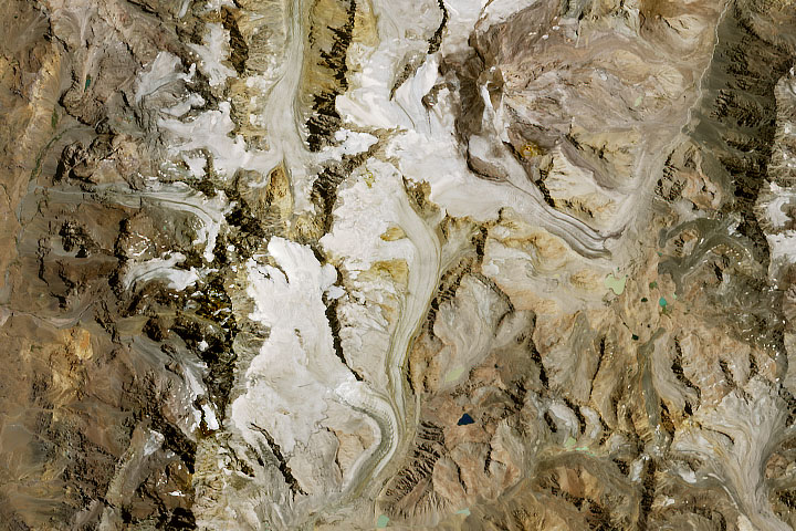
The OLI (Operational Land Imager) on Landsat 8 captured these images of Nordaustlandet—the second largest island in the archipelago—on August 9 as water and sediment drained off the coast and into the Arctic Ocean. Sediment is likely causing the striking swirls of color in the water surrounding the island. The melting of seasonal snow and an older, compressed layer of snow called “firn,” left some areas of glacial ice (light blue) bare and exposed in the images.
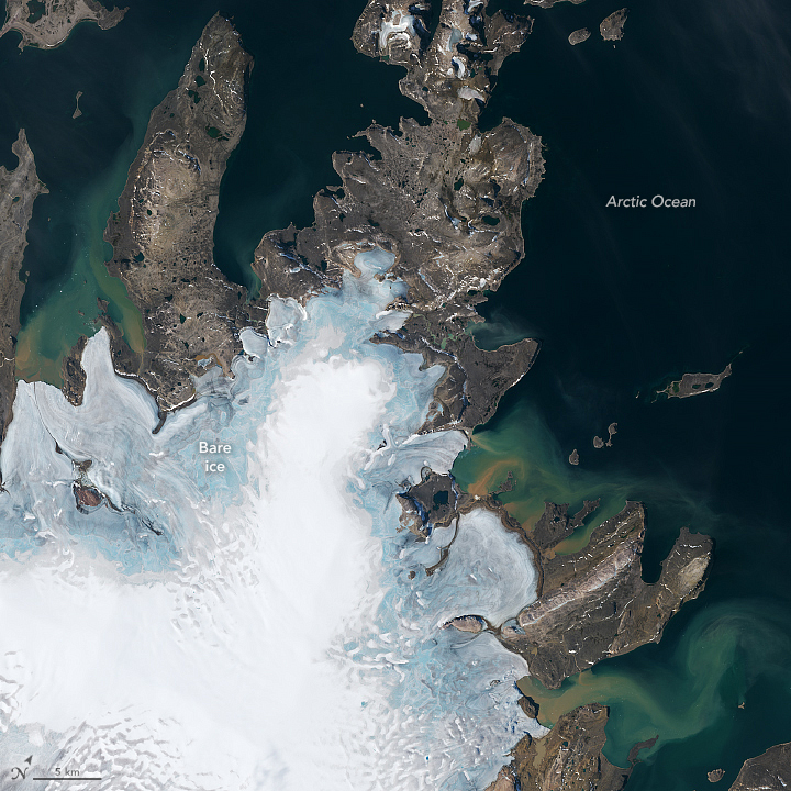
According to Xavier Fettweis, a climatologist at the University of Liège, Svalbard’s ice caps broke their all-time record for daily surface melt on July 23, 2024. Svalbard shed about 55 millimeters of water equivalent that day, a rate five times larger than normal.
The exceptional melting continued into August, corresponding with a persistent heat dome that baked parts of Scandinavia’s Arctic. In Longyearbyen, Svalbard’s capital on the main island of Spitsbergen, temperatures reached 20.2°C (68°F) on August 11, its highest August temperature on record and about 2.2°C (4°F) above the previous monthly record, according to meteorologist Daan van den Broek.
Svalbard experienced its warmest summer on record in 2023, according to the Copernicus State of the Climate report. The report cited several contributing factors for the warmth, including below-average sea ice cover and above-average sea surface temperatures.
NASA Earth Observatory images by Lauren Dauphin, using Landsat data from the U.S. Geological Survey. Story by Emily Cassidy.


