
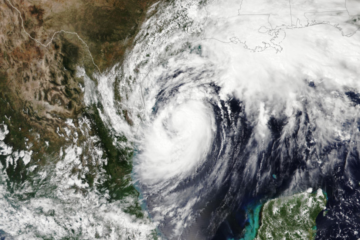
After battering Puerto Rico, Ernesto picked up steam over the western Atlantic Ocean as it moved toward Bermuda. The Category 2 hurricane was expected to pass near or over the island on August 17, 2024, generating dangerously large waves along the Atlantic shore of the U.S. and Canada.
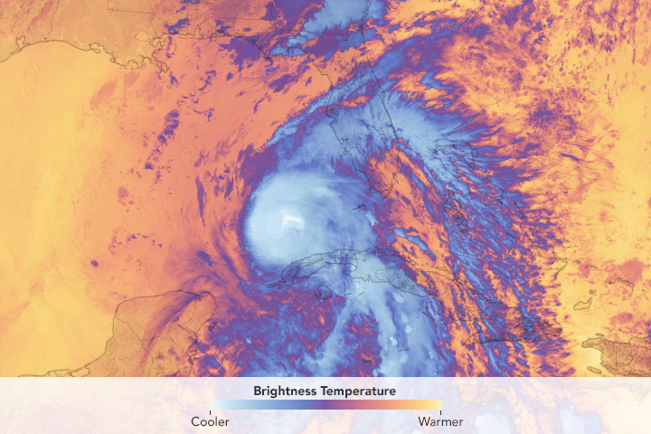
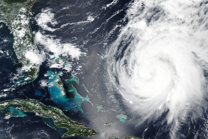
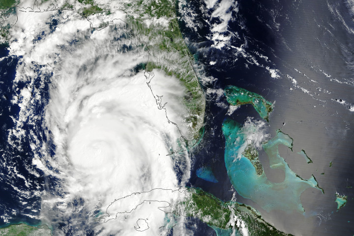
This image, acquired with the VIIRS (Visible Infrared Imaging Radiometer Suite) on the Suomi NPP satellite, shows Ernesto at about 18:00 Universal Time (3 p.m. local time in Bermuda) on August 15, when the center of the storm was 530 miles southwest of the British island territory. At the time, Ernesto had sustained winds of around 85 miles (140 kilometers) per hour and was continuing to strengthen.
Earlier in the week, Ernesto moved through the Leeward Islands, Virgin Islands, and eastern Puerto Rico, bringing torrential rains and wind gusts near hurricane strength. According to news reports, the storm knocked out power for about half of Puerto Rico’s residents and dumped 3 to 10 inches (8 to 25 centimeters) of rain over much of the island. The storm flooded roadways, downed power lines, and destroyed homes and vehicles.
As Ernesto moved north from Puerto Rico, NASA scientists teamed up with NOAA to drop small sensors into and around the storm to better understand how the storm was changing. On August 15, 35 dropsondes were released from NOAA’s Gulfstream IV jet from 40,000 feet above the Atlantic. As the dropsondes careened through the storm, they measured temperature, moisture, pressure, and wind conditions.
“Dropsonde data indicated that dry air along Ernesto’s path likely prevented it from becoming an even more powerful storm,” said Justin Stachnik, an atmospheric scientist at NASA Headquarters. “These dropsondes give scientists and weather forecasters a better picture of the moisture present near the storm, and they can retrieve measurements near the surface, where it’s not safe for aircraft to fly.”
The dropsonde measurements can be used to calibrate and validate simultaneous observations from satellites that are part of NASA’s TROPICS mission—a constellation of CubeSats designed to provide high-resolution, rapid updates of the intensity, size, and precipitation of tropical cyclones. “Calibrating satellite observations with these in-air measurements will allow NASA to better provide near-real-time monitoring of storms,” Stachnik said.
Although Ernesto was not expected to hit the mainland U.S., high surf and rip currents from the hurricane were expected to spread up the east coast on August 17 and 18 and could reach portions of Atlantic Canada.
NASA’s Disasters program has been activated in response to Hurricane Ernesto, working with the Puerto Rico Science, Technology, & Research Trust and the Puerto Rico Department of Public Safety to support response activities. As new information becomes available, the team will be posting maps and data products on its open-access mapping portal.
NASA Earth Observatory image by Wanmei Liang, using VIIRS data from NASA EOSDIS LANCE, GIBS/Worldview, and the Suomi National Polar-orbiting Partnership. Story by Emily Cassidy.
Image of the Day Atmosphere Severe Storms
The storm dropped torrential rain on Puerto Rico before intensifying in the Atlantic.
Image of the Day for August 17, 2024
View more Images of the Day:
Hurricane season in the basin runs from June 1 to November 30.
alert message


