The Earth Observatory has published its last Image of the Day on this website. Please join us on our new home at science.nasa.gov/earth/earth-observatory.
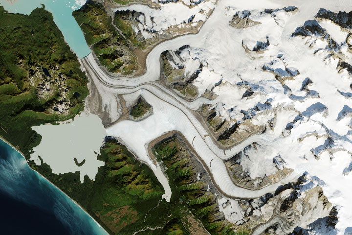
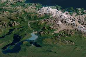
From a geological perspective, Adam’s Inlet in Alaska has undergone major changes in the blink of an eye. Just 130 years ago, the inlet was covered by ice hundreds of meters thick. Today, it is ice-free.
The inlet, which drains into the East Arm of Glacier Bay, lies within Glacier Bay National Park. “Since the end of the Little Ice Age about 150 years ago, Glacier Bay has seen deglaciation on a scale almost unseen anywhere else on Earth,” said Dan Shugar, a University of Calgary geomorphologist. “In Adam’s Inlet, the retreat of the ice has exposed a remarkable landscape. Steep slopes, glacial rivers, ocean tides, and sediment are smashing together to create a geological wonderland.”
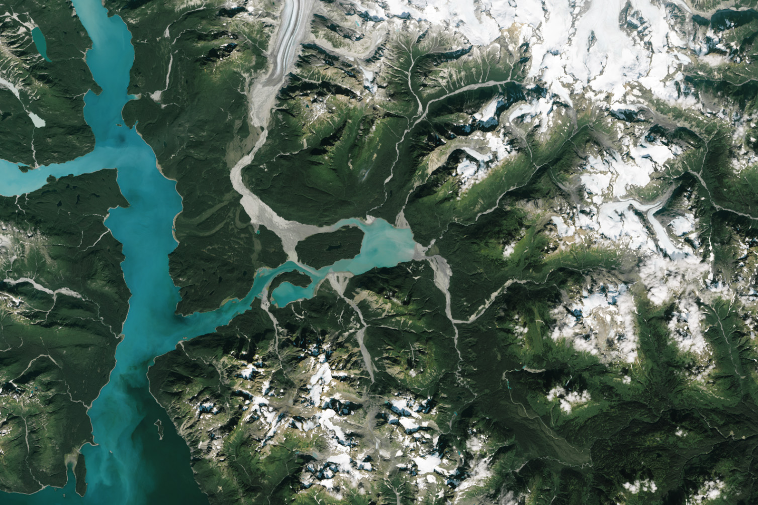
The OLI-2 (Operational Land Imager-2) on Landsat 9 captured this image of the area on August 28, 2023. Several streams flow into the inlet, including a large one that drains meltwater from the Casement Glacier. It is one of several glaciers in the eastern part of the park that has retreated by several kilometers in recent decades, partly because of warming air and water temperatures.
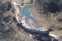
“These rivers transport incredible quantities of fine-grained sediment,” Shugar said. “They are braided, meaning they have lots of strands that interweave, and can change dramatically from day to day over the melt season.” They also dump large quantities of sediment into the ocean, resulting in striking offshore plumes and sometimes giving the water a turquoise color. This effect, seen in the eastern part of the inlet, is caused by fine-grained silt and clay particles (rock flour) suspended in the water that absorb certain wavelengths of light.
Also notable is the alluvial fan near the center of the image. These features form where sediment-laden rivers drain from narrow, steep valleys into broader plains. “When the gradient decreases, the water moves less quickly and is less able to carry sediment,” Shugar explained. “The sediment drops out and creates these beautiful landforms.”
Southeast of the alluvial fan, debris from a landslide has tumbled into a braided stream that enters the inlet from the south. The landslide occurred in 2020, delivering enough material to temporarily block the stream; it has since carved a channel through the debris.
While that event caused minimal damage, landslides crashing into inlets in this region have had serious consequences. In nearby Lituya Bay, an earthquake in 1958 triggered a landslide that sent 90 million tons of rock plunging into the inlet and generated tsunami waves that inundated land up to an elevation of 1,720 feet (524 meters)—higher than New York’s Empire State Building is tall. That event, one of the largest known examples of a landslide, generated waves that flattened so much surrounding forest that the damage is still visible in Landsat imagery today.
NASA Earth Observatory image by Wanmei Liang, using Landsat data from the U.S. Geological Survey. Story by Adam Voiland.