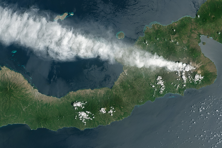
Fernandina, the youngest of the Galápagos islands, is also the most volcanically active. The island’s La Cumbre volcano lies directly atop the mantle plume, or hot spot, that produced all of the Galápagos islands. In recent decades, the volcano has erupted roughly every four years.
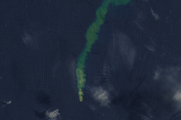
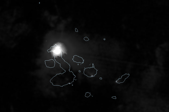
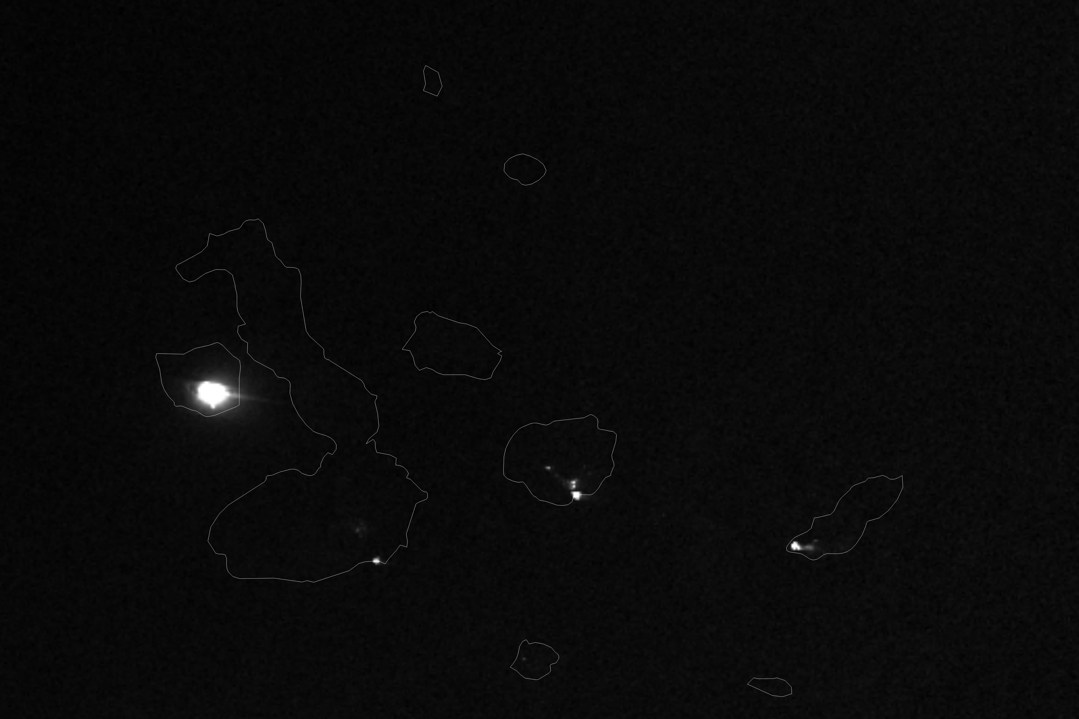
The most recent eruption began on March 2, 2024, when lava began to pour from a circular fissure on the volcano’s southeast flank. The day-night band of the VIIRS (Visible Infrared Imaging Radiometer Suite) on the NOAA-NASA Suomi NPP satellite captured this image (above) of the eruption’s glow early on March 5, 2024. Fernandina, the third largest island in the Galápagos archipelago, lies roughly 1,100 kilometers (700 miles) off the west coast of Ecuador.
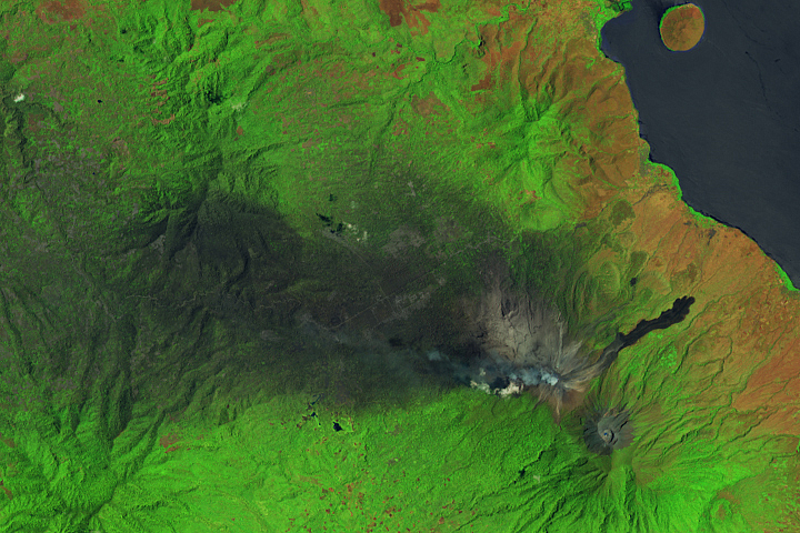
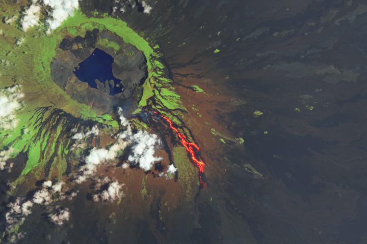
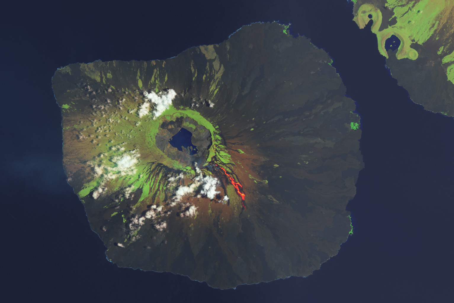
On March 7, the OLI (Operational Land Imager) on Landsat 8 captured an image (below) of lava as it spilled down the 1,476-meter (4,843-foot) peak. The image is a composite of shortwave infrared, near infrared, and green light (OLI bands 6-5-3). Shortwave infrared light (SWIR) is invisible to the naked eye, but strong SWIR signals indicate high temperatures.
The infrared hot spot highlights an active lava flow, which extends to the southeast for roughly 6 kilometers (4 miles). Older lava flows appear black. Most of Fernandina is rocky and inhospitable to vegetation due to recent lava flows, but a ring of vegetation grows on the volcano’s upper slopes. Vegetation covers more of the other Galápagos islands, where eruptions are less frequent.
Satellites have played a key role in monitoring Fernandina’s latest eruption. Since the end of a previous eruption in 2020, the European Space Agency’s Sentinel-1 satellites have measured a gradual inflation of the land surface in the volcano’s caldera—a sign that magma was entering the volcano and filling the magma chamber. Late on March 2, 2024, and early on March 3, 2024, the geostationary GOES-16 satellite and the polar-orbiting NOAA-NASA Suomi NPP and NOAA-20 satellites detected abundant thermal anomalies, signaling the movement of lava flows.
Around the same time, the OMPS (Ozone Mapping and Profiler Suite) on Suomi NPP and NOAA-20 began to observe a surge in sulfur dioxide (SO2), a gaseous pollutant, streaming from Fernandina. “The sulfur dioxide emissions are continuing, but have reduced significantly since March 3-4,” said Simon Carn, a volcanologist at Michigan Tech. “This is typical of lava-producing effusive eruptions, which usually show peak emissions early on followed by a steady decline towards the end of the eruption.”
Volcanic emissions from Galápagos volcanoes are typically rich in sulfur dioxide and have little ash. “Fernandina—and indeed all the Galápagos volcanoes—erupt low viscosity basaltic magma that allows the volcanic gases to easily separate from the magma, preventing ‘explosive’ fragmentation and ash production,” Carn explained.
In 1968, the volcano generated a much more explosive eruption when water from the lake in the caldera interacted with magma. “But there are no signs of that happening this time, as the eruption vent is on the crater rim, far from the lake,” Carn said. However, the eruption in March 2024 appears to have more longevity than other recent events. The eruption in 2020 lasted just two days and eruptions in 2017 and 2018 lasted three days each.
Fernandina is uninhabited and there is no infrastructure at risk, but the lava flows have proven to be a spectacle for people on passing ships. The island hosts a large population of rare land iguanas that nest on the rim of the caldera and deep within it. These large, yellow reptiles, which can grow to over 1 meter (3 feet) in length and weigh over 14 kilograms (30 pounds) , mostly eat the fruit and leaves of the prickly pear cactus.
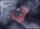
Other animals found on the island include marine iguanas, rice rats, flightless cormorants, and penguins. Emeritus NASA scientist Gene Feldman filmed the marine iguanas shown above on Santa Cruz, an island to the east of Fernandina, during a 2009 expedition to the Galápagos islands.
In addition to tracking the progression of the eruption from above, geologists will also be monitoring the event with sensors on the ground. “For the first time, we have a relatively dense network of seismometers and acoustic sensors on the island,” said Benjamin Bernard, a geologist at National Polytechnic School in Ecuador. “Remote sensing complements ground-based networks like this, which are very difficult to maintain in remote areas.”
NASA Earth Observatory images by Wanmei Liang, using Landsat data from the U.S. Geological Survey and VIIRS day-night band data from the Suomi National Polar-orbiting Partnership. Story by Adam Voiland.