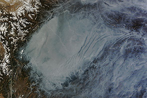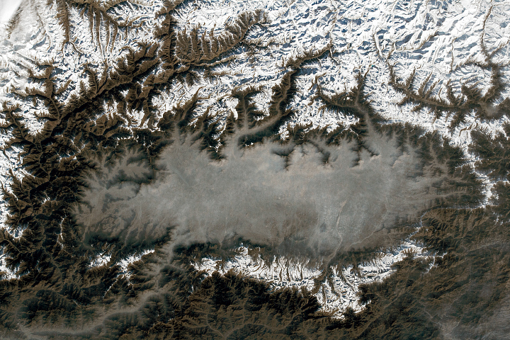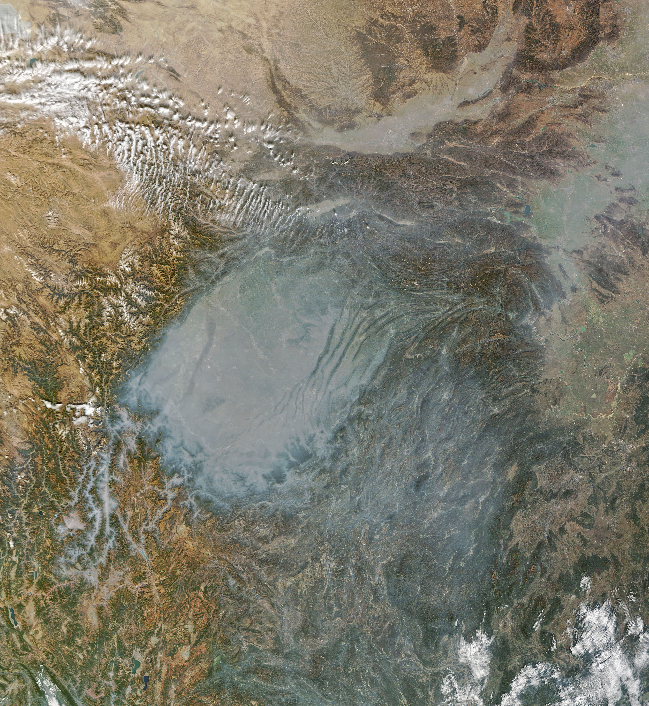
Hundreds of millions of years ago, the Sichuan Basin in southwestern China held a huge freshwater lake, roughly three times the size of Lake Superior, that was frequented by dinosaurs. The lake has long since dried and the modern basin has become a land of rolling hills and fertile farmland. Now, instead of water, something else often pools in the basin—air pollution and haze.
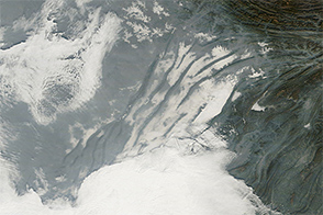
When the Moderate Resolution Imaging Spectroradiometer (MODIS) on NASA’s Terra satellite acquired this image on January 31, 2023, a layer of haze had settled in the basin. The pall obscured cities and other surface features that are visible on clearer days, though a series of ridges could be seen poking above the pollution in the northeastern part of the basin.
On the day the image was acquired, measurements from several ground-based sensors in Chongqing and around the southeastern part of the basin reported fine particulate matter (PM2.5) measurements well above 200 on the air quality index, according to data published by the World Air Quality Index Project. That is high enough to be designated “very unhealthy” by health authorities.
Particulate matter that is smaller than 2.5 microns (about one-thirtieth the width of a human hair) is dangerous because it is small enough to penetrate deep into human lungs. The World Health Organization considers PM2.5 to be safe at index levels below 25. Common sources of particulate matter during winter in the Sichuan Basin include coal and wood burning for heat, industrial activity, and vehicle emissions. Smoke from fires and dust storms can also contribute to poor air quality.
Outbreaks of haze are most likely to occur when warm, buoyant air moves over cooler, denser air—a situation meteorologists call a temperature inversion. Temperature inversions often develop on winter nights as surfaces lose heat and chill the air immediately above. Basins and valleys surrounded by mountains tend to strengthen inversions because cold air from mountaintops flows down slopes and pushes warmer air up from the floor in the process. The warm air acts like a lid and traps pollutants near the surface.
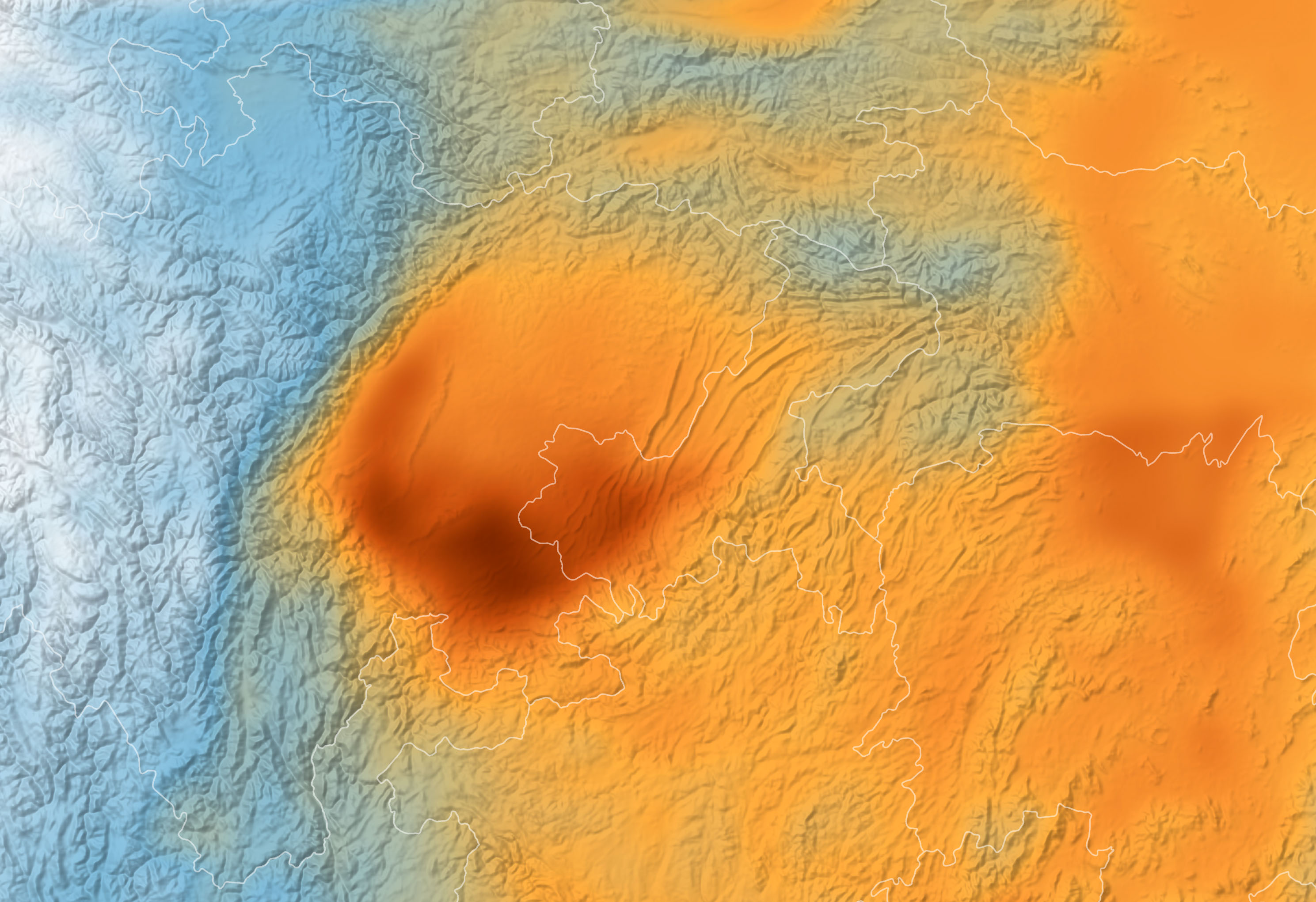
MODIS has made daily observations of the Sichuan Basin for more than two decades, allowing atmospheric scientists to map the spatial distribution of haze over the Sichuan Basin over time. One research team from the Nanjing University of Information Science and Technology analyzed all available MODIS data and found that haze tended to be thickest in the southern part of the basin around the large cities of Chengdu and Chongqing. Air was typically a bit cleaner in the northern part of the basin because the mountains enclosing that part of the basin are smaller and allow winds to circulate more easily.
The map above shows where haze was the thickest over the two-decade period. Specifically, it shows aerosol optical depth—a measure of how much light diminishes as it moves through the atmosphere and gets reflected or absorbed by particles. An optical depth of less than 0.1 (white) indicates a crystal-clear sky with maximum visibility, whereas a value of 1 or more (reddish brown) indicates very hazy conditions.
Despite regular haze events, such as the one shown above, several research teams have reported declines in haze over the Sichuan Basin in recent decades, particularly since 2013 when China began instituting a series of measures designed to limit air pollution. The Nanjing University team reported that measures of optical depth rose by about 0.05 per year between 2000 and 2006, but then began a decline that has accelerated over time. According to their analysis of MODIS optical depth data, the rate of decrease went from 0.02 per year between 2006 and 2012 to 0.06 per year between 2012 and 2020.
NASA Earth Observatory images by Joshua Stevens, using MODIS data from NASA EOSDIS LANCE and GIBS/Worldview. Story by Adam Voiland.