Marine stratocumulus clouds are relatively low in altitude (below about 1 mile) and typically too vast to be fully discerned from below. But observations from above, made by satellites orbiting hundreds of miles above Earth’s surface, have exposed these clouds’ impressive coverage as well as their compelling shapes and patterns.
The Moderate Resolution Imaging Spectroradiometer (MODIS) on NASA’s Terra and Aqua satellites has helped meteorologists determine that marine stratocumulus clouds are relatively common. On average, they cover approximately 23 percent of the global oceans, or about 15 percent of Earth’s total surface.
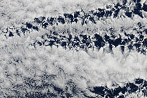
Organized marine stratocumulus clouds, a subcategory of marine stratocumulus clouds found in the subtropics and midlatitudes, take two forms: open-celled and closed-cell. Open-celled clouds appear as thin wisps surrounding empty pockets (the “cells”) and do not block much of the Sun’s radiation. Closed-cell clouds appear denser, fluffier, and without open centers, which allows them to reflect more of the Sun’s radiation back to space. Both types result from parcels of warm air rising, expanding, cooling, and condensing into visible liquid droplets. In open-celled clouds, cool air sinks in the vacant center while warm air rises along the edges; in closed-cell clouds, warm air rises in the center and cool air sinks along the edges.
It might seem counterintuitive, but it is the open-celled clouds that generate rainfall, while closed-cell clouds produce little to no rain. This contributes to open-celled clouds’ tendency to break up in shape over just a few hours, while closed-cell clouds can retain their form for up to half a day. Closed-cell systems are also more likely to form over colder areas of the ocean, while open-celled systems are more likely to form over ocean areas with stronger circulation.
Recent studies have found that local air quality can affect the formation of open- and closed-cell clouds. Smoke and dust particles, and aerosols from ships and factories can initiate a transition between these cloud types.
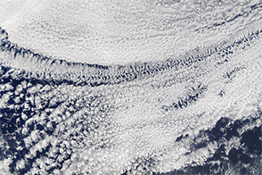
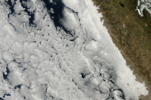
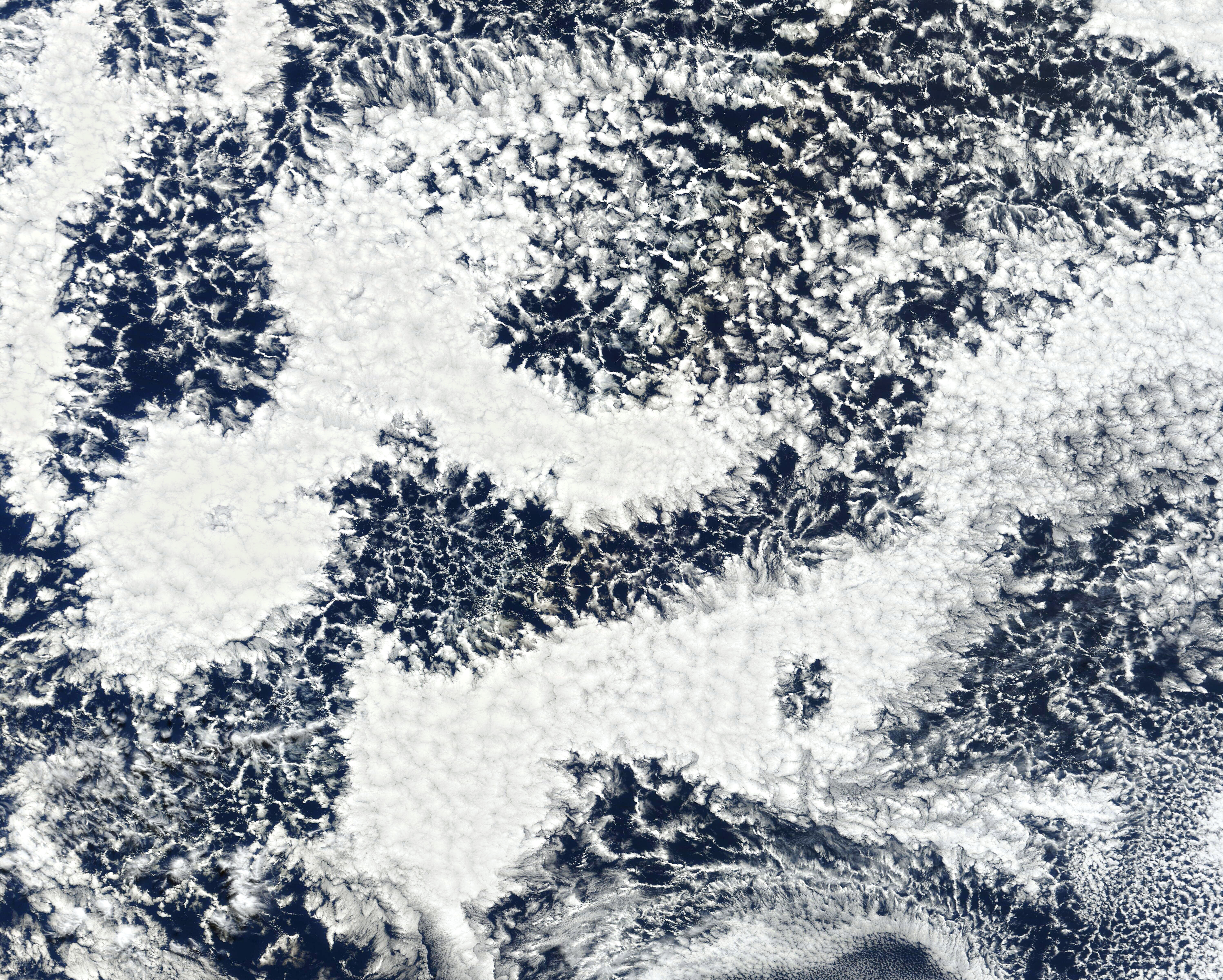
On August 25, 2022, MODIS on NASA’s Terra satellite acquired this image (top) of open- and closed-cell clouds about 1,000 miles west of Chile’s coast. According to scientists, the structure of the closed-cell cloud systems captured here appear roughly triangular, and they are larger than is typical of low atmosphere cellular cloud systems. This could be due to atmospheric instabilities, rain, or other variations in the atmosphere over this area of the Pacific Ocean. Images for the time-lapse video were acquired that day with the Advanced Baseline Imager (ABI) on the Geostationary Operational Environmental Satellite 17 (GOES-17). GOES-17 is operated by the National Oceanic and Atmospheric Administration (NOAA); NASA helps develop and launch the GOES series of satellites.
On August 25, large banks of similar-looking open- and closed-cell clouds dotted the western coasts of North and South America. The western coasts of continents are particularly favorable for the formation of these cloud banks because the ocean temperatures are lower relative to other areas at the same latitude, and the atmosphere is more stable near large land masses.
Over the next few days, MODIS observed new pockets of open- and closed-cell clouds forming and dispersing off the coast of South America. Better understanding the shapes and formation of low atmosphere cloud systems contributes to our ability to better predict weather and improve the accuracy of climate models.
NASA Earth Observatory image and video by Joshua Stevens, using MODIS data from NASA EOSDIS LANCE and GIBS/Worldview, and GOES 17 data from NOAA and the National Centers for Environmental Information (NCEI). Story by Hannah Richter, with information from Terence Kubar (NASA JPL).
alert message