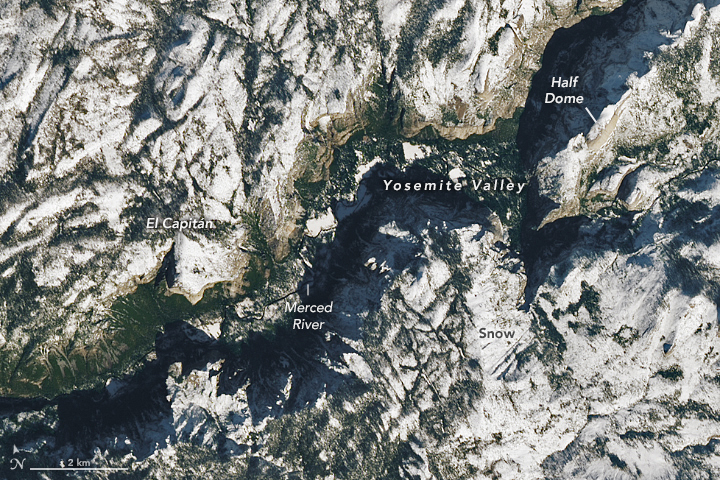

In the second week of November 2022, the first significant winter storm of the season pummeled California with record daily rainfall in the lowlands and heavy snowfall in the mountains. As the storm system moved on to the Great Plains, skies cleared over California and revealed this wintery view of the Central Sierra Nevada.
The Operational Land Imager-2 (OLI-2) on Landsat 9 acquired this natural-color image on November 13, 2022. It shows snow blanketing the central Sierras, including Yosemite National Park, and areas east into Mono County.
According to news reports, the storm on November 8 delivered a daily record 1.31 inches (3.33 centimeters) of rain to Los Angeles, about 280 miles (450 kilometers) southeast of Yosemite. In the higher elevations, precipitation fell as snow. The area near Devils Postpile, southeast of the park, received 28 inches (71 centimeters). Yosemite Valley—visible in the detailed image below—saw about 4 inches, while some of the park’s higher peaks saw as much as 30 inches.

On November 13, snow still spanned much of the central Sierras and a dusting was still visible on the floor of Yosemite Valley. But the snowy scene is interrupted by the bare surfaces of the valley’s famous steep granite cliffs and domes (brown) and evergreen trees (green).
Snowfall in Yosemite National Park led to the closure of Tioga Road, which bisects the park and provides access to areas east, including Tuolumne Meadows. The road usually closes each year in November and reopens in late May or early June. Big Oak Flat Road was also closed during the storm when a rockfall left huge boulders blocking the road.
The storm led officials to declare the end to the park’s fire season. Fire season ends after a storm delivers at least two inches of precipitation.
NASA Earth Observatory images by Lauren Dauphin, using Landsat data from the U.S. Geological Survey. Story by Kathryn Hansen.