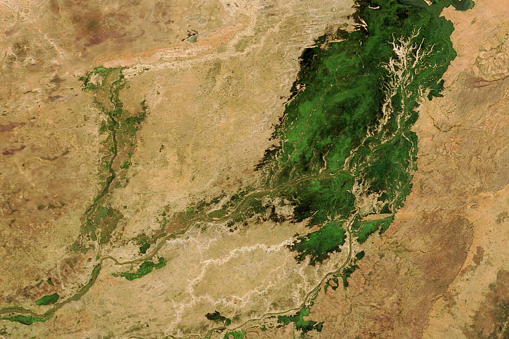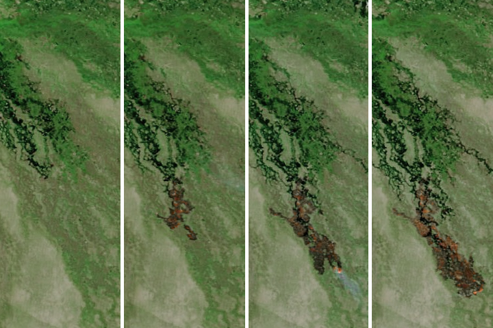
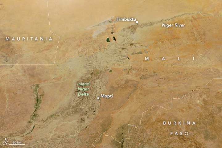
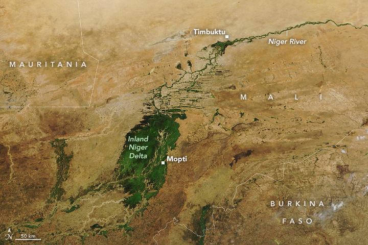
Each year from around August to December, a burst of green overtakes the typically brown landscape of central Mali. The greening is due to aquatic grasses and other vegetation taking advantage of the seasonal inflow of water that spread across the Inner Niger Delta—the largest inland delta in western Africa. In October 2022, water reached the highest levels seen in more than 50 years.
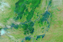
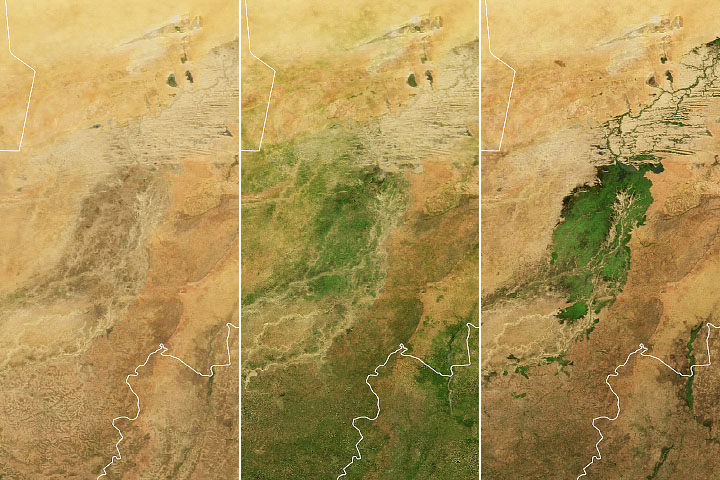
The Moderate Resolution Imaging Spectroradiometer (MODIS) on NASA’s Terra satellite acquired this image (right) on November 3, 2022, about a week after water levels peaked in the southern part of the inland delta. For comparison, the left image acquired by MODIS on NASA’s Aqua satellite shows the same area in May 2022—a time of year when the delta is relatively dry.
The Niger River’s headwaters lie about 900 kilometers (560 miles) to the southwest in the Guinea Highlands. Wet season rains across the Upper Niger Basin cause the Niger River to swell, which then flows northeast toward the inland delta. Joined by the Bani River near Mopti, water from the river systems spreads across the floodplain into a broad network of channels, wetlands, and islands.
The process plays out over months, with flooding influenced by the cumulative amount of rainfall across the entire wet season. The timing of the wet season varies across the Upper Niger Basin. In the mountainous upper reaches of the Niger River, the wet season extends from March to October. Across the entire West Africa region, the wettest month is usually August.
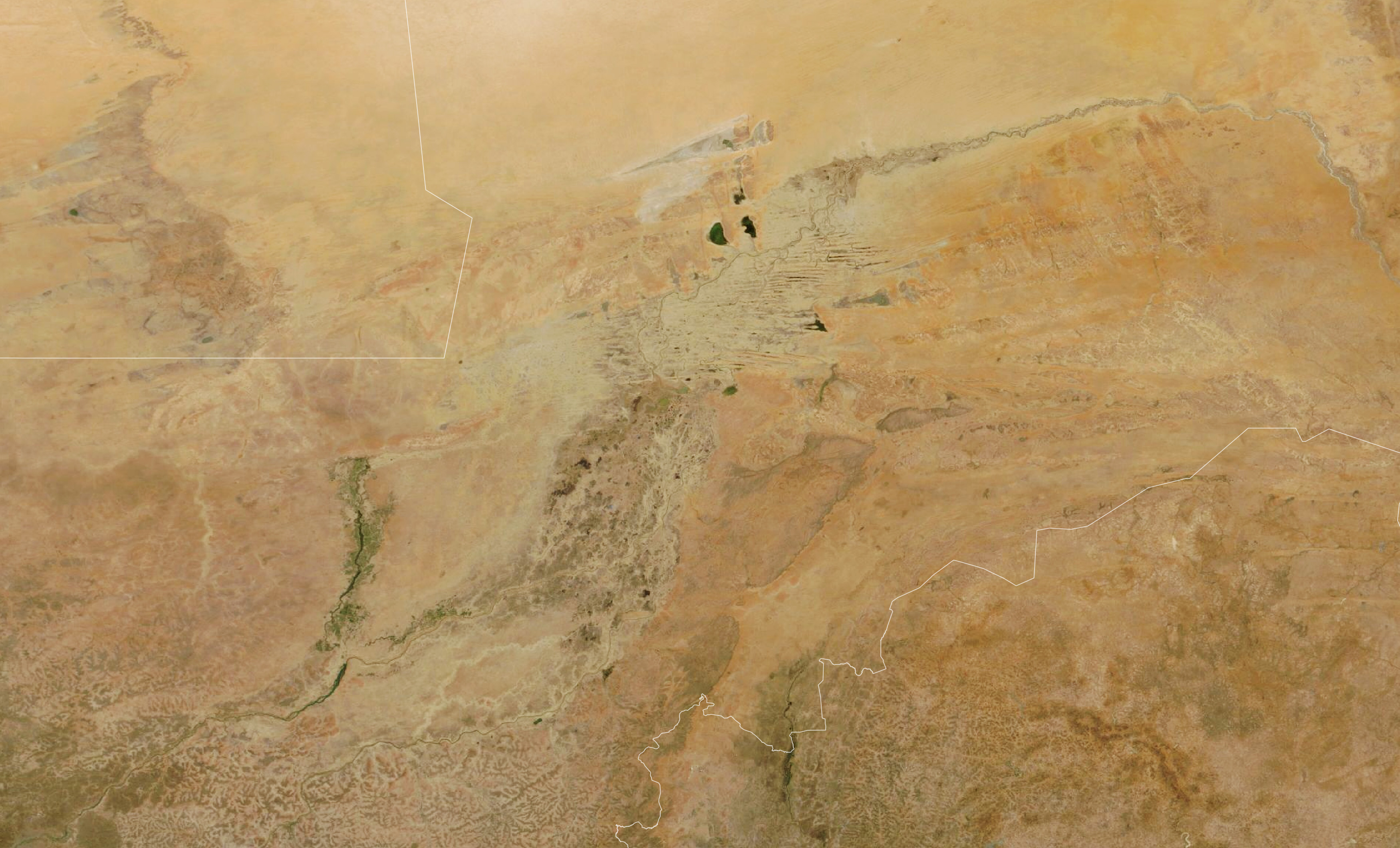
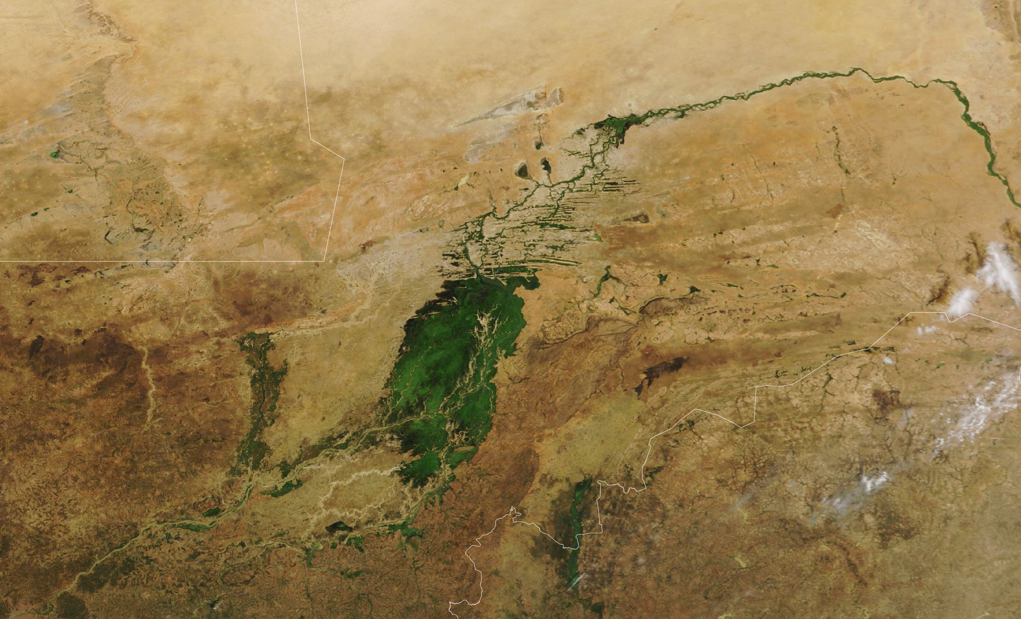
Despite these variations, the amount of rainfall across the upper basin in July and August is usually a good indication of the amount of flooding that will happen across the delta by October through December. In July and August 2022, rainfall was well above the 2001–2021 average. According to a bulletin from OPIDIN, flooding on the Inner Niger Delta peaked at the town of Mopti in late October 2022 at 675 centimeters (22.1 feet)—the highest levels seen since 1969. Water inundated 19,000 square kilometers of the delta.
As the parched landscape becomes saturated, the delta greens. Partly floating long-stemmed grasses dominate the delta, including Echinochloa stagnina. This species, known locally as bourgou, is often planted by people and used for animal feed. There is also plenty of wild rice, or Oryza longistaminata. The light-brown areas branching across the greenery are sand ridges and drying stream channels.
The flooding progresses from the southwest to the northeast. After peaking at Mopti, water levels are next expected to peak in the central part of the delta during the last week of November, and then peak in the north over a week later.
NASA Earth Observatory images by Lauren Dauphin, using MODIS data from NASA EOSDIS LANCE and GIBS/Worldview. Story by Kathryn Hansen.