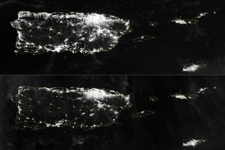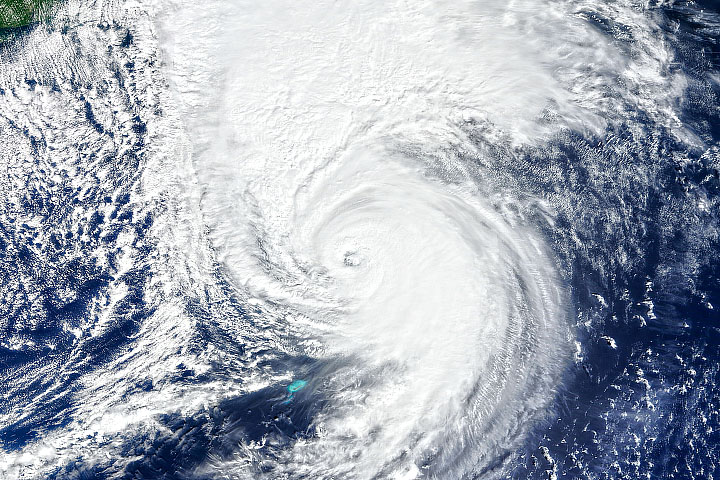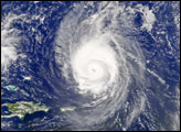
A hurricane that began the week wreaking havoc in the tropical Atlantic will end the week in the Canadian Maritime provinces. After making landfall in Puerto Rico and bringing fierce winds and rain to the Dominican Republic and Bermuda, Hurricane Fiona—fueled by anomalously warm seas—appeared to be headed for landfall in Nova Scotia and Prince Edward Island as one of the strongest storms ever to reach Canada.
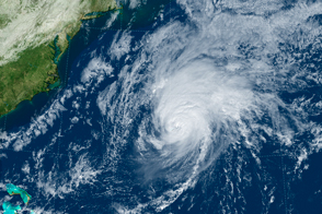
Forecasters from Environment Canada predicted that Fiona would make landfall on September 24, 2022, in eastern Nova Scotia as a hurricane or post-tropical cyclone. The storm was expected to deliver rains of 100 to 150 millimeters (4 to 6 inches) across widespread areas, a storm surge up to 2 meters (6.5 feet), and wind gusts around 175 kilometers (110 miles) per hour. Hurricane and tropical storm warnings were declared for nearly 1,300 kilometers (800 miles) of coastline from New Brunswick and southeast Quebec to Nova Scotia, Newfoundland, and Labrador.
Some forecasters discussed the idea that atmospheric conditions could lead Fiona to transform into a vast post-tropical superstorm similar to Hurricane Sandy. Others compared it to Hurricane Dorian, which struck Nova Scotia as a category 2 cyclone in 2019.
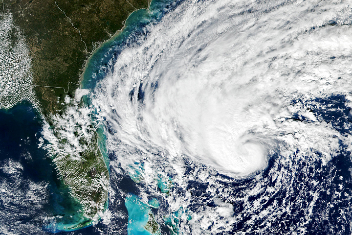
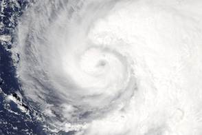
The natural-color image above shows Hurricane Fiona in the late morning on September 23, 2022. The image was acquired by the Moderate Resolution Imaging Spectroradiometer (MODIS) on NASA’s Terra satellite. Around the time of the image, the U.S. National Hurricane Center reported that Fiona had sustained winds of 115 knots (130 miles/210 kilometers per hour). The storm passed just west of Bermuda, bringing heavy rain and bursts of wind at 160 kilometers (100 miles) per hour. About 80 percent of the island was reported to be without power in the wake of the storm.
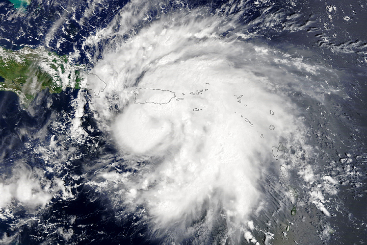
While traveling north, Hurricane Fiona passed over waters that were significantly warmer than normal, thereby providing fuel to sustain and even intensify the storm system. In fact, the storm crossed Puerto Rico as a category 1 hurricane; within days, it intensified to category 3 and 4 strength as it moved well beyond tropical latitudes.
The map above shows sea surface temperature anomalies for September 22, 2022, across the northwest Atlantic Ocean. It depicts how much the surface layer was above or below the long-term average temperature for this time of year. Note how the storm appeared to stir up colder waters in its wake as it moved north. The data come from the Multiscale Ultrahigh Resolution Sea Surface Temperature (MUR SST) project, based at NASA’s Jet Propulsion Laboratory. MUR SST blends measurements of sea surface temperatures from multiple NASA, NOAA, and international satellites, as well as ship and buoy observations.
NASA Earth Observatory images by Joshua Stevens, using MODIS data from NASA EOSDIS LANCE and GIBS/Worldview, data from the Multiscale Ultrahigh Resolution (MUR) project, and information from the National Hurricane Center. Story by Michael Carlowicz.