Powerful tropical cyclones made landfall on opposite sides of the world on September 18, 2022. In the Atlantic Ocean, Hurricane Fiona lashed Puerto Rico almost five years to the day after Hurricane Maria devastated the island. In the Western Pacific, Typhoon Nanmadol soaked the Japanese island of Kyushu before blowing across most of the island nation.
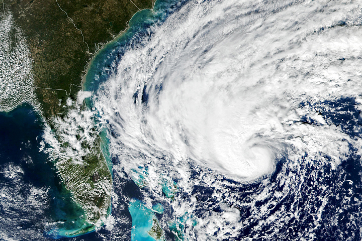
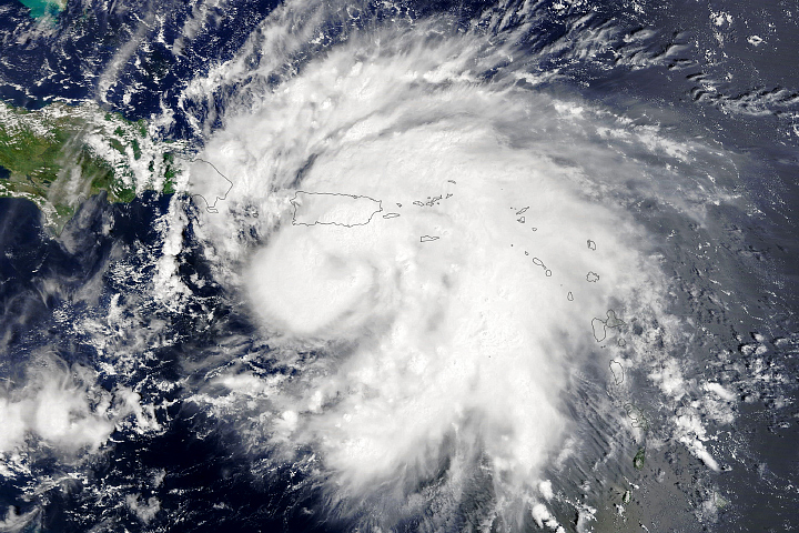
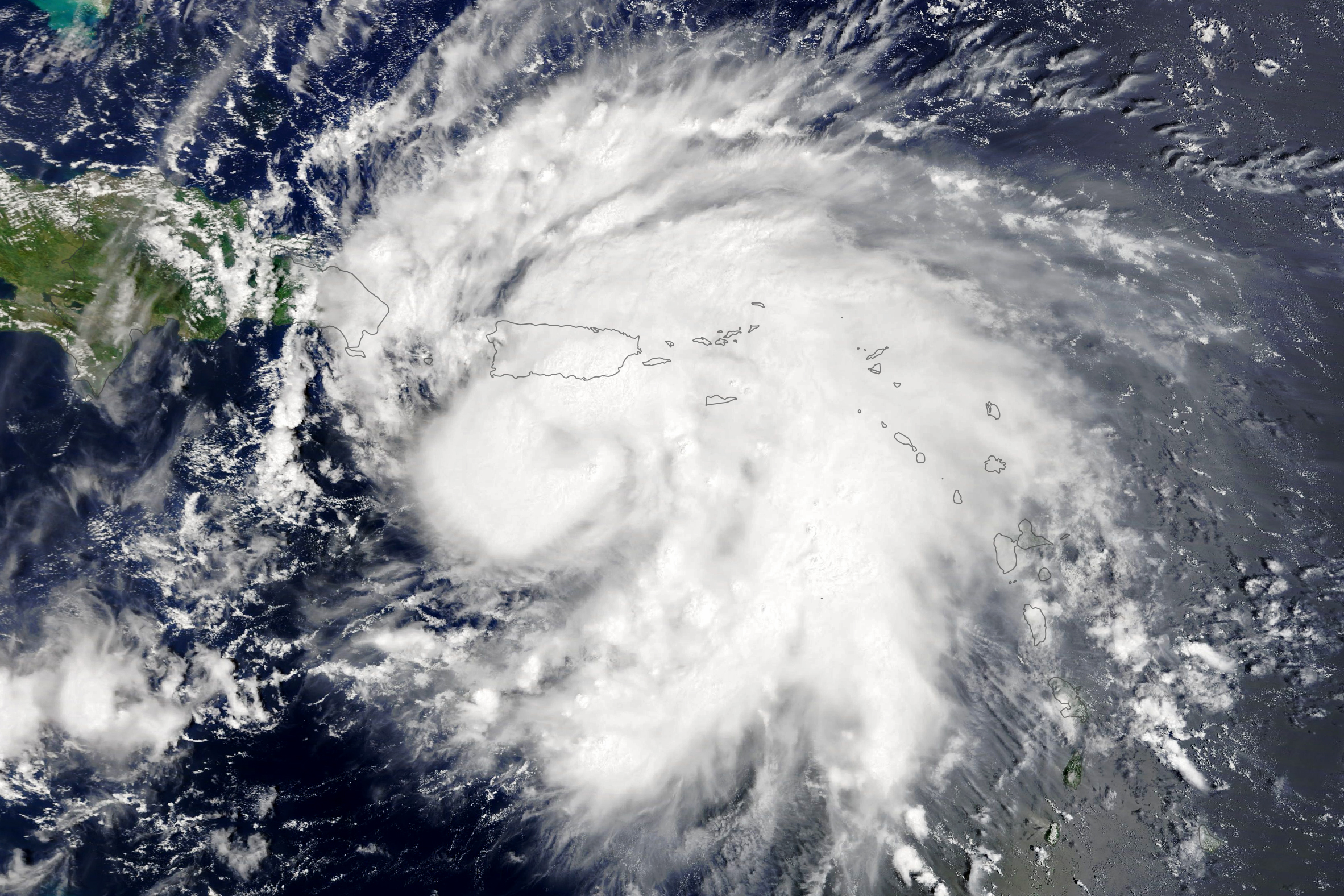
The natural-color image above shows Hurricane Fiona shortly before landfall on September 18. The image was acquired by the Moderate Resolution Imaging Spectroradiometer (MODIS) on NASA’s Terra satellite. It was the third Atlantic hurricane of the 2022 season.
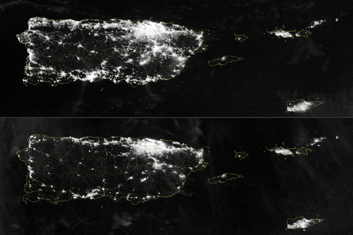
Fiona came ashore in southwestern Puerto Rico in the late afternoon. Though the storm only reached category 1 intensity—with sustained winds around 85 miles (135 kilometers) per hour—it moved slowly and had more time to cause damage. The hurricane dropped 1 to 2 feet (300 to 600 millimeters) of rain in numerous locations, and the persistent winds took down trees, electric power lines, and roofs. Heavy rain fell on some mountainous areas, causing at least ten rivers to swell to flood stage.
By midday on September 19, roughly 90 percent of customers on the island were without electricity. Another 25 percent lacked access to running water, according to news reports.
Hurricane Fiona later brought torrential rain and flooding on September 19 to the Dominican Republic. Forecasters are expecting the storm to head north and intensify into a major hurricane, the first of the Atlantic season. The current forecast from the U.S. National Hurricane Center suggests the storm could pass near Bermuda.
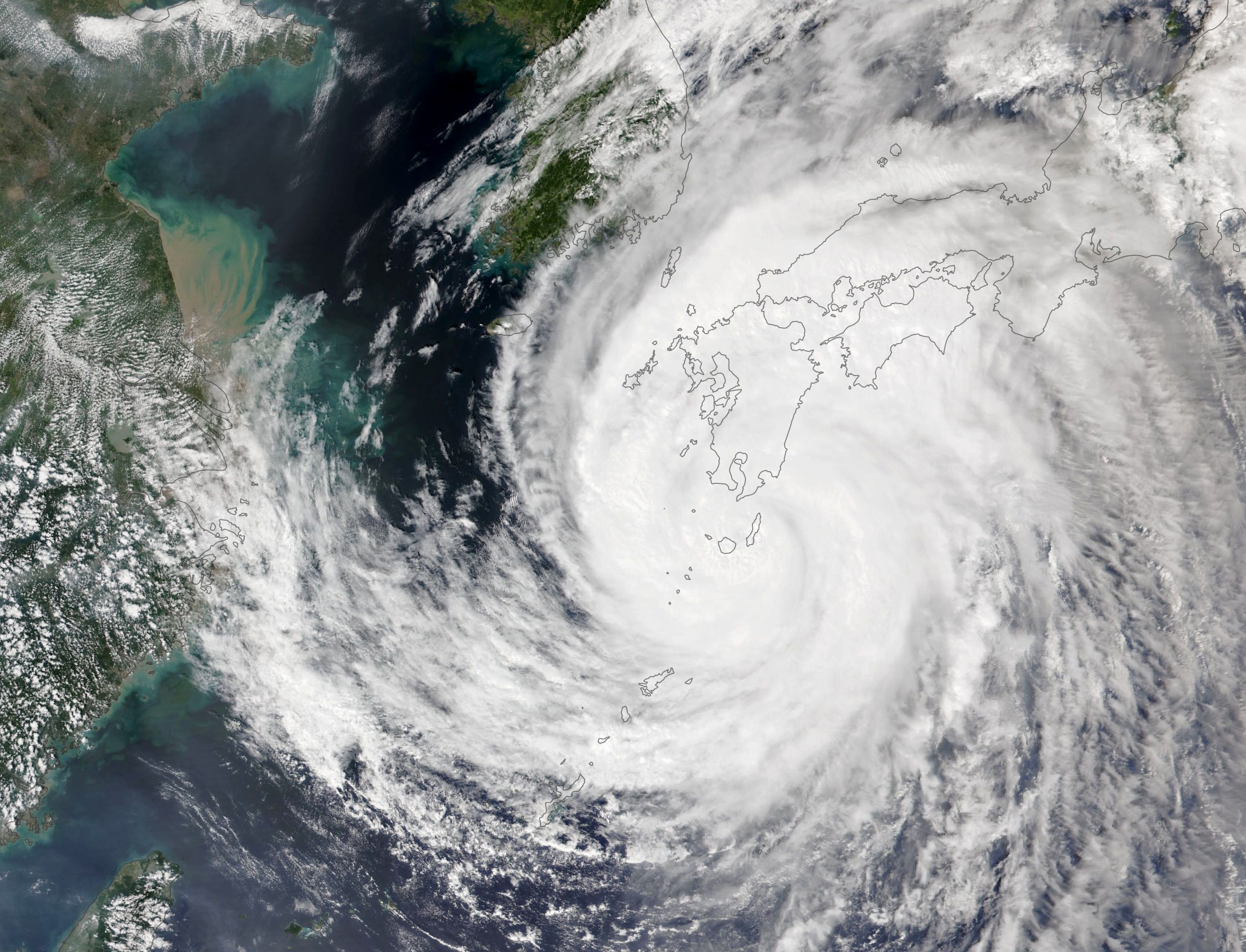
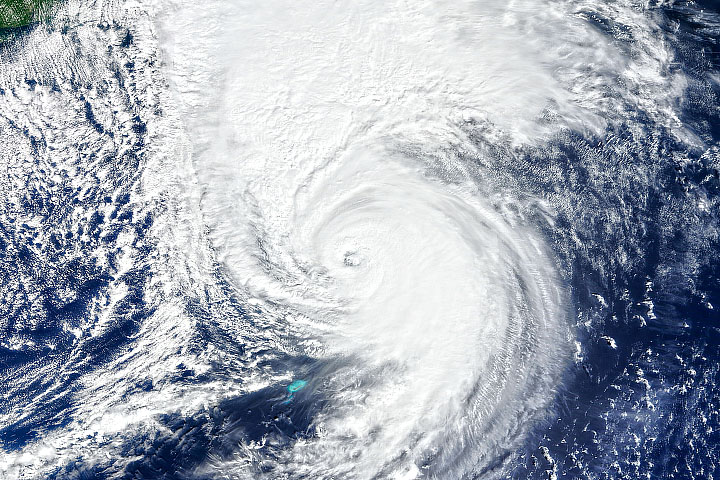
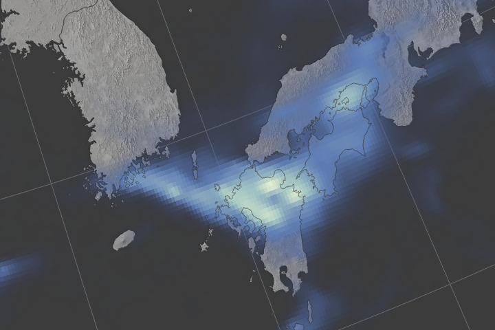
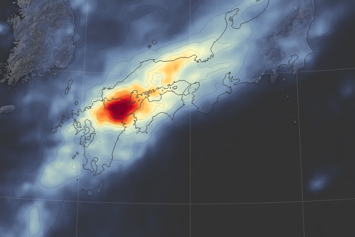
While Fiona was arriving in Puerto Rico, Typhoon Nanmadol blew into southwestern Japan, also bringing flooding rains. Just before midday on September 18, the Visible Infrared Imaging Radiometer Suite (VIIRS) on the NOAA-20 satellite acquired this natural-color image of the storm.
Nanmadol made landfall near Kagoshima late on September 18 as a category-2 storm with 175 kilometer (110 mile) per hour sustained winds. Widespread rainfall totals reached 300 to 500 millimeters (12 to 19 inches), and several rivers and streams overflowed. At least 300,000 customers lost electric power, and most rail and air traffic was halted.
Astronaut Bob Hines tweeted dramatic photos of Nanmadol, noting: “It’s incredible how something that seems so beautiful from space can be so terrible on Earth.”
The Western Pacific typhoon season stretches across the entire year, but the majority of storms usually form between May and October. So far in 2022, 16 tropical storms or depressions have formed in the basin, of which seven have become typhoons.
NASA Earth Observatory images by Lauren Dauphin, using MODIS data from NASA EOSDIS LANCE and GIBS/Worldview and VIIRS data from NASA EOSDIS LANCE, GIBS/Worldview, and the Joint Polar Satellite System (JPSS). Story by Michael Carlowicz.
alert message