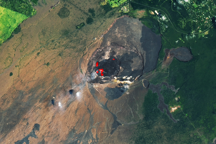
The Earth Observatory has published its last Image of the Day on this website. Please join us on our new home at science.nasa.gov/earth/earth-observatory.
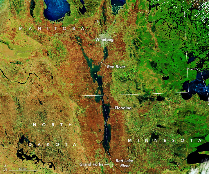
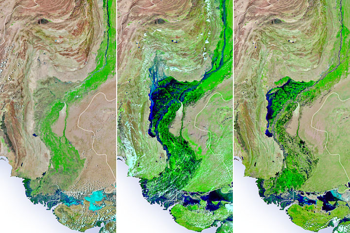
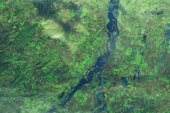
The Red River Valley in Minnesota, North Dakota, and Manitoba is facing some of its worst flooding in a decade. An extreme spring blizzard, multiple rainstorms, and melting winter ice swelled the Red River of the North and its tributaries, driving them out of their banks and across a broad, flat floodplain. The deluge comes one year after the same region endured extreme drought.
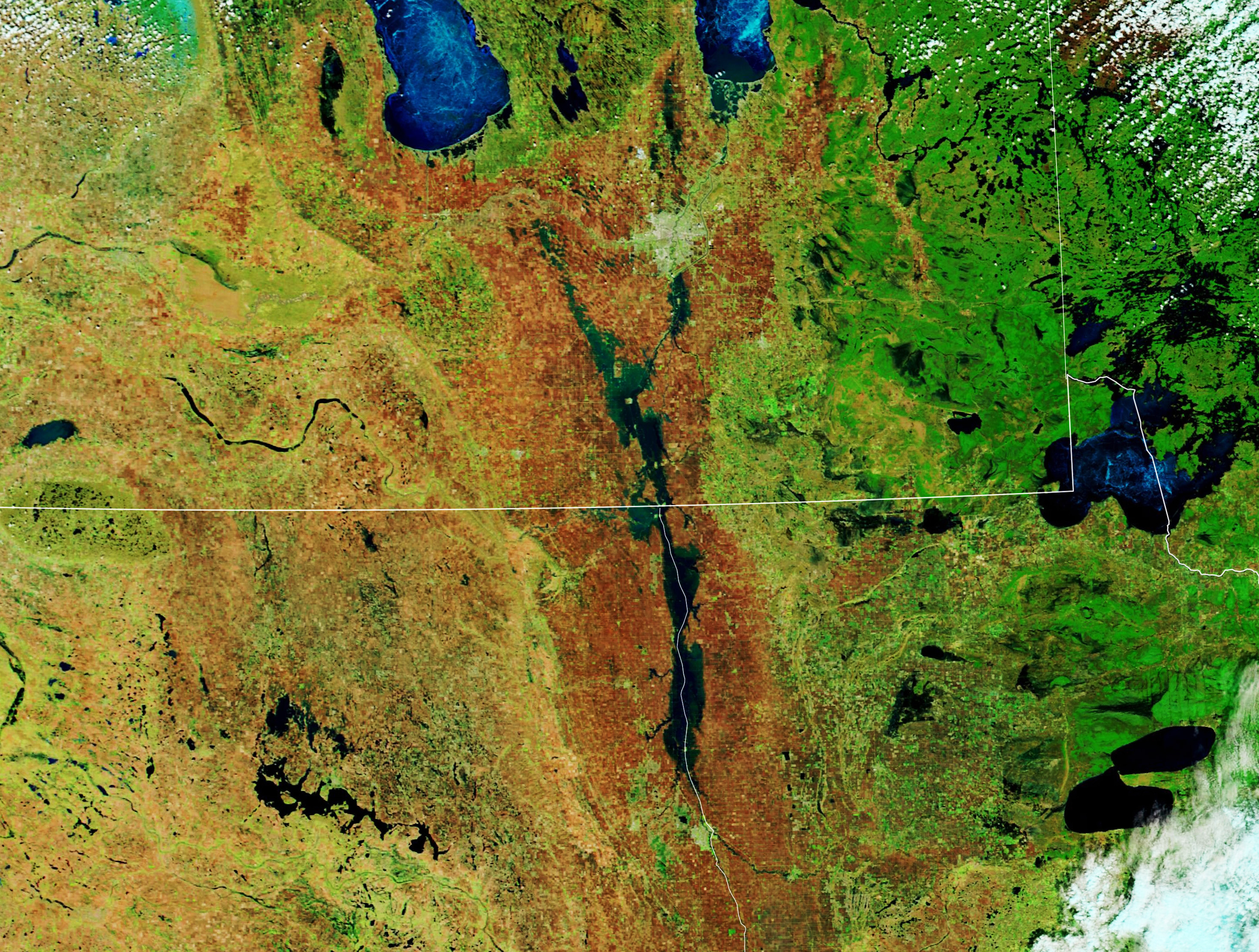
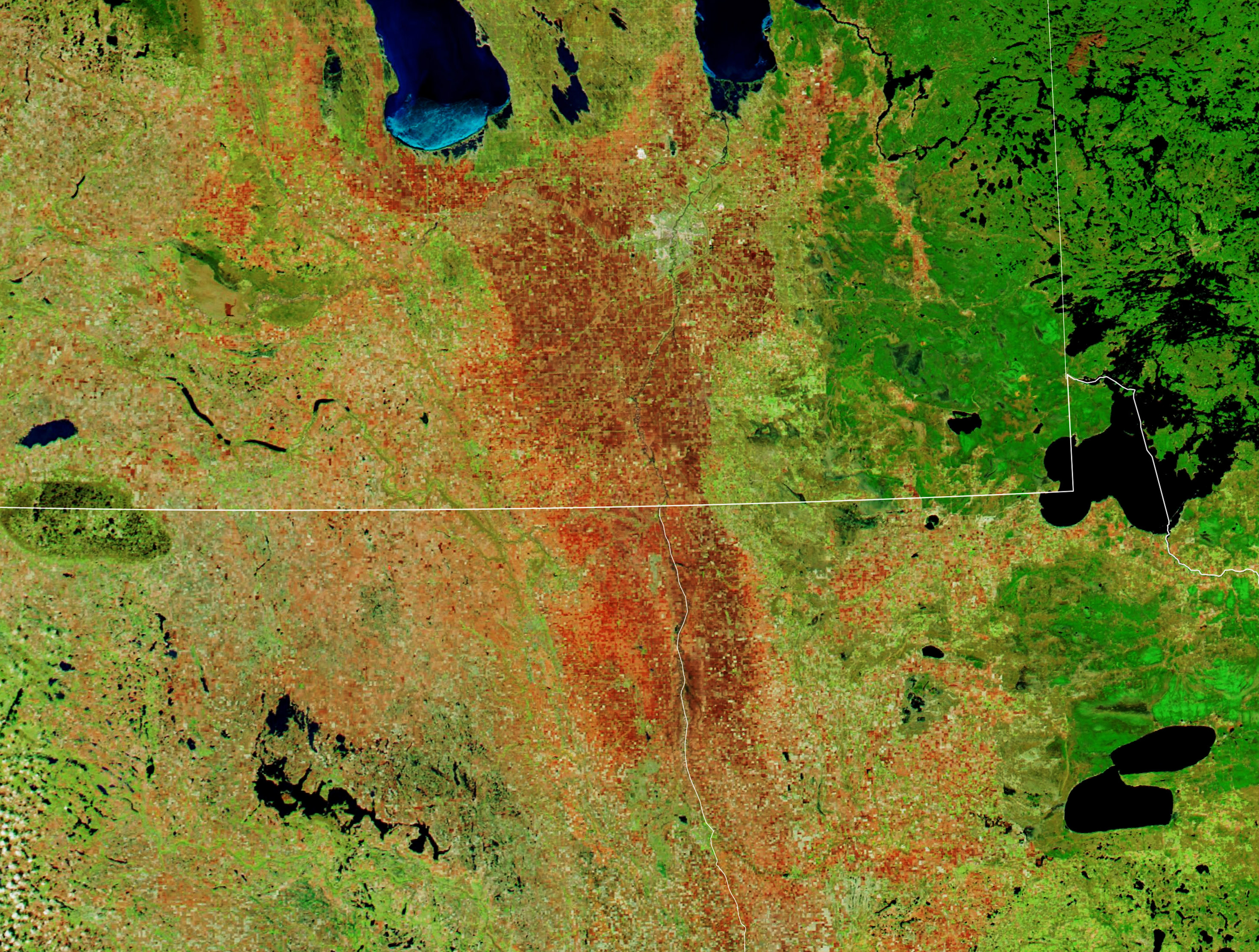
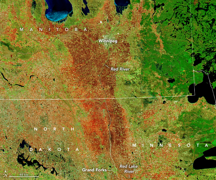
The false-color images above were acquired with the Moderate Resolution Imaging Spectroradiometer (MODIS) instruments on NASA’s Terra and Aqua satellites. The first image shows the flooded valley as observed by Terra on May 10, 2022; Aqua acquired the second image on May 11, 2020, under more typical spring conditions. The images combine shortwave infrared and visible light (MODIS bands 7-2-1) to better distinguish river water out of its banks.
According to the U.S. National Weather Service, the water level on the Red River at Pembina, North Dakota (near the U.S.–Canada border) crested at 52.27 feet on May 8; flood stage there is 39 feet. The Red River has mostly been dropping at Grand Forks, after cresting just below major flood stage last week. The Red River remained in major flood stage at Oslo, Minnesota: river gauges measured 36.09 feet on May 11, while flood stage is 26 feet. According to news reports, water managers in northeast North Dakota remain concerned about the 65-year-old Bourbanis Dam, which has been battered by weeks of high water.
In Canada, at least 26 municipalities remain in states of emergency across southern Manitoba Province. Roads have been flooded on both sides of the international border, and some towns have been isolated by the high water. According to Canadian authorities, the Red River flood this year is already the sixth largest on record (by volume) at Emerson, Manitoba. Forecasters were calling for more rain in the region on May 12.
The flow and topography of the Red River basin are unusual, leading to somewhat regular spring flooding. The river runs north from the Dakotas and Minnesota, through Manitoba, toward Hudson Bay. As a result, the upper reaches of the river (to the south) typically warm, thaw, and flow with spring meltwater and rain when channels to the north are still frozen or choked with ice. This can lead the river to slow or back up onto the floodplain.
The river valley is also nearly flat, and it runs through a trough that was shaped by continental glaciers about 10,000 years ago. The elevation drop along the river from Fargo, North Dakota to the Canadian border is roughly 130 feet (40 meters). The minimal slope allows the river to meander across the landscape; meanwhile, the areas surrounding the trough are steeper and more rugged. The combination of steeper slopes on the edges and merging streams in the flat middle allows water to spread out and rise, while also slowing drainage.
NASA Earth Observatory images by Lauren Dauphin, using MODIS data from NASA EOSDIS LANCE and GIBS/Worldview. Story by Michael Carlowicz.