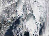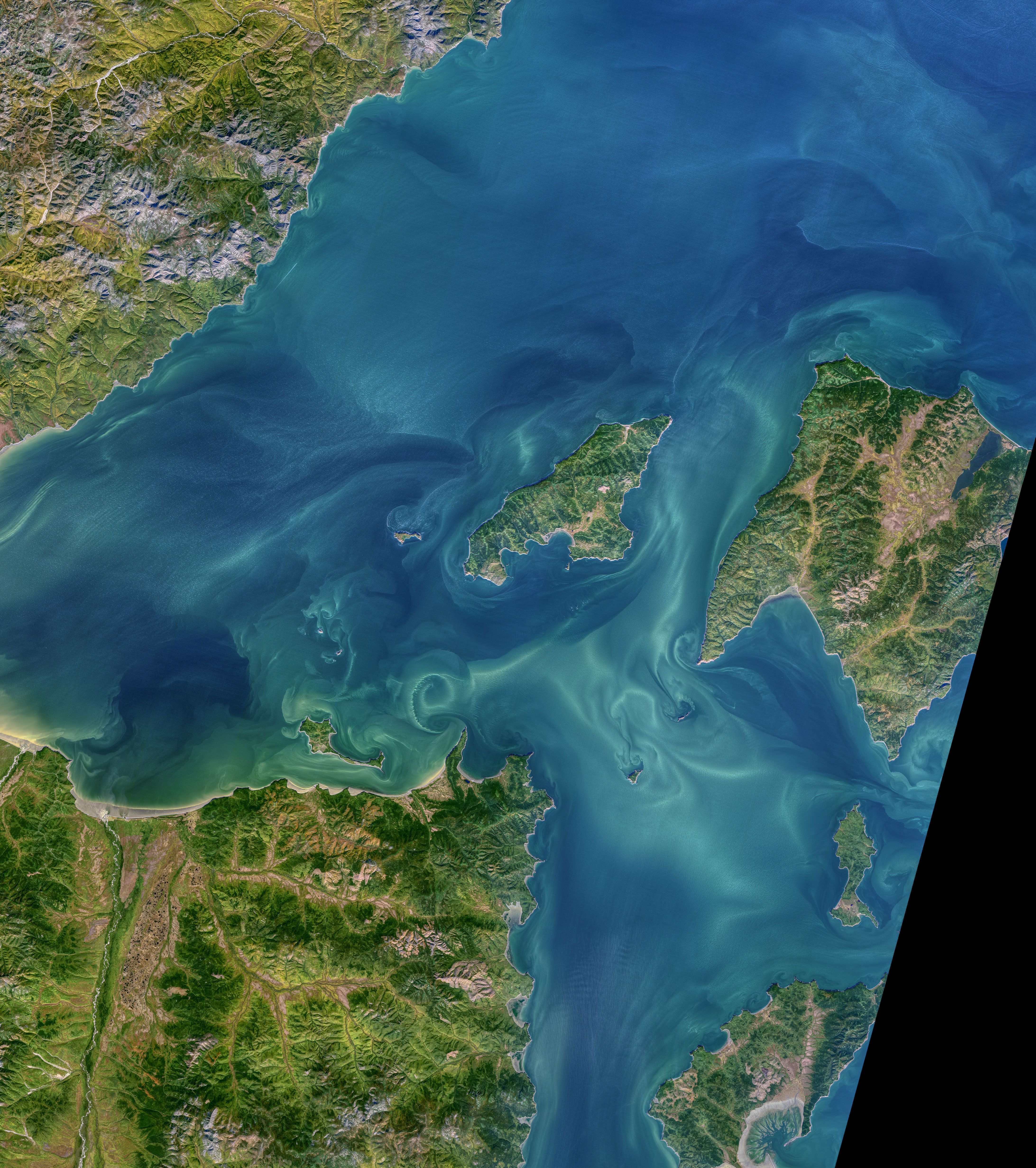
Some of the highest diurnal tides in the world—nearly 14 meters (46 feet)—have been recorded in the Sea of Okhotsk. In the Russian Far East, narrow bays funnel and amplify the incoming tides, making it a prime location for tidal power generation.
The transition from smooth, laminar flow to mixed, turbulent flow is visible in this natural-color image of tidal currents in the western Sea of Okhotsk. The image of the Shantar Islands and Uda Bay was acquired on September 24, 2021, by the Operational Land Imager (OLI) on Landsat 8.
The currents around the Shantar Islands are heavily influenced by the strong tides and by freshwater discharge from rivers draining into Uda Bay. The waters here are frozen for much of the year. When the sea ice melts and freshwater snowmelt swells the Uda River, plumes of low-salinity water can reach far offshore.
As the strong tides and currents flow through straits in the Shantar Islands, they encounter rocky outcrops, headlands, capes, and small islands that disrupt the laminar flow. This can create chains of spiral eddies that rotate in alternate directions as they form. These chains are known as vortex streets or von Kármán vortices. The physical processes that create the vortices were first described in 1912 by Theodore von Kármán, a Hungarian-American physicist and a co-founder of NASA's Jet Propulsion Laboratory. In the Shantar Islands, vortices in the chain propagate mainly to the east at low tide and to the west at high tide.
NASA image by Norman Kuring/NASA's Ocean Color Web, using Landsat data from the U.S. Geological Survey. Story by Sara E. Pratt.