As farmers and backyard gardeners know, plants grow best when they are watered just right—not too little, not too much. A growing number of South Asian farmers are now optimally irrigating their crops thanks to engineers, cell phones, and satellite data. The new tool is helping farmers simultaneously maximize their yield and conserve water.
Water sustainability, food security, and farmers’ livelihoods are all at stake in South Asia, so it is critical to end overwatering. Faisal Hossain, an environmental engineer at the University of Washington, and colleagues are harnessing free and open satellite data to help local farmers water just right.
In research published in March 2021 in Water Resources Research, Hossain and colleagues demonstrated that a staggering amount of groundwater could be saved if a satellite-based irrigation advisory system is deployed to alert farmers who are overwatering crops. In the demonstration project, the team found that SMS text message advisories could potentially save as much as 80 million cubic meters of water in India and 150 million in Pakistan.
While modern irrigation has largely offset the unpredictable nature of weather that once vexed farmers, the effective “rain-on-demand” achievement comes with a cost: water use by the food sector now accounts for some 60 to 90 percent of global freshwater use. In countries with monsoon-dominated flood-then-drought weather patterns, year-round farming is particularly reliant on groundwater extraction.
“Water scarcity is a big issue in South Asia and in most places around the world,” Hossain observed. “If you look at data, the 800-pound gorilla of water use is the food sector.” Previous research has shown that an unsustainable amount of water has been pumped out of the ground in South Asia in recent years. At the same time, crops are often over-watered, lowering yields and squandering a precious resource.
The University of Washington team is working closely with water and agriculture bureaus of South Asia to decrease wasteful irrigation. They developed an Irrigation Advisory System (IAS) that uses free and open data to assess where crops need less or more water. They tested it with 100,000 farmers in the region.
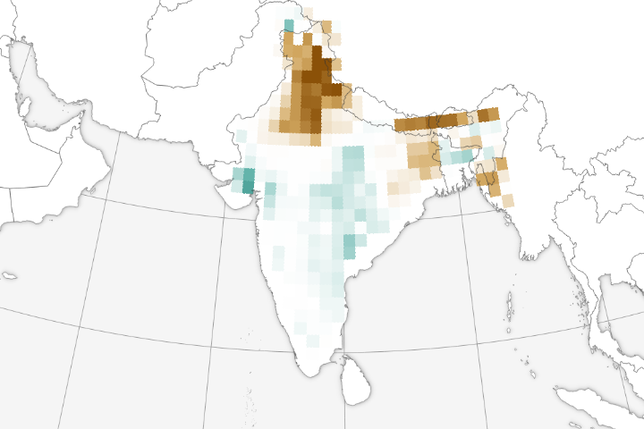
The multi-step process starts with satellite gravimetry data from the Gravity Recovery and Climate Experiment Follow On (GRACE-FO), which offers a qualitative synopsis of current groundwater conditions. This water storage information allows the IAS to identify regions where groundwater depletion trends are the most alarming and persistent.
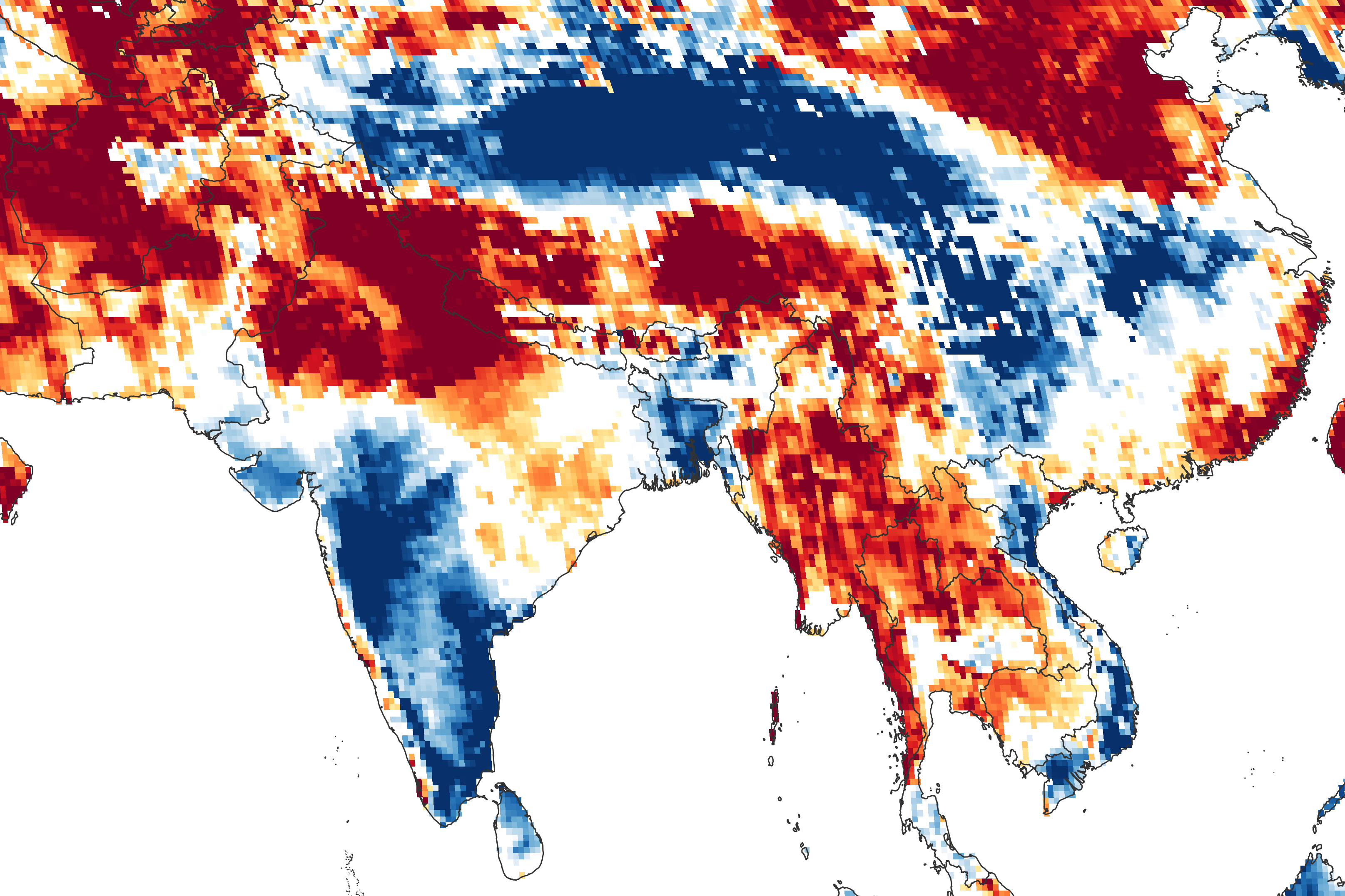
The map above shows shallow groundwater storage in southern Asia on March 15, 2021, as measured by GRACE-FO. The colors depict the wetness percentile; that is, how the levels of groundwater compare to long-term records for the month. Blue areas have more abundant water than usual, and orange and red areas have less. The darkest reds represent dry conditions that should occur only 2 percent of the time (about once every 50 years).
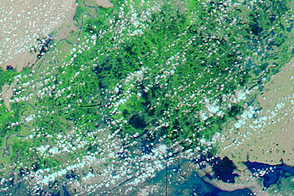
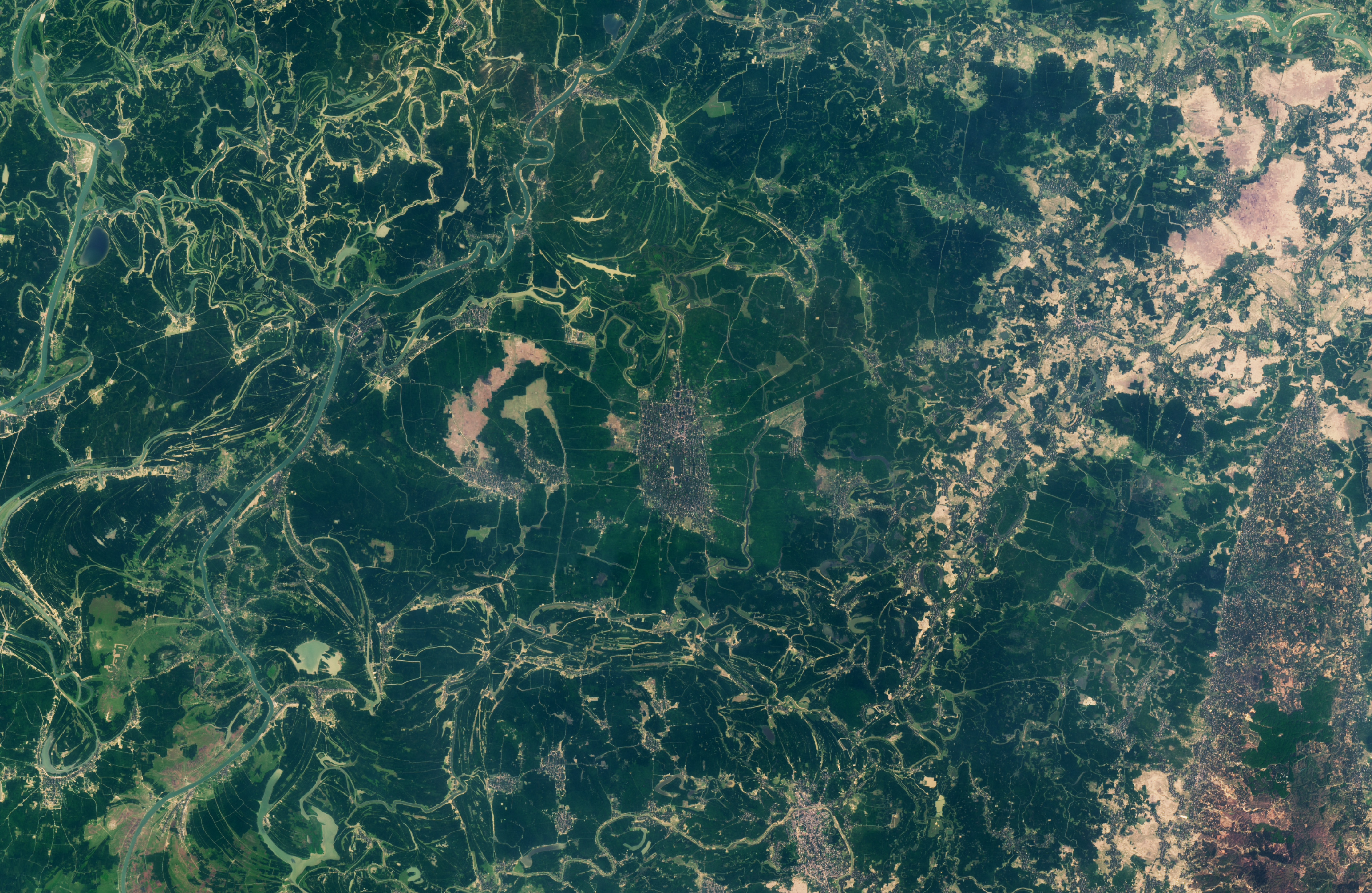
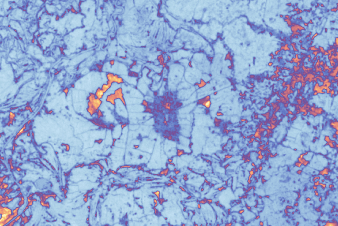
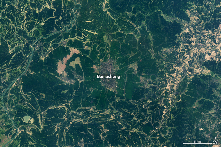
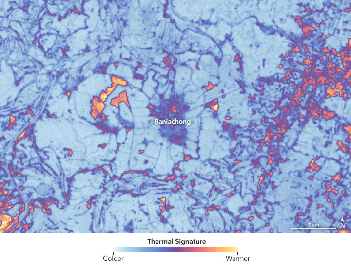
The next step is to estimate the amount of water needed by certain crops, and then use Landsat’s Thermal Infrared Sensor (TIRS) to find overwatering farms. The images at the top of this page shows Baniachong, Bangladesh, northeast of Dhaka. The natural color image (top left) from the Landsat 8 Operational Land Imager (OLI) shows a village surrounded by lush green rice fields. In the right image, TIRS reveals land surface temperatures around the same area: bright colors are warmer and darker colors are cooler.
From this thermal data, the team can calculate the amount of evapotranspiration—the movement of moisture and heat from the land to the air as the surface warms and plants “breathe.” Knowing the level of evapotranspiration helps Hossain and colleagues derive the amount of water being spread by farmers on their fields. When the amount of water used for irrigation is 20 percent higher than the amount needed—taking into consideration weather conditions and the crop growth stage—the farmers receive text messages from IAS that their fields that are being excessively irrigated.
“I think this is a human rights issue for farmers to have free access to science-based best practices,” Hossain noted. “If we want to talk about water sustainability, we have to make agricultural water use as efficient as possible by growing more with less water. Even if we can improve by just 1 percent, it translates to huge savings in water, more than what entire nations consume for domestic needs.”
NASA Earth Observatory images by Lauren Dauphin, using Landsat data from the U.S. Geological Survey and GRACE data from the National Drought Mitigation Center. Story by Laura Rocchio, Landsat Communication & Public Engagement Team, with Mike Carlowicz.