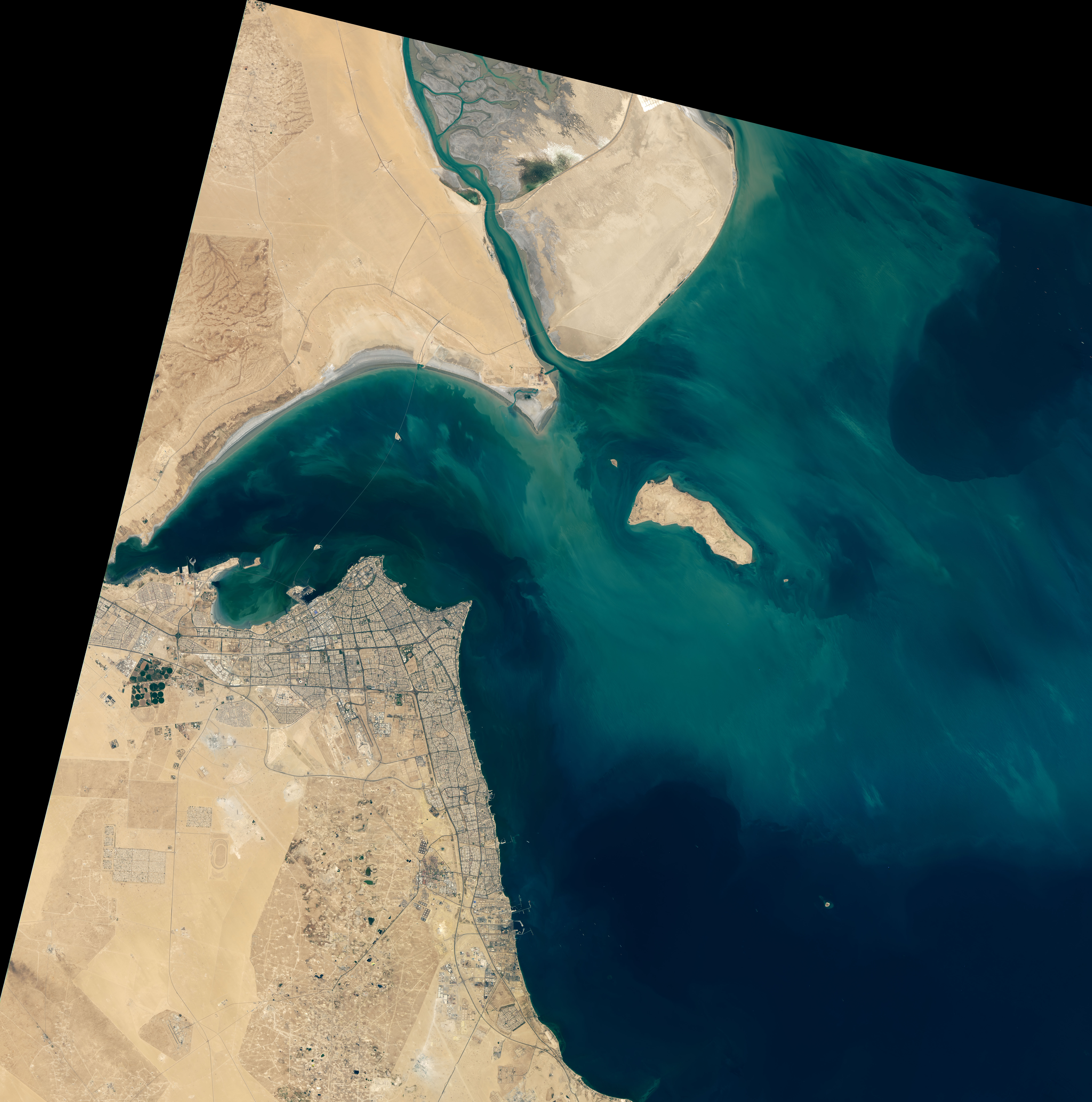
After five years of planning and construction and more than three billion dollars in construction costs, one of the world’s longest bridges is complete. Opened in May 2019, the 48-kilometer (30-mile) Sheikh Jaber Al-Ahmad Al-Sabah Causeway is one of the largest construction projects in Kuwait’s history.
The Operational Land Imager on Landsat 8 acquired these images of the causeway on September 8, 2019. Approximately 75 percent of the bridge (36 kilometers or 22 miles) stands over water. It also crosses two artificial islands (Bay Island North and Bay Island South) that were constructed for entertainment and tourism purposes.
Building the bridge was challenging in the coastal environment, where dangerously high temperatures and varying humidity can create extremely hot and dry conditions. Much of the construction occurred in early morning and after dark, with crews using high-powered lights or sun shields when necessary. The causeway is primarily composed of concrete piles and steel and layered with waterproofing and asphalt.
Construction companies reported that they tried to take extra care to preserve the ecosystem near the bay, specifically for green tiger shrimp. In one case, they created an alternative breeding area comprised of 1,000 rock and reef blocks in order to draw the shrimp away from the construction site.
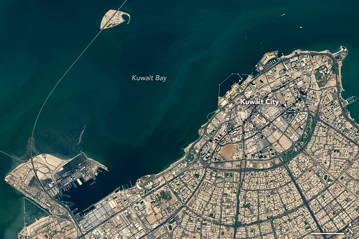
Named after the late Sheikh Jaber Al Sabah, the causeway was built to help reshape the country into an international trade center, weening it away from an oil-dependent economy. The bridge reduces travel time by nearly an hour from the capital, Kuwait City, to the northern shore of Kuwait Bay and the proposed future site of Madinat Al-Hareer.
Meaning “Silk City” in Arabic, Madinat Al-Hareer is being proposed as a free trade zone and seaport. With development costs of more than $100 billion, the planned megacity will also include an airport, Olympic stadium, and a tower surpassing Dubai’s Burj Khalifa, currently the world’s tallest building. The causeway and Silk City are just a few elements in Kuwait National Development Plan 2035.
NASA Earth Observatory images by Lauren Dauphin, using Landsat data from the U.S. Geological Survey. Story by Kasha Patel.