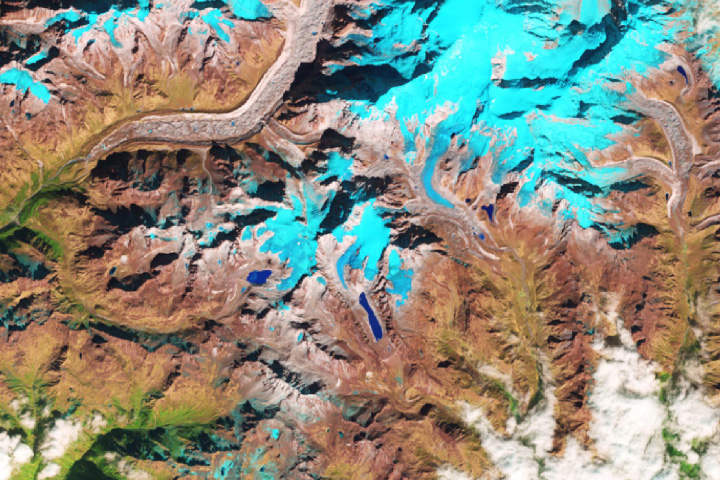
Over the past two decades, rising temperatures have rapidly transformed ice from Alaska’s Excelsior Glacier into a lake of meltwater. Today, that lake on the Kenai Peninsula measures more than five times the size of New York’s Central Park.
Big Johnstone Lake first began forming in 1941; it has doubled in size in the past 24 years. Since 1994, Excelsior Glacier has retreated about 200 meters per year—nearly twice as fast as the previous 50 years—and has shortened by 30 percent. “To see the amount of expansion and retreat in that amount of time is exceptional,” said Mauri Pelto, a glaciologist at Nichols College.
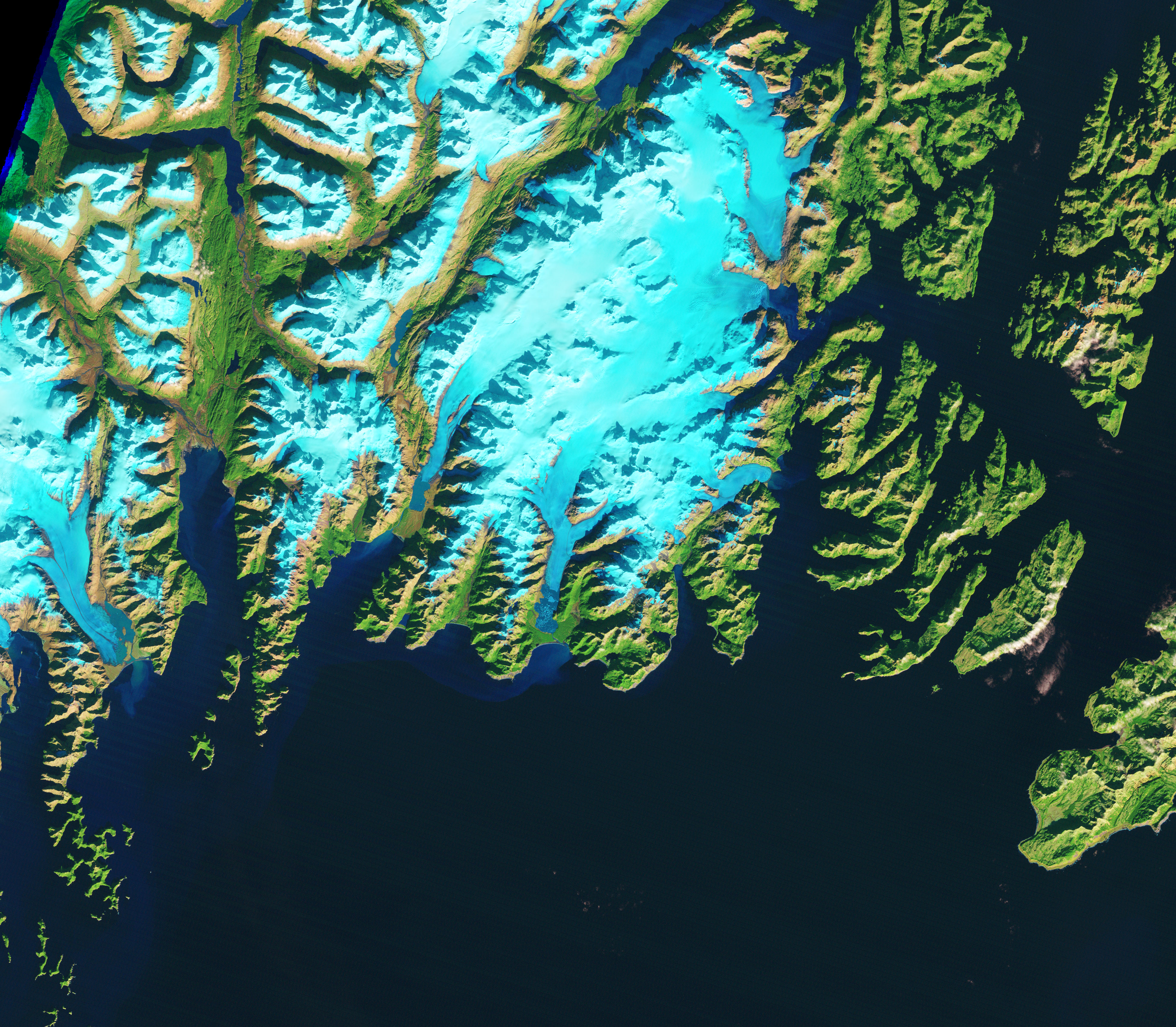
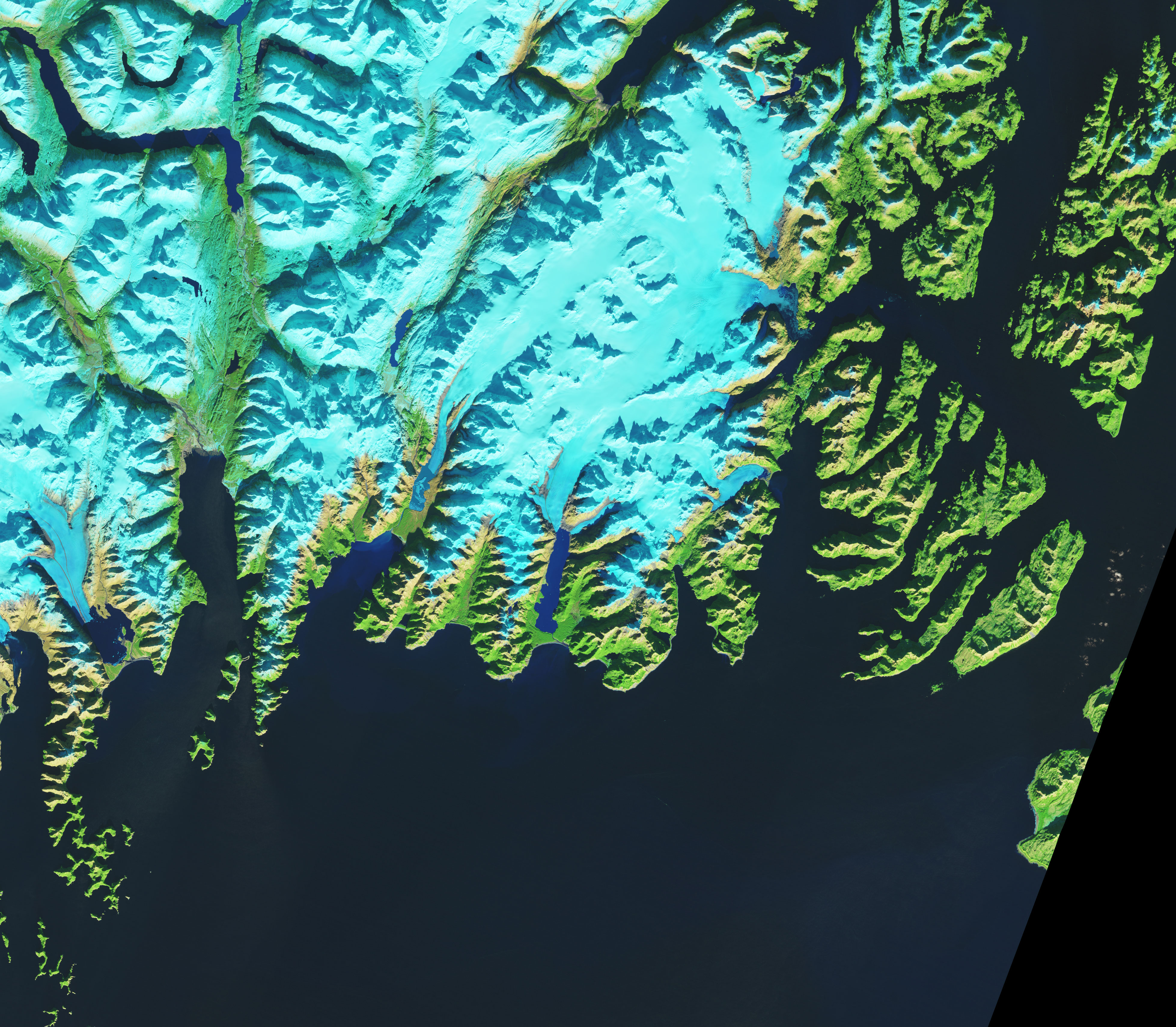
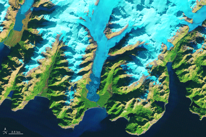
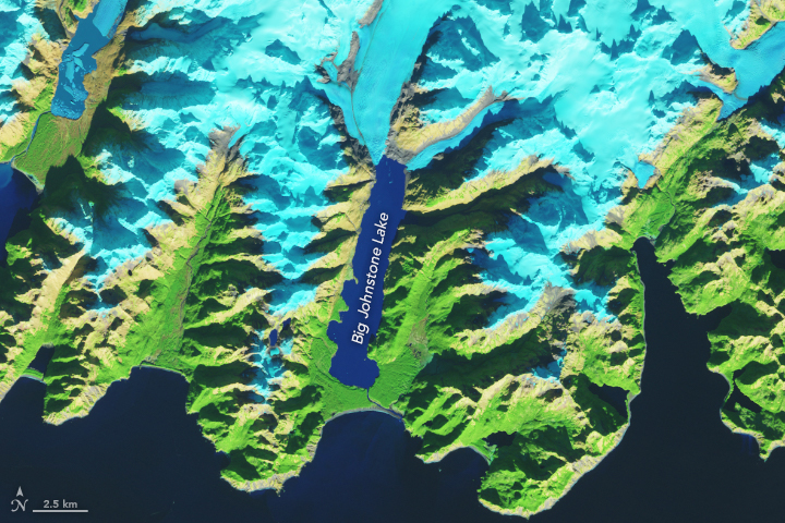
These false-color images show Excelsior Glacier and Big Johnstone Lake. The left image was acquired on October 16, 1986, by the Thematic Mapper on the Landsat 5 satellite using bands 5-4-3. The right image was acquired on October 31, 2018, by the Operational Land Imager on the Landsat 8 satellite using bands 6-5-4. In these images, various visible and infrared wavelengths were combined to better differentiate areas of water that are frozen (light blue) from those that contain significant meltwater (dark blue). Rocks are brown and vegetation is green. Note that by 2018 the glacier had retreated to a point where the eastern and western tributaries had separated.
Warm temperatures are a major cause of the rapid retreat, but Pelto notes that the melting has also destabilized the glacier. Specifically, Pelto looked at the number of cracks that cut through the glacier—called rifting. Rifting can lead to icebergs breaking off the glacier, known as calving.
“When you began to develop these rifts, it is because the glacier is so thin that it is not stable and it calves," said Pelto, who noticed rifting when he looked at satellite imagery of the glacier in 2013. "Calving is another way of losing large amounts of mass.”
The 1986 image shows floating chunks of ice and debris in the lake. But in the past two years, there have been no floating icebergs observed in Landsat satellite imagery, according to Pelto. Note, also, the differences in water clarity between the two images. The lake has turned a deeper shade of blue because there is less glacial flour. This fine-grained silt is produced by glaciers as they grind and pulverize rock, and it ends up in the lake through calving events.
Pelto says he no longer expects large calving to occur because the glacier has retreated onto a higher slope, making it difficult for large chunks to break off. Also, the intersection (or front) where the glacier meets the lake is much narrower than before, so fewer icebergs are forming.
“It will still retreat, but it will slow down a lot—more on the order of tens of meters per year instead of hundreds,” said Pelto. “That’s the difference between something that calves and something that doesn’t.”
NASA Earth Observatory image by Lauren Dauphin, using Landsat data from the U.S. Geological Survey. Story by Kasha Patel.
alert message