The Earth Observatory has published its last Image of the Day on this website. Please join us on our new home at science.nasa.gov/earth/earth-observatory.
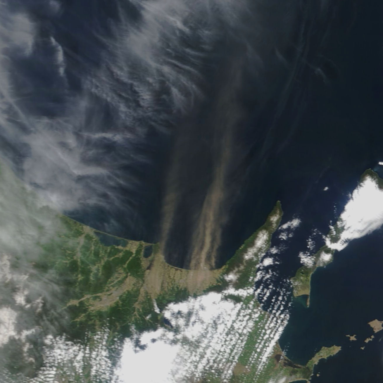
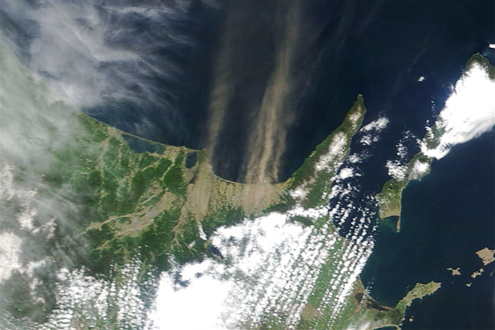
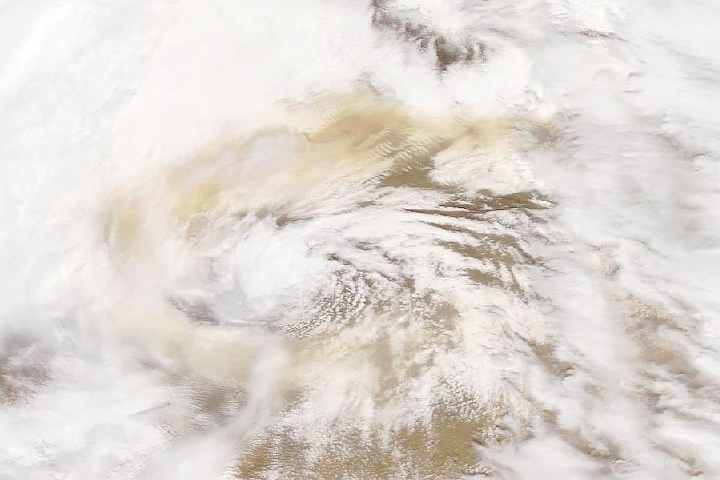
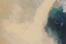
When satellites observe large dust plumes over Japan, the dust typically comes from vast deserts in Central Asia and arrives on westerly winds. However, on May 20, 2019, the Moderate Resolution Imaging Spectroradiometer (MODIS) on the Terra satellite acquired an image of a different type of dust event—a plume streaming from farmland near Shari and Kiyosato in northern Hokkaido.
Unusually dry weather in April and May 2019 likely dried out the land surface and made it easier for strong southerly winds to lift so much dust. In the nearby town of Betsukai, the Japan Meteorological Agency recorded maximum instantaneous wind speeds within 10 minute periods of 59 kilometers (37 miles) per hour on May 20, noted Teppei J. Yasunari, an atmospheric scientist with Hokkaido University’s Arctic Research Center. Dust storms typically can occur if winds exceed 40 kilometers per hour.
The seasonal rhythms of farming likely contributed as well. Landsat satellite imagery suggests that many fields in the area had little green vegetation or may have been tilled recently, both of which would make it easier for gusty winds to pick up dust.
Scientists who routinely monitor global dust storm activity say it is unusual for Japan to produce such a large dust plume. Though on average there are 20 teragrams (44 billion tons) of dust in the air at any one time, most of it comes from large deserts in North Africa, the Middle East, and Central Asia.
NASA Earth Observatory images by Adam Voiland, using MODIS data from NASA EOSDIS/LANCE and GIBS/Worldview. Caption by Adam Voiland.


