Over the past week, both Haiti and the Dominican Republic, the two countries on the island of Hispaniola, have been ravaged by severe flooding after several days of heavy rain. Hundreds have perished in the two countries as a direct result of mud slides and flash flooding. The hardest hit area was in and around the town of Jimani in the southwestern part of the Dominican Republic near the border with Haiti. The Soliel River overflowed its banks before dawn on the morning of the 25th of May 2004 catching the town by surprise.
A trough of low pressure across the central Caribbean provided the impetus for the numerous showers and heavy rains. The effect was amplified as moisture-laden low-level southerly winds from the Caribbean interacted with the topography of the island. The Dominican weather service reported that 10 inches of rain fell near Jimani in just 24 hours.
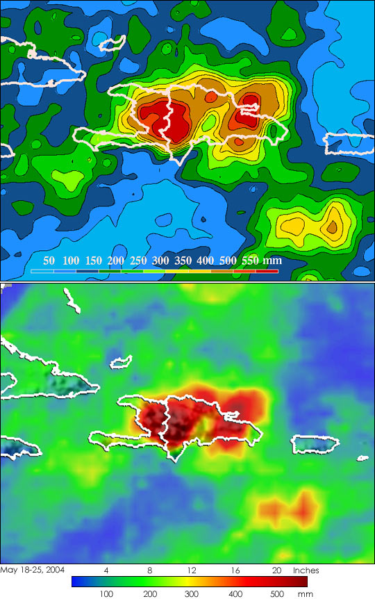
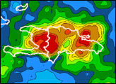
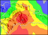
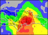
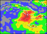
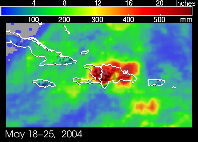
The Tropical Rainfall Measuring Mission satellite which was launched in November of 1997 uses both passive and active sensors to measure rainfall over the global tropics from space. The TRMM-based, near-real time Multi-satellite Precipitation Analysis (MPA) at the NASA Goddard Space Flight Center provides quantitative rainfall estimates over the global tropics. The above images show rainfall accumulation between May 18 and May 25, 2004. The first lower shows MPA rainfall totals over the northern Caribbean. The red areas indicate rainfall totals in excess of 14 inches over most of Hispaniola. Darker red areas along the border between Haiti and the Dominican Republic show rainfall totals for the period approaching 24 inches. The second image provides a close-in view of rainfall contours over the same period. It shows that the highest totals are right along the border between Haiti and the Dominican Republic and over the northeastern part of the Dominican Republic and exceed 550 mm (21.7 inches).
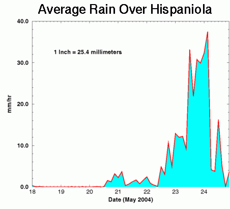
The above animations show that the bulk of the rain appears to have fallen in a single day on May 23. This graph confirms what the animations show in more detail. It shows the instantaneous average rainfall over a 250-km radius centered at 19N 72W (near the center of the border between Haiti and the Dominican Republic) over the period. It reveals that most of the rain did, in fact, fall on the 23rd of May although significant amounts fell on May 22 and 24 as well. The dates begin at 00Z (midnight Greenwich Mean Time, or 7 pm local time). This graph shows the accumulated rainfall with time for the same area and period. By 00Z on the 25th, an average of 300 mm (11.8 inches) of rain had fallen over the area with a maximum single point accumulation of 598 mm (23.5 inches).
TRMM is a joint mission between NASA and the Japanese space agency JAXA.
Images produced by Hal Pierce (SSAI/NASA GSFC) and caption by Steve Lang


