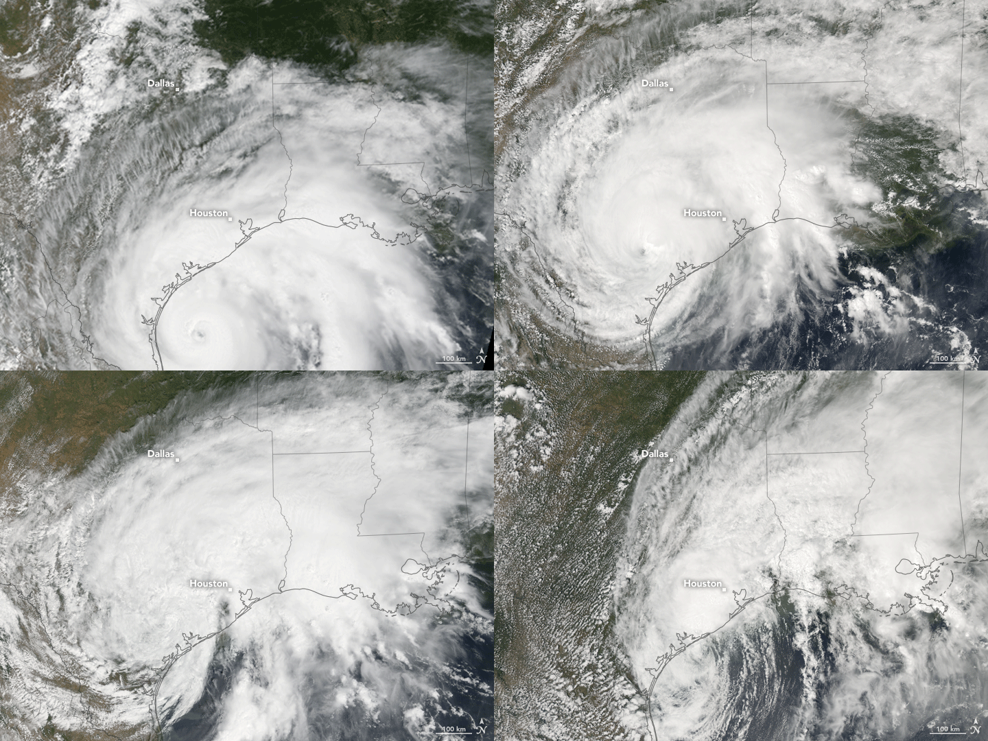


On August 25, 2017, Hurricane Harvey made landfall in Texas as a category 4 storm. Harvey has since been downgraded to tropical storm status, but its slow progression has brought a deluge of rain and catastrophic flooding to the region.
This animation is composed from images captured once per day between 12:25 p.m. Central Daylight Time on August 25 and 2:30 p.m. on August 28. Images were acquired with the Moderate Resolution Imaging Spectroradiometer (MODIS) on NASA’s Terra and Aqua satellites.
Notice how the storm appears to stall in the later scenes. By the morning of August 28, Harvey’s center was moving southeastward near the Texas coast at a mere 7 kilometers (5 miles) per hour. Satellite-based measurements of rainfall from August 21 to August 28, 2017, indicated that the slow-moving system delivered rainfall totals on the order of 20 inches from the coast near Galveston Bay to the Houston area. (These rainfall totals are regional, remotely-sensed estimates, and local amounts can be significantly higher when measured from the ground.) NOAA forecasters reported that as much as 50 inches of rain could fall in places around the Houston and Galveston areas.
NASA Earth Observatory images by Jesse Allen, using MODIS data from the Land Atmosphere Near real-time Capability for EOS (LANCE) and the University of Wisconsin’s Space Science and Engineering Center Direct Broadcast system. Caption by Kathryn Hansen.