The southern route is open, while the northern route still has some lingering ice in Parry Channel.
Published Sep 13, 2015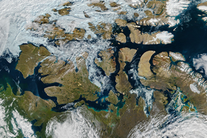
By mid-August 2016, the famed high-latitude sea route in the Arctic Ocean was open.
Published Aug 20, 2016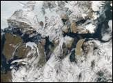
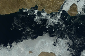
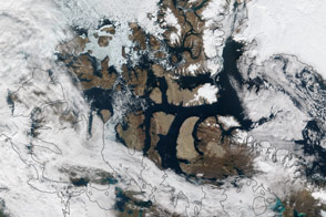
Acquired July 17, 2012, and August 3, 2012, these natural-color images show the retreat of sea ice from the Parry Channel in the Northwest Passage.
Published Aug 9, 2012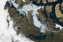
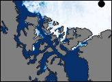
Acquired August 27, 2009, this true-color image shows the partial opening of the Northwest Passage in the Canadian Arctic Archipelago. Besides some ice-free and ice-clogged channels, the image also shows the varied topography of snow-free islands.
Published Sep 3, 2009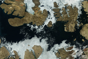
Acquired August 2, 2012, this image shows a largely open Northwest Passage.
Published Aug 6, 2012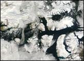
On September 15, 2007, the Moderate Resolution Imaging Spectroradiometer (MODIS) on NASA’s Terra satellite captured a largely cloud-free image of the Northwest Passage. Although the sea route had been characterized as nearly open weeks earlier, persistent cloud cover prevented a MODIS true-color image of the open route.
Published Sep 24, 2007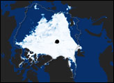
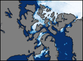
This image shows sea ice around the Northwest Passage as observed by the Advanced Microwave Scanning Radiometer for EOS (AMSR-E) aboard NASA’s Aqua satellite on August 22, 2007. McClure Strait, Parry Channel, Victoria Strait, and McClintock Channel (north of Victoria Strait), all appear nearly ice-free. North of McClure Strait, an area of sea ice remains, but it is fragmented.
Published Aug 28, 2007alert message
