
50 trillion pixels of Landsat data give researchers a lot of opportunities to look at Earth processes on scales from days to decades.
Published Apr 16, 2015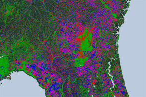
Open-access data from the NASA-USGS Landsat mission and cloud computing make for a highly detailed view of gains and losses in global and regional tree cover since 2000.
Published Nov 16, 2013
The opening of the Landsat data archive and a partnership with Google has allowed researchers to track the fine details of forest change around the world.
Published May 7, 2015
When the Landsat archive is combined with modern computing power, scientists can view the planet not just across space, but also time.
Published Jun 11, 2013Image of the Day Land Unique Imagery Human Presence Remote Sensing

A composite view of the United States represents one of the ways scientists are exploring Landsat 8’s capabilities.
Published Feb 11, 2014
What does Landsat have in common with the Gutenberg Bible, Tolstoy’s personal library, and the Book of Kells?
Published Nov 24, 2011
Landsat observed the loss of 3.7 million hectares (14,000 square miles) of tropical forest.
Published Sep 26, 2012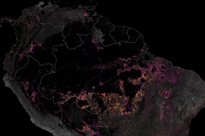
Satellites have played a key role in monitoring and reducing the rate of deforestation in the rainforest.
Published Dec 19, 2019
Decades of satellite data make it possible to map how deforestation has evolved over time.
Published Nov 21, 2019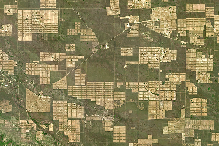
Roughly 20 percent of Gran Chaco’s forest has been converted into farmland or grazing land since 1985.
Published May 1, 2018
Researchers studying tropical forests have mapped out a way to preserve significant amounts of carbon-rich vegetation and biodiversity by connecting existing protected areas.
Published Apr 2, 2014
Being able to see traces of human history in satellite imagery is dependent on what details can be resolved on a given image. There are four main types of image resolution.
Published Oct 4, 2017
The area east of Santa Cruz was originally dry tropical forest.
Published May 27, 2001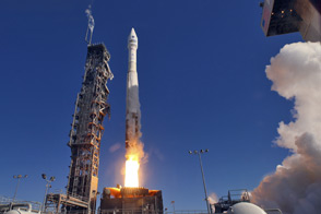
LDCM extends an unprecedented four-decade record of global land observations.
Published Feb 12, 2013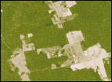
This pair of images reveals how dramatically and rapidly the Amazon can be transformed. The images compare deforested areas (tan) to forest (green) in 2000 (top) versus 2006 (bottom). The area, which is in southern Rondônia southwest of the Pacaás Novos National Park, was almost completely cleared during the period. The decreased greenness of the remaining forest in 2006 may be from a variety of causes: drought, degradation from logging or accidental fire, or different angles of observation during the two satellite overpasses.
Published Mar 31, 2007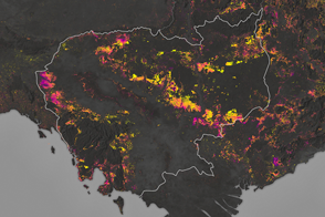
Forests are being turned into rubber plantations, farmland, and timber at a rapid rate.
Published Jan 10, 2017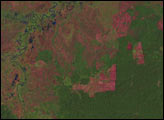
Researchers have turned to citizen scientists to help detect previously unknown or recently disrupted kelp forests in satellite imagery.
Published Jan 13, 2015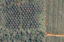
Acquired May 27, 2003, this true-color Landsat ETM image shows part of a plantation in Malaysian Borneo, along the edge of the forest. The area outlined in white in the ETM image appears in greater detail in the image acquired on June 18, 2002, by the commercial satellite Ikonos. The images show the differences between forest, cleared land, and palm plantation.
Published Sep 10, 2009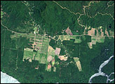
In June 2008, an international team of researchers released a report on the state of Papua New Guinea’s forests. The study summarized the findings from a five-year project in which the scientists compared high-resolution satellite imagery from the early 1970s and the early 2000s. The researchers found evidence of rapid deforestation and degradation, driven primarily by logging, subsistence agriculture, fires, and the development of mines and plantations.
Published Jun 8, 2008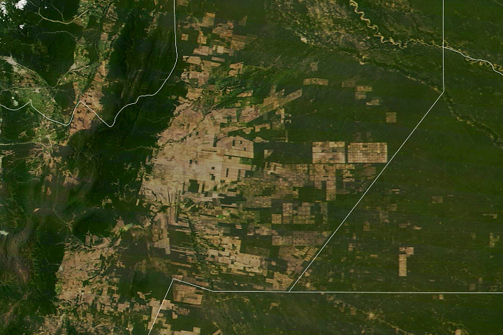
South America’s second-largest forest has been experiencing rapid tree losses in recent decades.
Published May 20, 2020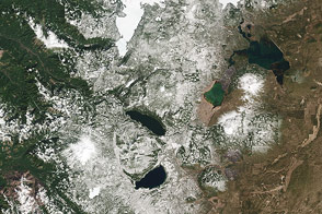
The Cascade Mountains and nearby forests and lakes provide a good test of the visual range of the new LDCM satellite.
Published Apr 30, 2013alert message
