Fires in Quebec, Canada, are the likely source.
Published Jun 27, 2013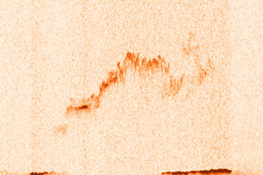
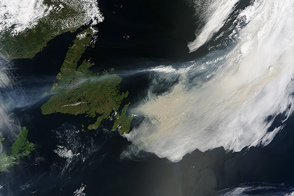
As satellites observed, an intense wildfire in Quebec, Canada, lofted smoke high into the atmosphere in June 2013. Winds then drove the smoke across the Atlantic Ocean all the way to Europe.
Published Jun 28, 2013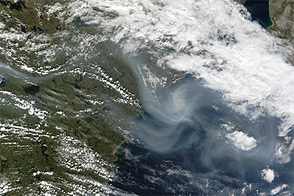
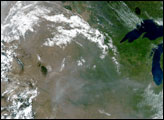
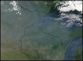
Acquired July 25, 2011, this natural-color image shows smoke from wildfires blowing eastward across Canada.
Published Jul 26, 2011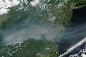
A plume of smoke from wildfires burning in Canada reached the eastern United States.
Published Jun 11, 2015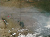
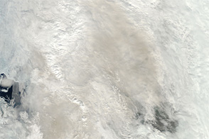
This image from mid-June 2012 shows smoke over Davis Strait. The smoke may have originated from wildfires in Labrador.
Published Jun 21, 2012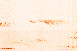
With dozens of wildfires burning in a part of Russia best known for its frigid winters, the CALIPSO satellite offered this view through the clouds and smoke.
Published Jul 30, 2014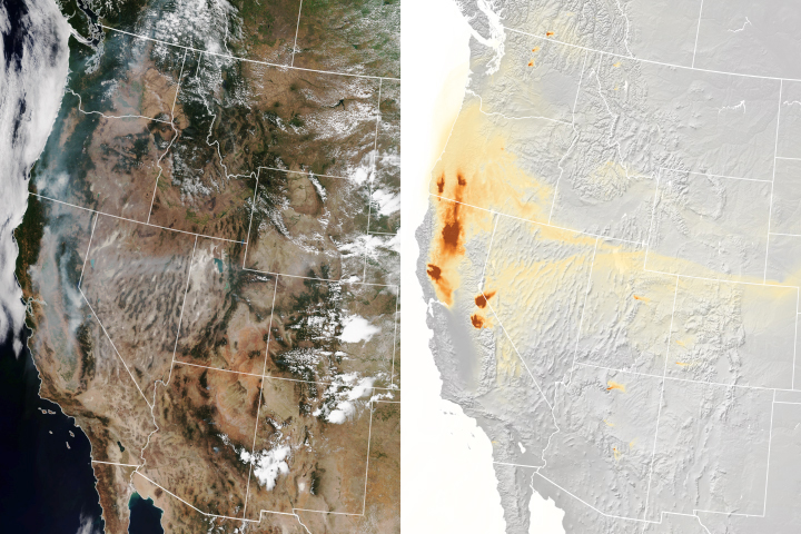
A new experimental model that relies on data from NOAA and NASA satellites has proven remarkably good at simulating the behavior of wildfire smoke.
Published Nov 6, 2018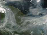
Thick smoke choked the skies over Manitoba, Ontario, and Hudson Bay on Tuesday, July 24, 2007. Thick swaths of smoke hundreds of kilometers across stretch eastward over Canada’s land and water. The smoke can be distinguished from the nearby clouds by the difference in color. Whereas clouds are bright white, the smoke is dingy gray.
Published Jul 27, 2007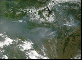
alert message
