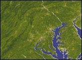
For more than two decades, satellites have been observing seasonal patterns of Earth's vegetation. In eastern North America, the spring “green up” is one of the most dramatic changes satellites observe.
Published Sep 15, 2007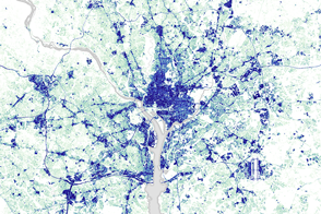
Since 1984, the Capital Beltway has gotten wider and much busier as suburbs have sprung up along it.
Published Mar 29, 2016
New research quantifies how plants along urban roads, in parks, and in wooded neighborhoods can regulate the warming effects of urbanization.
Published Aug 26, 2015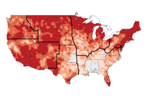
Climate change is already affecting the American people in far-reaching ways, says a new climate report.
Published May 8, 2014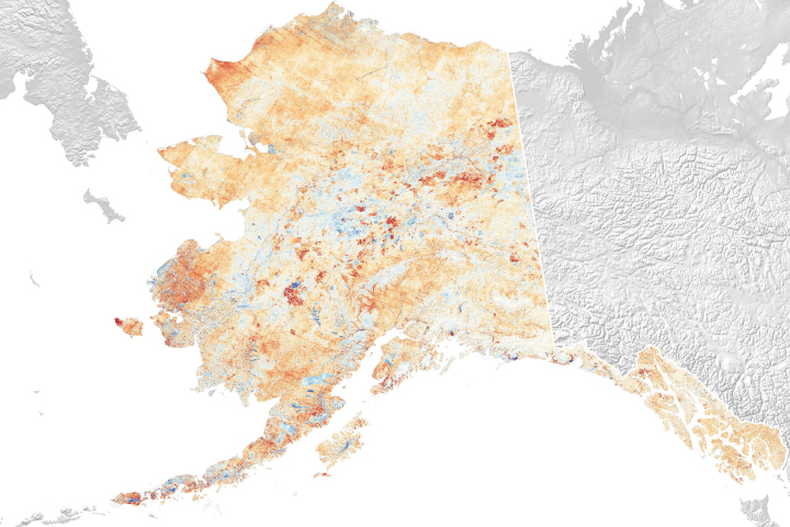
Erosion is one of the major changes to the state’s landscape in recent decades.
Published Feb 11, 2019
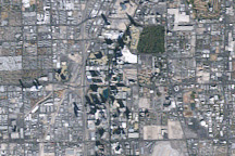
Las Vegas experienced rapid growth between 1984 and 2009, and the growth was recorded by NASA’s long-lived Landsat 5 satellite.
Published Mar 1, 2009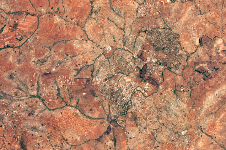
A fishing town became a bustling city after Malawi’s president moved the capital there.
Published Dec 19, 2018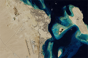
Over just a few decades, this Red Sea settlement has morphed from a small village into a haven for tourists.
Published Jan 15, 2015
What does Landsat have in common with the Gutenberg Bible, Tolstoy’s personal library, and the Book of Kells?
Published Nov 24, 2011
New research shows shrubs and other plants infiltrating the countryside and advancing northward in Quebec.
Published Dec 10, 2011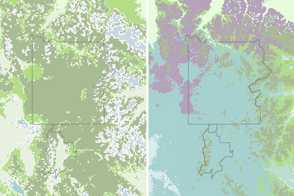
Climate change can make an area less suitable for some trees and plants and more suitable for others.
Published May 22, 2016
Climate change could lead to a net loss of plant life in some regions, and also could change the ratio of species that grow in them.
Published Oct 17, 2019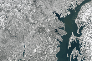
A severe winter storm coated the Mid-Atlantic of the United States with a thick blanket of snow.
Published Jan 24, 2016
A large and lasting footprint on the state’s landscape comes from wildfire.
Published Feb 21, 2019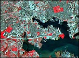
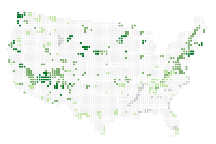
In National Parks across the United States, recent springs are among the earliest ever observed compared to the past 112 years.
Published Apr 6, 2018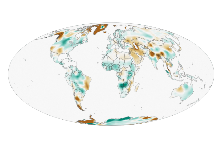
Wet landscapes are getting wetter and dry areas are getting drier due to a variety of factors, including water management, climate change, and natural cycles.
Published May 23, 2018
When the Landsat archive is combined with modern computing power, scientists can view the planet not just across space, but also time.
Published Jun 11, 2013Image of the Day Land Unique Imagery Human Presence Remote Sensing
A new data set from the NASA Earth Exchange shows projected changes in temperature in response to different scenarios of increasing carbon dioxide.
Published Jun 12, 2015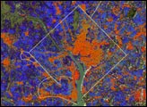

50 trillion pixels of Landsat data give researchers a lot of opportunities to look at Earth processes on scales from days to decades.
Published Apr 16, 2015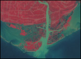
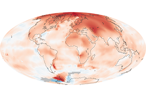
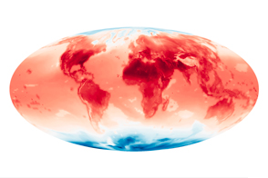
The average global temperature has increased by about 0.8°Celsius since 1880, and two-thirds of the warming occurred after 1975.
Published Dec 10, 2010alert message
