The VIIRS instrument on the Suomi NPP satellite captured this afternoon view of the dangerous storm.
Published Oct 28, 2012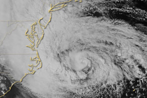
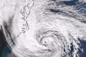
Special sensors on the Suomi NPP satellite captured this view of the storm and the East Coast.
Published Oct 29, 2012
Acquired October 23, 2012, this image shows Tropical Storm Sandy over the Caribbean Sea.
Published Oct 25, 2012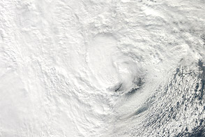
NASA’s Aqua satellite acquired this natural-color view of the storm just before it hit New Jersey.
Published Oct 29, 2012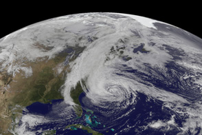
A U.S. geostationary weather satellite captured this image of the storm on the afternoon of October 28, 2012.
Published Oct 28, 2012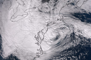
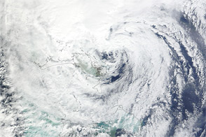
The dramatic late-season storm was observed shortly before making landfall on the U.S. Northeast Coast.
Published Oct 30, 2012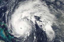
Hurricane Earl is a well-formed storm east of the Bahamas in this true-color image from September 1, 2010.
Published Sep 1, 2010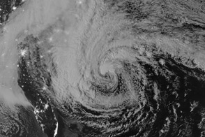
Special sensors on the Suomi NPP satellite captured this view of the storm and the East Coast of the United States as lit by moonlight.
Published Oct 29, 2012Image of the Day Atmosphere Water Severe Storms Human Presence

Satellites and astronauts observed the potent storm as it headed for landfall in the southeastern United States.
Published Sep 12, 2018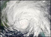
Acquired October 26, 2012, this natural-color image shows Hurricane Sandy east of Florida.
Published Oct 26, 2012alert message
