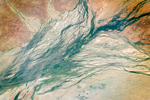
These wide Australian floodplains are unique on the planet. Scientists think they are caused by the extreme variation in water and sediment discharges from the local rivers.
Published Oct 10, 2016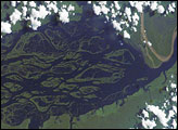
The wide, multi-island zone in the Rio Negro (Black River) shown in this astronaut photograph from September 2, 2006, is one of two, long “archipelagoes” upstream of the city of Manaus (not shown) in central Amazonia. Sixty kilometers of the total 120-kilemeter length of this archipelago appear in this image.
Published Dec 4, 2006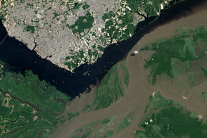
The confluence of the Rio Negro and Rio Solimões in Brazil is famous for unusual mixing patterns.
Published Sep 7, 2012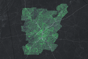
Researchers and conservationists are taking advantage of existing forests to bolster Atlanta’s natural defenses.
Published Nov 22, 2016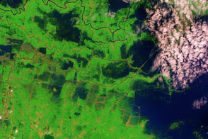
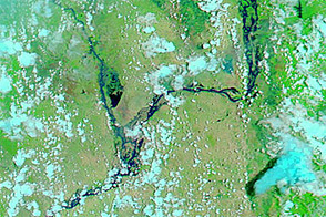
Acquired October 9, 2011, and November 5, 2005, these false-color images compare conditions in India’s Bihar Province, which experienced serious flooding in 2011.
Published Oct 20, 2011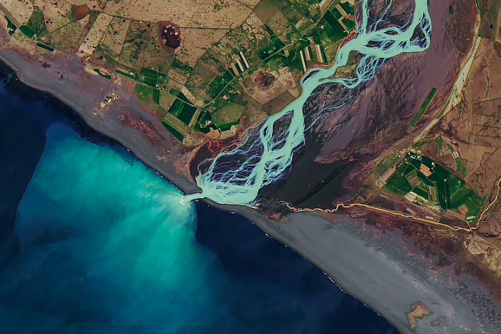
In a country rich with compelling geologic phenomena, even the rivers are connected to the landscape of fire and ice.
Published Aug 6, 2019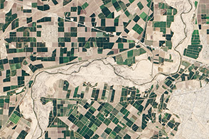
A one-time pulse of water is bringing a burst of new life to the lower Colorado River.
Published May 1, 2014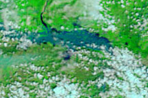
These false-color images show a portion of the Krishna River in southern India in flood stage on October 5, 2009 (top), and before the flooding on September 10, 2009 (bottom).
Published Oct 5, 2009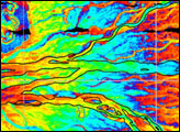
Acquired August 2, 2011, and March 6, 2011, these false-color images compare conditions along part of the Irrawaddy River in Burma, which rises substantially during the summer monsoon.
Published Aug 5, 2011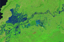
Like many rivers across the world, the Nzoia River in western Kenya pushes over its banks annually. In November 2008, the river burst through the dykes to flood the low-lying land around it.
Published Nov 22, 2008
Natural vegetation and irrigated farmland along the Snake River Plain in Idaho use dramatically different amounts of water during the growing season.
Published Jan 26, 2010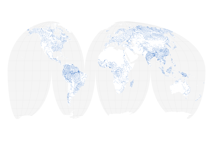
A new map of the world’s rivers and their widths shows that surface waterways are collectively wider and cover more area than previously thought.
Published Jul 18, 2018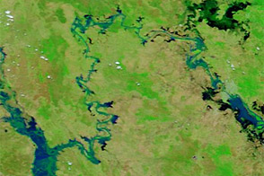
Acquired January 17 and 30, 2013, these images compare conditions along the Mackenzie-Fitzroy River system.
Published Jan 31, 2013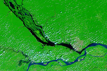
The impact of severe drought on the Negro River, a tributary of the Amazon River, and other rivers in the basin is dramatically evident in this pair of images, which show that every body of water has shrunk in 2010 compared to 2008.
Published Dec 11, 2010alert message
