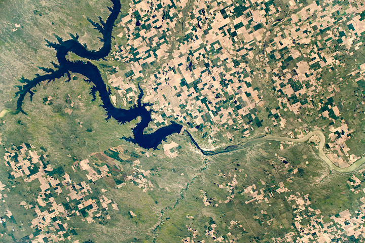
The fourth largest man-made reservoir in North America extends from Pierre, South Dakota, to Bismarck, North Dakota.
Published Dec 8, 2019
Acquired on August 11, 1984 (top), and September 1, 2009 (bottom), these true-color images show dramatic expansion of Devils Lake in North Dakota. In the 1990s, the lake began flooding, spilling into neighboring Stump Lake.
Published Feb 14, 2010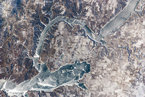
An astronaut aboard the International Space Station photographed frozen Lake Sakakawea while the air temperature near the lake was a frigid -24°C (-11°F).
Published Feb 27, 2012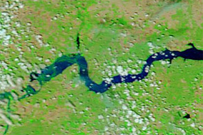
Acquired June 11, 2011, and June 4, 2010, these false-color images compare conditions around Williston, North Dakota, during the 2011 floods and the year before.
Published Jun 13, 2011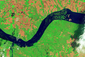
Acquired June 5, 2011, and May 19, 2005, these false-color images compare conditions around Lewis and Clark Lake in South Dakota.
Published Jun 7, 2011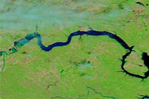
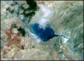
Acquired June 1, 2011, and June 4, 2010, these false-color images compare parts of the Missouri and Souris Rivers.
Published Jun 2, 2011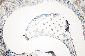
The meandering Missouri River doubled back on itself and formed this U-shaped lake.
Published Jan 13, 2014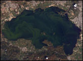
Lago de Valencia (Lake Valencia) is located in north-central Venezuela and is the largest freshwater lake in the country. The lake was formed approximately 2-3 million years ago due to faulting and subsequent damming of the Valencia River. The lake has been completely dry during several discrete periods of its geologic history. Since 1976 Lake Valencia water levels have risen due to diversion of water from neighboring watersheds—it currently acts as a reservoir for the surrounding urban centers (such as Maracay).
Published Nov 22, 2004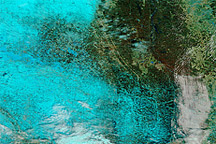
Acquired April 6, 2011, March 18, 2011, and March 7, 2011, these false-color images show melting snow and rising water levels in North Dakota, South Dakota, and Minnesota.
Published Apr 11, 2011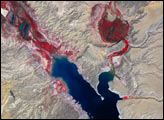
alert message
