
A series of fires spread through parts of the Canadian province, including these blazes near Lake Winnipegosis.
Published May 23, 2018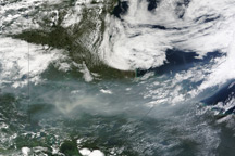
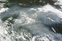
A ribbon of smoke snakes across western Canada in this true-color image from August 2, 2010.
Published Aug 3, 2010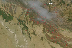
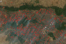
An arc of hundreds of individual fires wraps around the northern part of Cambodia, north of the Tônlé Sab lake, on February 9, 2009.
Published Feb 11, 2009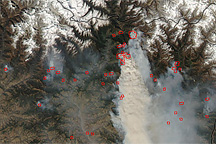
On March 12, 2009, the MODIS instrument on NASA’s Aqua satellite caught a glimpse of a relatively rare event: large–scale forest fires in the Himalaya Mountains of Nepal.
Published Mar 13, 2009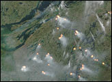
In 2013, Landsat 8 captured views of a wildfire burning through boreal forests in western Quebec on June 22 and July 8.
Published Jul 14, 2013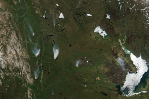
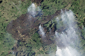
Fires burned in the Northwest Territories, spreading smoke across the region.
Published May 29, 2015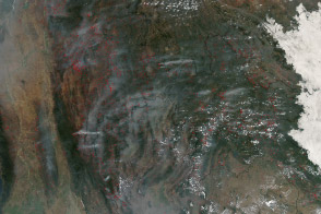
Hundreds of fires veiled northern Indochina in smoke as the traditional land-use burning season neared its peak.
Published Mar 19, 2014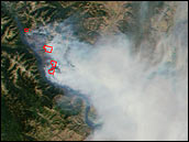
The U.S. Forest Service and National Interagency Fire Center used a new tool to help monitor active wildfires across the entire United States and decide how to best combat them.
Published Aug 21, 2001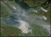
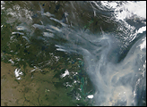
A thick, gray-brown cloud of smoke stretches across hundreds of kilometers over Canada’s Northwest Territories, Alberta, and Saskatchewan in this image from June 26, 2010.
Published Jun 28, 2010alert message
