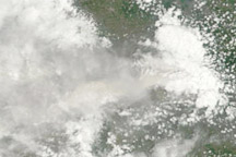
The eruption of Merapi Volcano continues after almost two weeks of nearly constant activity.
Published Nov 8, 2010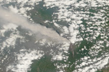
A thick plume of ash rose from Mount Merapi on November 10, 2010, when this photo-like image was taken. It is the most cloud-free image of the eruption to date.
Published Nov 11, 2010
NASA satellites detected ash from Mount Kelut nearly 20 kilometers (12 miles) in the atmosphere within two hours of the explosive February 13 eruption.
Published Feb 15, 2014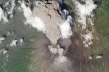
Satellite view of an ash plume and pyroclastic flow on Sakurajima Volcano.
Published Aug 20, 2010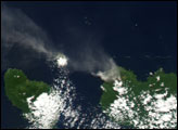
Batu Tara erupted ash over 2,000 meters high on March 15, 2010.
Published Mar 15, 2010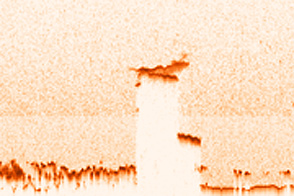
Acquired June 5, 2011, this image shows infrared nighttime observations and an atmospheric profile of the volcanic ash plume from Puyehue-Cordón Caulle in Chile.
Published Jun 14, 2011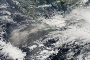
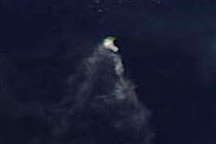
A major eruption occurred at Indonesia’s Kelud volcano on February 13, 2014.
Published Feb 14, 2014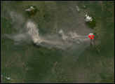
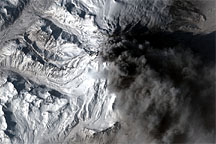
In contrast to the explosive eruptions of the previous week, ash emissions from Mount Redoubt became more frequent but confined to lower altitudes on March 30, 2009. The commercial satellite GeoEye-1 captured a high-resolution view of the volcano the same day.
Published Apr 1, 2009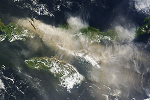
An explosive volcanic eruption in Indonesia has proved a hazard to air travelers.
Published Jun 3, 2014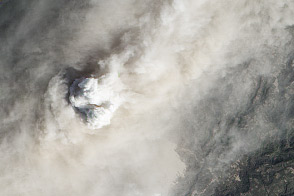
An intense eruption in Indonesia has covered the surrounding landscape in ash.
Published Jan 19, 2014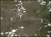
alert message
