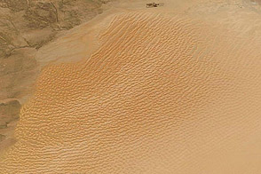
Sand dunes march through southwestern Libya today, but during the past several million years, this region was a lake district.
Published Dec 15, 2011
Using Landsat to track patterns in irrigation may help water managers sketch out a more sustainable future for the Ogallala Aquifer in the central United States.
Published Jul 9, 2018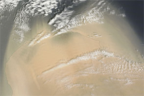
Acquired on April 17, 2012, this natural-color image shows thick dust blowing off the coast of Libya for the second consecutive day.
Published Apr 17, 2012
For more than 100 years, groups in the western United States have fought over water. During the 1880s, sheep ranchers and cattle ranchers argued over drinking water for their livestock on the high plains. In 1913, the city of Los Angeles began to draw water away from small agricultural communities in Owen Valley, leaving a dusty dry lake bed. In the late 1950s, construction of the Glen Canyon Dam catalyzed the American environmental movement. Today, farmers are fighting fishermen, environmentalists, and Native American tribes over the water in the Upper Klamath River Basin. The Landsat 7 satellite, launched by NASA and operated by the U.S. Geological Survey, documented an extreme drought in the area along the California/Oregon border in the spring of 2001.
Published Sep 8, 2001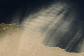
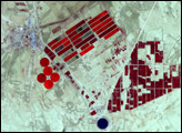
Acquired February 7, 2013, this natural-color image shows dust plumes and irrigation projects along Libya’s coast.
Published Feb 12, 2013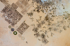
Different farming patterns mark various attempts to grow crops on the dry North African landscape.
Published Jan 2, 2017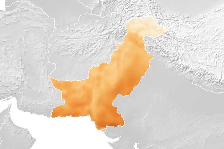
A project using NASA satellite data helps reduce overwatering and enhances crop yields for Pakistani farmers.
Published Oct 18, 2018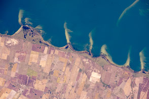
Sand spits and other wind- and wave-built patterns distinguish the south coast of Brazil.
Published May 2, 2016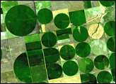
alert message
