In this active tectonic environment, salt squeezes through faults in the rock until it reaches the surface and flows like a glacier.
Published Oct 25, 2015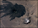
The Tibesti Mountain Range in northern Chad is one of the world’s least-studied volcanic regions. A look at the area from space, however, must intrigue vulcanologists. One of the Tibesti Mountain’s features is Tarso Toussidé.
Published Mar 18, 2007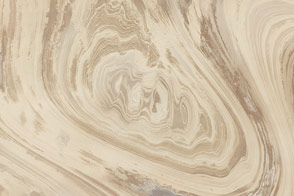
The rocks of Dasht-e Kavir tell tales of a much wetter environment millions of years ago.
Published Feb 17, 2013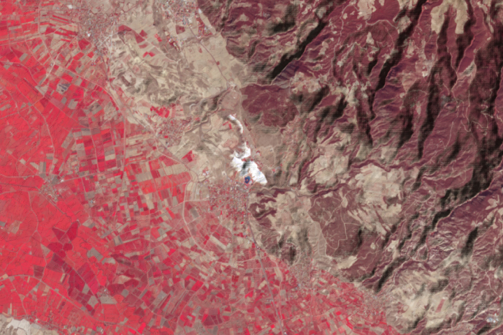
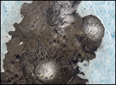
The hot springs at Pamukkale, Turkey, have produced the world’s largest deposit of travertine.
Published Nov 24, 2021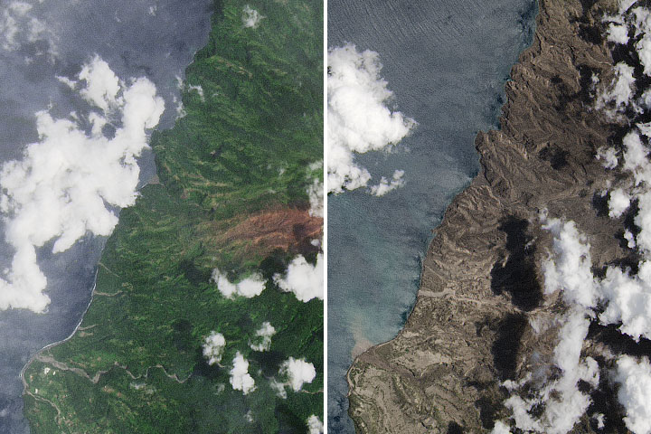
Following several explosive eruptions on the Caribbean island of Saint Vincent, volcanic ash poses myriad hazards in the air and on the ground.
Published Apr 28, 2021Image of the Day Atmosphere Land Volcanoes Human Presence Remote Sensing
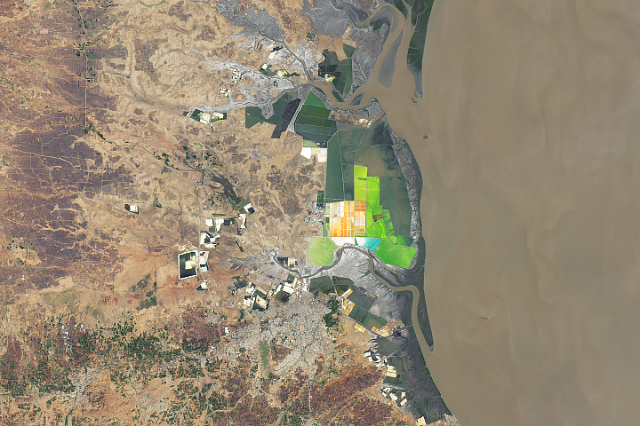
The west-central state of Gujarat accounts for nearly three-quarters of India’s annual salt production.
Published Oct 21, 2019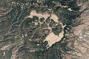
Acquired May 22, 2002, this natural-color image shows Valles Caldera in New Mexico.
Published May 22, 2011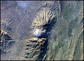
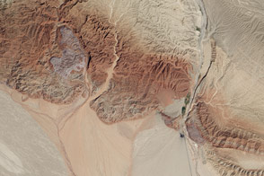
The Zagros Mountains in southwestern Iran present an impressive landscape of long linear ridges and valleys. Formed by collision of the Eurasian and Arabian tectonic plates, the ridges and valleys extend hundreds of kilometers. Stresses induced in the Earth’s crust by the collision caused extensive folding of the preexisting layered sedimentary rocks. Subsequent erosion removed softer rocks, such as mudstone and siltstone while leaving harder rocks, such as limestone and dolomite. This differential erosion formed the linear ridges of the Zagros Mountains. This astronaut photograph of the southwestern edge of the Zagros mountain belt includes another common feature of the region—a salt dome (Kuh-e-Namak or “mountain of salt” in Farsi).
Published Apr 17, 2006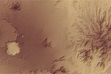
Two nearby volcanoes in the Tibesti Range Mountains in northern Chad exhibit dramatically different surface characteristics in a topographic image.
Published Mar 3, 2007alert message
