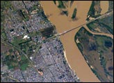
The Paraná River, in the center of the view, has been the principal transportation artery of central South America since the times of early colonization. Consequently, the river gave rise to the growth of port cities such as Argentina’s second city, Rosario (bottom center), now a major industrial center (pop. > 1.1 million). Rosario is the center of a vibrant local agricultural economy—intensive agriculture is visible on the left margin of the view. As such, Rosario is one of the key cities in South America’s MERCOSUR common market (Argentina, Brazil, Paraguay, Uruguay). Other cities have expanded along the river bank, especially northward (for example, Capitan Bermudez, top left).
Published Nov 7, 2005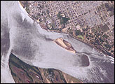
Corrientes, Argentina (sits on the east bank of the Paraná River, South America’s third largest river. Corrientes is located just inside Argentina, across the river from the southwestern tip of Paraguay.
Published Nov 8, 2004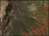

The capital of Paraguay has been hit hard by flooding.
Published Jan 17, 2016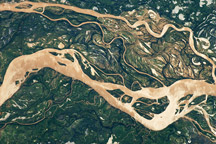
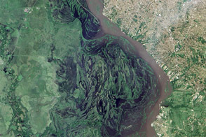
The Paraná River is South America’s second largest, and an important transportation route for landlocked cities in Argentina, Paraguay, Bolivia, and Brazil.
Published May 2, 2011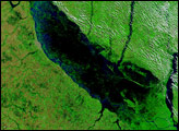
Taken July 8, 2011, this astronaut photograph shows the border region of Turkey, Armenia, and Iran, including the Aras River.
Published Jul 25, 2011
Acquired May 1, 2011, this natural-color image shows the James River completely filling the river valley near Jamesville, South Dakota.
Published May 3, 2011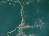
alert message
