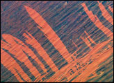
Bright orange fire scars show up the underlying dune sand in the Simpson Desert, 300 kilometers east of Alice Springs, in this astronaut photograph taken from the International Space Station in November, 2003. The fire scars were produced in a recent fire, probably during the same year. The image suggests a time sequence of events. Fires first advanced into the view from the lower left—parallel with the major dune trend and dominant wind direction. Then the wind shifted direction by about 90 degrees so that fires advanced across the dunes in a series of frond-like tendrils.
Published Jun 13, 2005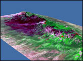
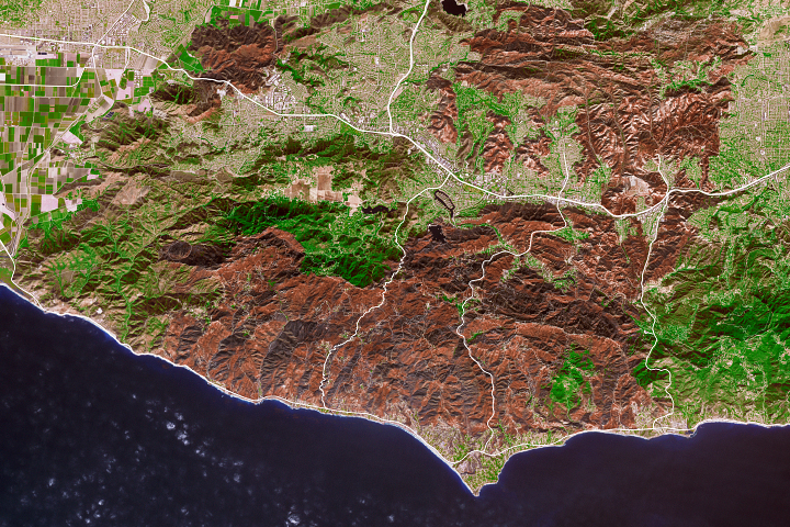
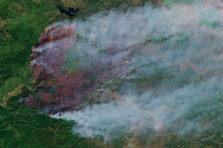
This false-color image illustrates the extent of the Station Fire in southern California.
Published Sep 15, 2009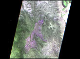

The blaze is the largest in Arizona this year and the largest in the United States right now.
Published Jun 16, 2020Image of the Day Heat Land Fires Human Presence Remote Sensing
As the destructive California fire nears full containment, it has left behind an expanse of charred land.
Published Nov 19, 2018
A wildfire in Fresno County, California has burned more than 28,000 acres.
Published Jul 20, 2020
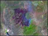
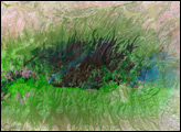
Land recently burned in Southern California’s Bull Fire is charcoal black in this false color image taken on August 1, 2010, when the fire was nearly contained.
Published Aug 2, 2010
The wildfire has burned more than 50,000 acres, making it the state’s largest blaze in 2019.
Published Sep 13, 2019
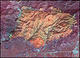
As of October 1, the Twitchell Canyon Fire continued to burn and had consumed 44,446 acres in the Fishlake National Forest.
Published Oct 1, 2010alert message
