
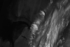
Melt ponds on the surface of Greenland’s ice sheet are an important indicator of the strength of the 2013 melt season.
Published Jul 9, 2013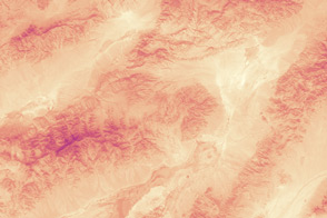
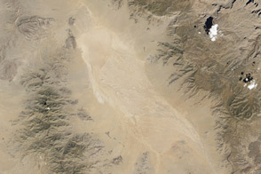
With the thermometer rising past 129 degrees Fahrenheit, Death Valley National Park may have set the record for the all-time hottest June day ever recorded in the United States.
Published Jul 4, 2013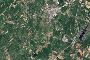
Modern remote sensing tools are helping to shed new light on the historic battle.
Published Jul 3, 2013
When the Landsat archive is combined with modern computing power, scientists can view the planet not just across space, but also time.
Published Jun 11, 2013Image of the Day Land Unique Imagery Human Presence Remote Sensing
One of LDCM’s sensors can detect faint cirrus clouds that can slightly alter a scene.
Published May 24, 2013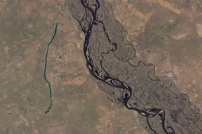
Fifty-six images were stitched together to present a seamless mosaic of what the newest Landsat saw on April 19, 2013. Here are some highlights of the satellite tour.
Published May 16, 2013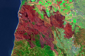
As wildfires wind down, teams of scientists hit the field to assess the damage. In many cases, they have help from satellites.
Published May 9, 2013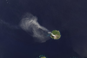
The TIRS instrument on the new Landsat Data Continuity Mission satellite helps scientists pinpoint fine differences in temperature.
Published May 7, 2013Image of the Day Atmosphere Heat Land Volcanoes Temperature Extremes
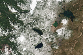
The Cascade Mountains and nearby forests and lakes provide a good test of the visual range of the new LDCM satellite.
Published Apr 30, 2013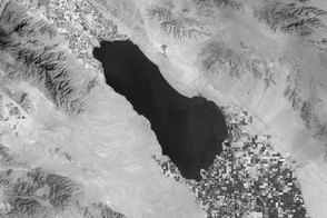
Thermal infrared imagery of the Southern California desert picks up the invisible water in the farmland around the Salton Sea.
Published Apr 23, 2013Image of the Day Heat Land Water Drought Temperature Extremes

The geology of the Grand Canyon has amazed visitors since John Wesley Powell first navigated the Colorado River in 1869. Now the Landsat Data Continuity Mission (LDCM) offers a new view of the gorge.
Published Apr 20, 2013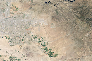
The Thermal Infrared Sensor on the newest Landsat provides insight into something invisible to human eyes: the temperature of the land surface.
Published Apr 18, 2013Image of the Day Heat Drought Human Presence Temperature Extremes
Researchers use ground and airborne instruments, as well as Landsat 7, to calibrate the imagery from the Landsat Data Continuity Mission.
Published Apr 16, 2013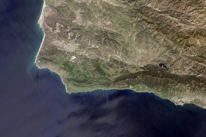
The new Landsat Data Continuity Mission satellite captured a glimpse of Vandenberg Air Force Base and the central California coast. Vandenberg has been the launch site for a majority of U.S. Earth science research missions.
Published Apr 11, 2013Image of the Day Land Water Unique Imagery Human Presence Remote Sensing
