Acquired February 5, 2011, this natural-color image shows sediment suspended along the Queensland coast, near the city of Townsville.
Published Feb 7, 2011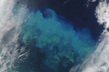
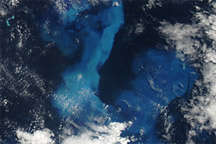
Streaks of brilliant blue water over Australia’s Great Barrier Reef in this true-color image reveals some of Cyclone Yasi’s impact on the ocean.
Published Feb 4, 2011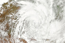
This image, from February 4, 2011, shows that ex-cyclone Yasi maintained its distinctive spiral shape after two days moving over Australia’s eastern coast and interior.
Published Feb 4, 2011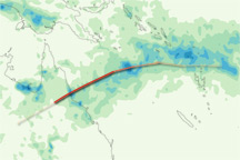
This color-coded map shows rainfall amounts associated with Tropical Cyclone Yasi from January 28 to February 3, 2011.
Published Feb 4, 2011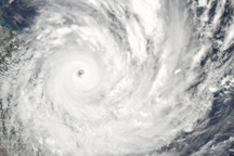
This natural-color image shows Cyclone Yasi approaching the east coast of Australia on February 2.
Published Feb 2, 2011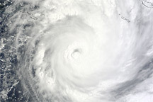
Acquired February 2, 2011 (local time), this natural-color image shows Tropical Cyclone Yasi approaching the Queensland coast.
Published Feb 2, 2011
Acquired January 30, 2011, this natural-color image shows Tropical Cyclone Yasi over the southern Pacific Ocean.
Published Jan 31, 2011