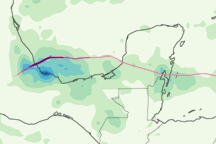
This color-coded map shows the rainfall and storm track associated with Hurricane Karl from September 14 to 18, 2010.
Published Sep 24, 2010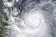
Acquired September 16, 2010, this natural-color image shows Hurricane Karl over the Gulf of Mexico and southern Mecixo.
Published Sep 17, 2010