Acquired November 9, 2009, this true-color image shows Tropical Storm Ida just off the coast of the southeastern United States.
Published Nov 11, 2009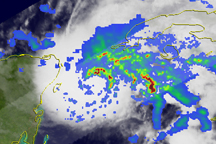
Bands of heavy rain circled the center of Hurricane Ida on November 8, when the storm was passing through the Yucatan Channel, but as the storm headed northward into the Gulf of Mexico on November 9, the rainfall bands became less organized.
Published Nov 9, 2009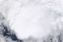
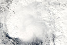
Acquired November 9, 2009, this true-color image shows Tropical Storm Ida over the Gulf of Mexico, southeast of the Mississippi River Delta.
Published Nov 9, 2009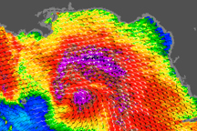
Hurricane Ida has a concentrated center of strong winds in this visualization of the storm’s wind field as observed by the QuikSCAT satellite on November 9, 2009.
Published Nov 9, 2009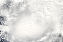
Acquired on November 7, 2009, this true-color image shows Tropical Storm Ida over the Caribbean Sea, between Mexico and Cuba.
Published Nov 9, 2009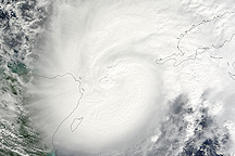
The eye of Tropical Storm Ida was poised over the Yucatan Channel when NASA’s Terra MODIS sensor captured this image on November 8, 2009.
Published Nov 9, 2009
Tropical Storm Ida sprawls over Nicaragua and Honduras in this natural-color image from November 5, 2009.
Published Nov 5, 2009