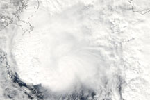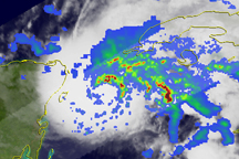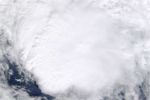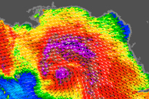

After making landfall in Central America, Tropical Storm Ida traveled northward across the Gulf of Mexico and toward the southeastern United States. The Moderate Resolution Imaging Spectroradiometer (MODIS) on NASA’s Aqua satellite captured this image of the storm on November 9, 2009, at 12:50 p.m. Central Standard Time (18:50 UTC). Ida maintains a roughly circular shape off the coasts of Louisiana, Mississippi, and Alabama. Immediately to the east, a wall of clouds stretches southward over the Gulf of Mexico west of Florida. Storm clouds also extend far inland over the Gulf states.
The U.S. National Hurricane Center reported that Ida made landfall in the United States around 7:00 a.m. Central Standard Time on November 10, 2009. The storm came ashore just northwest of Bon Secour, Alabama. Two hours later, the storm was roughly 50 kilometers (30 miles) east-southeast of Mobile, Alabama, and roughly 40 kilometers (25 miles) west-northwest of Pensacola, Florida. Although the storm’s wind speeds had decreased, it was expected to bring as much as 15 centimeters (6 inches) of rain to the eastern Gulf Coast, the southeastern United States, and the southern mid-Atlantic states.
NASA image by Jeff Schmaltz, MODIS Rapid Response Team. Caption by Michon Scott, NASA Earth Observatory.
Image of the Day Atmosphere Water Severe Storms
Acquired November 9, 2009, this true-color image shows Tropical Storm Ida just off the coast of the southeastern United States.
Image of the Day for November 11, 2009
Late in the Atlantic hurricane season, Tropical Storm Ida soaked Central America in the first week of November 2009.


