
Rapid growth in several cities along the Pearl River Delta has made a Chinese megacity larger and more populous than any other urban area in the world.
Published Sep 15, 2015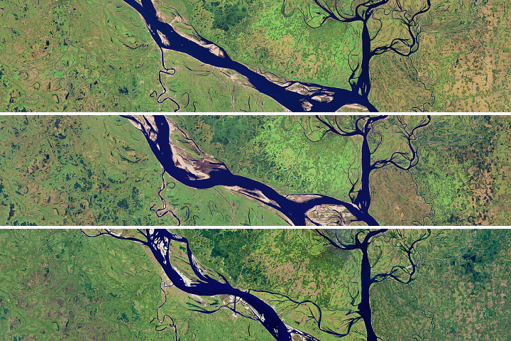
The lower portion of the Padma River has wide meandering curves, an indicator of extensive erosion.
Published Aug 28, 2018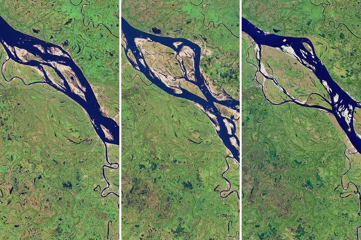
As the shape of river changes over decades, the upper reaches show the most change, particularly with widening and meandering bends.
Published Aug 13, 2018
Floods and new infrastructure have long since separated the distinctive bend in the river that was portrayed by landscape painter Thomas Cole in 1836.
Published Oct 15, 2017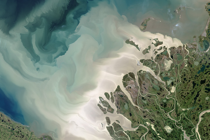
Canada’s largest and longest river delivers vast amounts of fresh water and sediment to the sea.
Published Aug 6, 2017
Acquired September 20 and November 23, 2002, these natural-color images show agricultural fields in Jizzax Province at the end of summer and in late fall.
Published Apr 24, 2011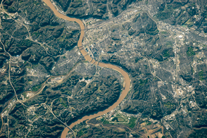
Steep bluffs and curving bends give this stretch of the Ohio River a distinctive look.
Published May 23, 2016
Trees have long been cherished here for timber and for the colors they bring to “the Fall Rhapsody.”
Published Oct 24, 2020
Acquired May 1, 2011, this natural-color image shows the James River completely filling the river valley near Jamesville, South Dakota.
Published May 3, 2011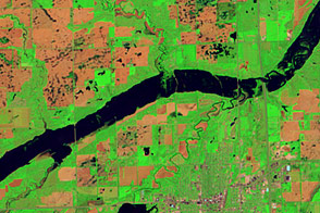
Acquired June 5, 2011, and May 19, 2005, these false-color images compare conditions along the James River near Mitchell, South Dakota.
Published Jun 7, 2011
As they prepare for a satellite that will measure the height and areal extent of rivers in unprecedented detail, hydrologists have released a better map of North American river widths.
Published Jul 9, 2015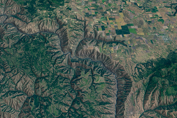
The Salmon River in Idaho, one of the longest free-flowing rivers in the United States, rushes through a geologic wonderland of wooded ridges, eroded bluffs, and stone towers and crags.
Published Jul 22, 2020
A satellite image offers inky evidence of the organic-rich freshwater that the Suwannee River delivers to the Gulf of Mexico.
Published Oct 27, 2018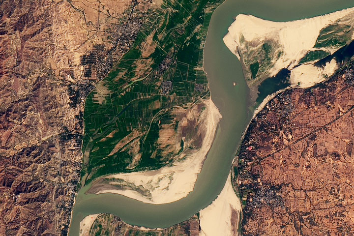
One of the most impressive archeological sites in Asia, Bagan is a key center for historic Buddhist culture.
Published Feb 24, 2020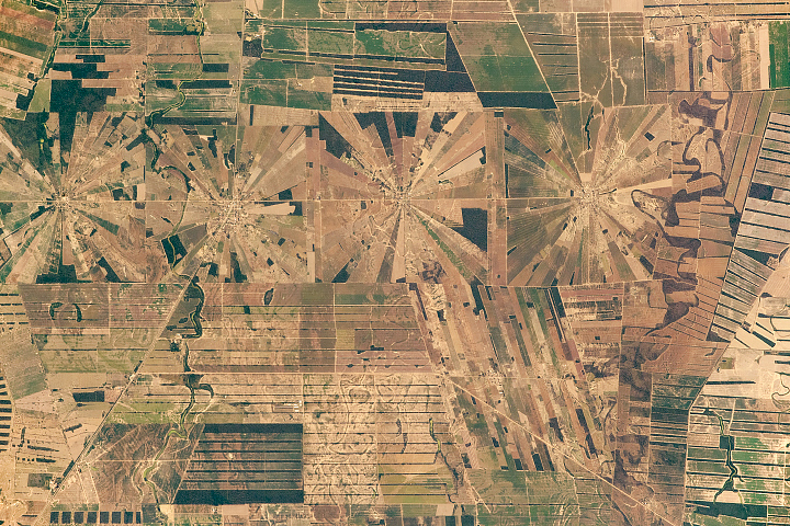
Peculiar shaped agricultural fields comprise what may be a unique pattern on Earth for its size and repetitiveness.
Published Mar 25, 2019
In the past few centuries, a river in northwestern Canada stopped wandering and assumed a more direct route to the sea.
Published Sep 4, 2012
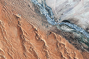
Acquired April 2, 2011, and February 27, 2011, these natural-color images show rising waters on the Kuiseb River, which flowed all the way to the Atlantic Ocean for the first time in decades.
Published Apr 12, 2011
The ephemeral waters crossing the parched landscape of Namibia nurture a riparian ecosystem and a native people.
Published Nov 29, 2014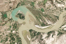
Between 1992 and 2009, a section of the lower Indus River changes course following the formation of an oxbow lake.
Published May 9, 2010