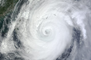
The storm was headed for Okinawa and the main island of Japan in late September 2012.
Published Sep 29, 2012
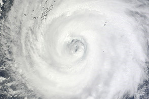
Typhoon Halong churned south of Japan when the Aqua satellite acquired this image on August 6, 2014.
Published Aug 6, 2014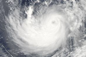
On July 15, 2011, the MODIS instrument on NASA's Aqua satellite captured this view of Typhoon Ma-on.
Published Jul 16, 2011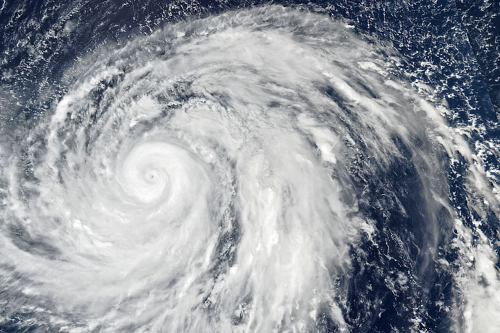
The typhoon grew from a tropical storm to a category 5 storm in less than a day.
Published Oct 8, 2019
The storm was expected to intensify significantly and might make landfall on the Japanese mainland.
Published Oct 21, 2017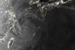
As the typhoon churned the East China Sea and pounded Okinawa with flooding rains, the larger Japanese islands braced for landfall.
Published Jul 10, 2014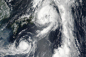
Acquired August 4, 2011, this natural-color image shows Typhoon Muifa moving toward Mainland China.
Published Aug 4, 2011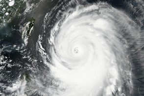
Poised to go ashore over Japan, Typhoon Roke is a large, well-developed storm in this image from September 20, 2011.
Published Sep 21, 2011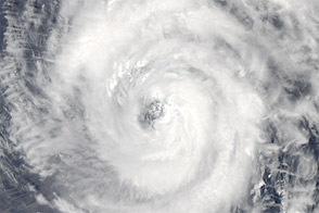
Acquired May 25, 2012, this natural-color image shows Typhoon Sanvu over the western Pacific Ocean.
Published May 25, 2012
Acquired October 16, 2009, this true-color image shows Typhoon Lupit spanning several hundred kilometers as it hovers over the Pacific Ocean east of the Philippines.
Published Oct 16, 2009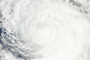
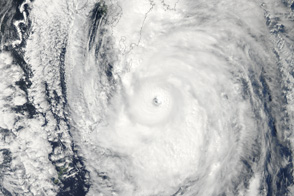
Acquired July 18, 2011, this natural-color image shows Typhoon Ma-on approaching southern Japan.
Published Jul 18, 2011