The Earth Observatory has published its last Image of the Day on this website. Please join us on our new home at science.nasa.gov/earth/earth-observatory.
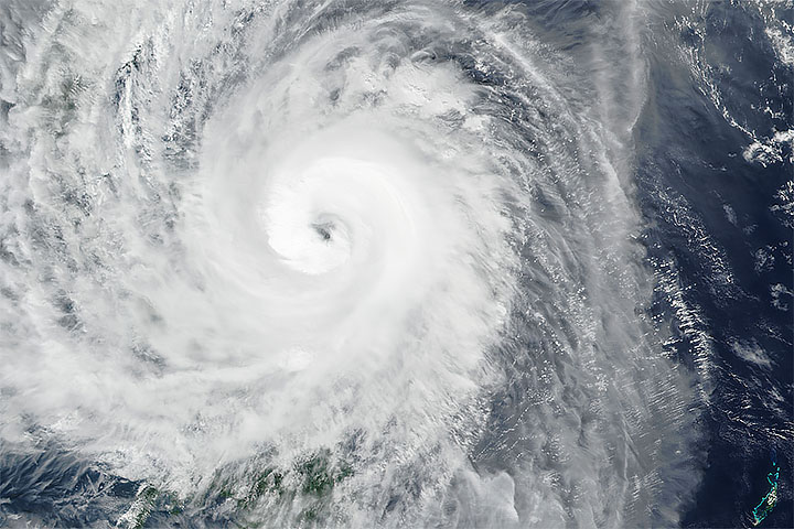
Spinning in the western Pacific Ocean, Super Typhoon Hagibis is making headlines for the speed at which it intensified. In less than a day, between October 6–7, 2019, wind speeds increased by 100 miles per hour as Hagibis grew from a tropical storm to a category 5 typhoon.
At 1:25 p.m. Chamorro Standard Time (03:25 Universal Time) on October 8, 2019, the Visible Infrared Imaging Radiometer Suite (VIIRS) on the NOAA-NASA Suomi NPP satellite acquired this natural-color image of Hagibis near the Mariana Islands. The storm’s sustained winds had decreased slightly to 250 kilometers (155 miles) per hour, making it the equivalent of a category 4 storm on the Saffir-Simpson wind scale.
According to news reports, the storm’s center passed over an uninhabited island in the Marianas, but strong winds could continue to threaten islands in the region even as the storm moves away. Forecasts show the storm gradually weakening throughout the week as it moves north toward Japan.
NASA Earth Observatory image by Joshua Stevens, using VIIRS data from NASA EOSDIS/LANCE and GIBS/Worldview, and the Suomi National Polar-orbiting Partnership. Text by Kathryn Hansen.