
When the Landsat archive is combined with modern computing power, scientists can view the planet not just across space, but also time.
Published Jun 11, 2013Image of the Day Land Unique Imagery Human Presence Remote Sensing

What does Landsat have in common with the Gutenberg Bible, Tolstoy’s personal library, and the Book of Kells?
Published Nov 24, 2011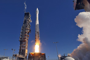
LDCM extends an unprecedented four-decade record of global land observations.
Published Feb 12, 2013
50 trillion pixels of Landsat data give researchers a lot of opportunities to look at Earth processes on scales from days to decades.
Published Apr 16, 2015
A composite view of the United States represents one of the ways scientists are exploring Landsat 8’s capabilities.
Published Feb 11, 2014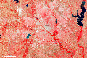
This image of the Dallas metro area was the very first image in the archives of the Landsat mission, launched in 1972.
Published Jul 23, 2012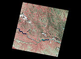
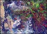
The first scene from Landsat 7 was acquired on Sunday, April 18. The scene includes the Sioux Falls and Yankton areas.
Published Apr 26, 1999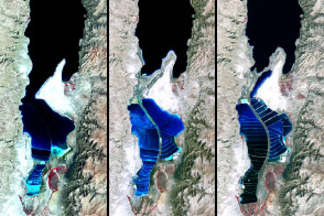
The lake between Israel and Jordan provides a bounty of salt and of history.
Published Apr 6, 2012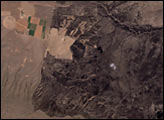
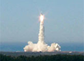
Landsat 7, NASA's newest Earth-observing satellite, launched without a hitch on April 15, 1999, at 2:32 p.m. EST from Vandenberg Air Force Base, California.
Published Apr 19, 1999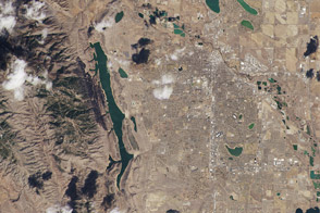
One of the satellite’s first uncalibrated images showed where the Front Range meets the Great Plains in Colorado.
Published Mar 22, 2013