
Acquired October 23, 2012, this image shows Tropical Storm Sandy over the Caribbean Sea.
Published Oct 25, 2012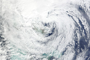
Acquired October 26, 2012, this natural-color image shows Hurricane Sandy east of Florida.
Published Oct 26, 2012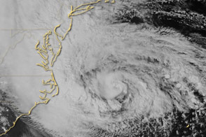
Special sensors on the Suomi NPP satellite captured this view of the storm and the East Coast.
Published Oct 29, 2012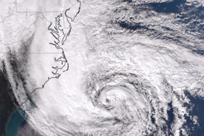
The VIIRS instrument on the Suomi NPP satellite captured this afternoon view of the dangerous storm.
Published Oct 28, 2012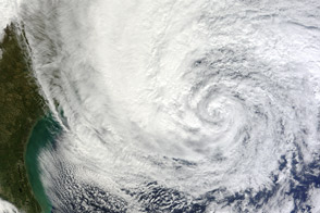
As the U.S. East Coast prepared for landfall of the potent storm, Sandy churned up the Atlantic Ocean along the Gulf Stream.
Published Oct 28, 2012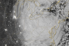
Acquired October 30, 2012, this nighttime image shows Sandy after the storm made landfall.
Published Oct 30, 2012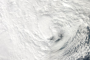
NASA’s Aqua satellite acquired this natural-color view of the storm just before it hit New Jersey.
Published Oct 29, 2012
A U.S. geostationary weather satellite captured this image of the storm on the afternoon of October 28, 2012.
Published Oct 28, 2012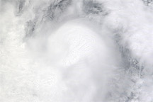
Acquired August 25, 2010, this natural-color image shows Hurricane Frank just off the coast of Mexico.
Published Aug 26, 2010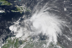
Tropical Storm Matthew gained strength and reached hurricane status on September 29, 2016.
Published Sep 30, 2016
Acquired August 23, 2009, this true-color image shows Hurricane Bill missing the U.S., apparently headed northward toward Canada.
Published Aug 23, 2009