Water vapor reveals the invisible drivers that are bringing snow, ice, and rain to much of the United States over the holiday travel period.
Published Nov 27, 2013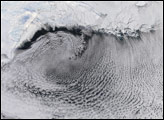
Vortex wind patterns swirling over sea ice in the Bering Sea in mid-January 2006 have created stunning cloud street patterns.
Published Jan 25, 2006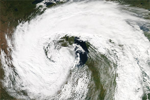
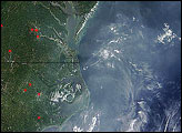
Acquired September 26, 2011, this natural-color image shows a mid-latitude cyclone over the eastern United States.
Published Sep 27, 2011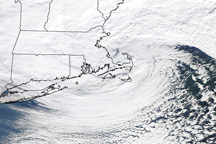
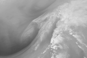
The storm that hammered New England on January 12, 2011, is a classic, comma shaped Nor’easter, as shown in this photo-like image.
Published Jan 13, 2011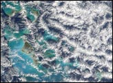
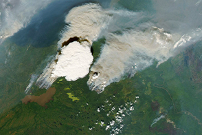
Events on Earth’s surface can affect the development and shape of clouds in the sky.
Published Jan 3, 2017Image of the Day Heat Land Water Snow and Ice Remote Sensing
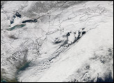
A classic nor'easter blew across the East Coast of the United States on February 11 and 12, 2006, dumping heavy snow from Virginia to Massachusetts.
Published Feb 14, 2006Image of the Day Atmosphere Land Life Unique Imagery Snow and Ice

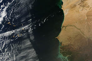
Dry air surging off the western coast of Africa ran into a wall of moist air over the Atlantic, creating a distinctive line in a marine cloud layer.
Published Feb 28, 2013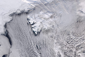
Cool air moving across Arctic sea ice gives rise to long parallel bands of cumulus clouds over the Norwegian Sea.
Published Mar 31, 2016Image of the Day Atmosphere Land Water Unique Imagery Snow and Ice
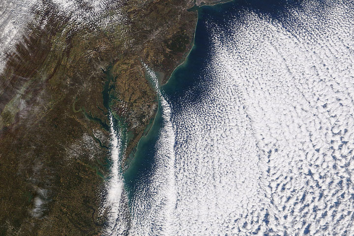
Cold air moving over relatively warm ocean water produced a pattern of clouds that lined up in organized rows.
Published Nov 14, 2019