The Earth Observatory has published its last Image of the Day on this website. Please join us on our new home at science.nasa.gov/earth/earth-observatory.
Phytoplankton blooms popped up in the panhandle region of Alaska and along the coast of British Columbia slightly later in the year than the main blooms that tend to occur in May. News outlets in Juneau reported reddish-brown algae, while cloudy blue-green patches have been seen along the southeast coast.
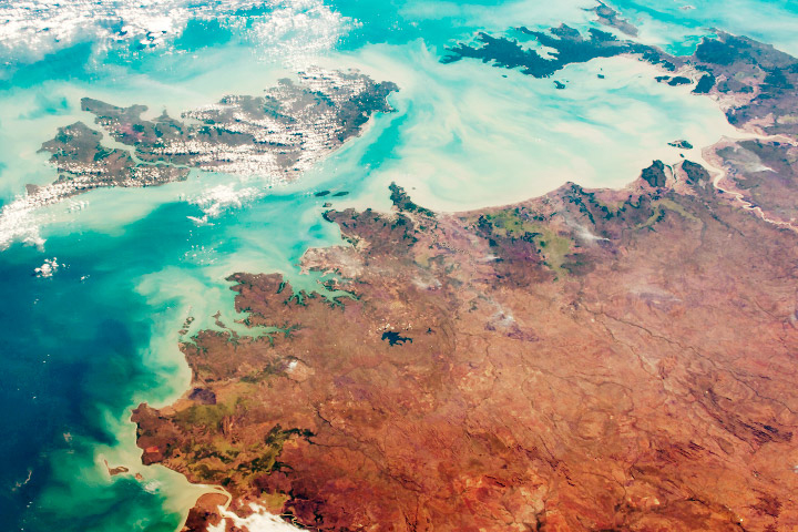
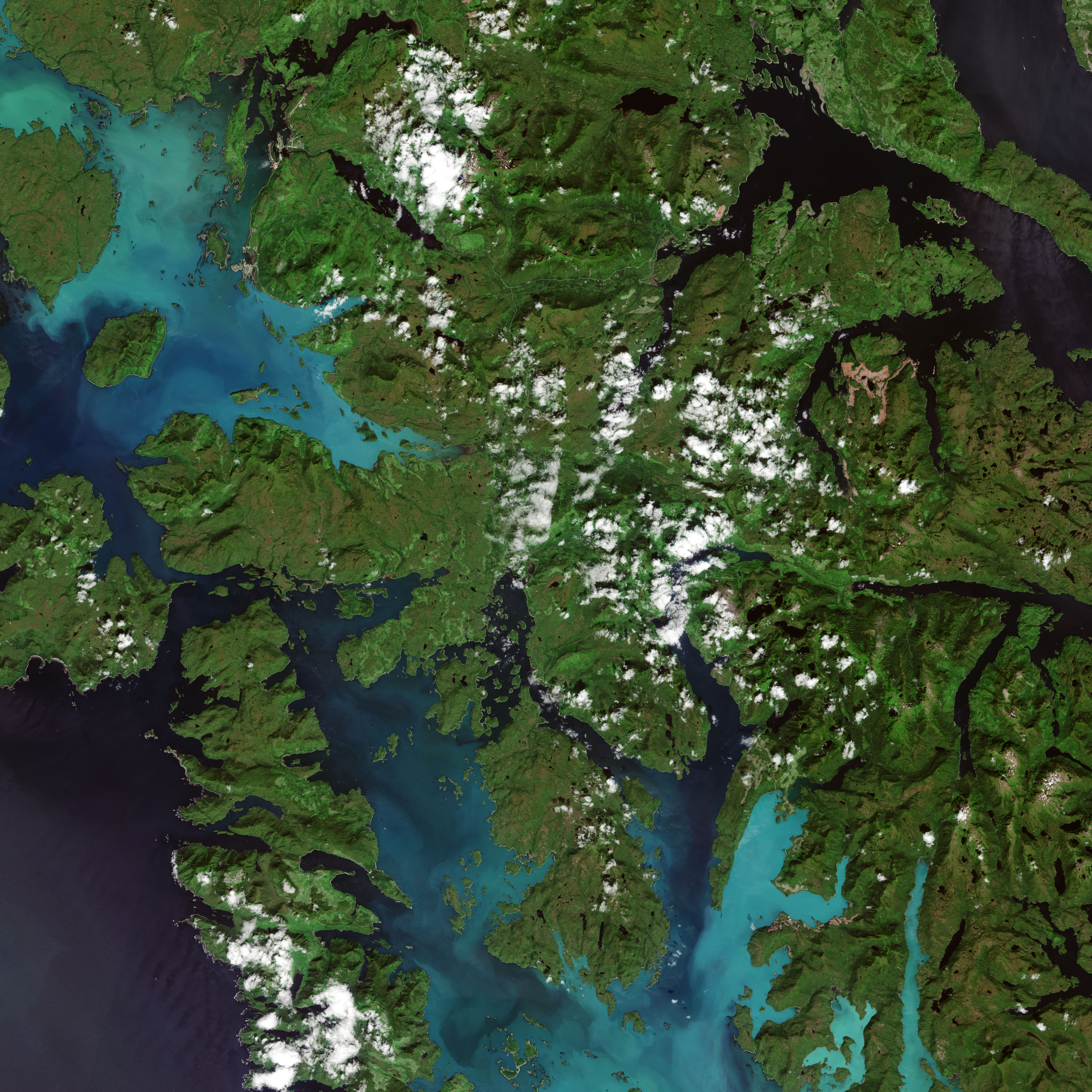
The satellite image above shows milky blue waters near Prince of Wales Island. The discoloration is thought to be caused by a bloom of non-toxic phytoplankton known as coccolithophores. It is most likely a patch of Emiliania huxleyi, although a water sample would have to be analyzed in a lab to confirm the species. Coccolithophores have mineral plates made out of limestone, so they have a chalky appearance when seen from space. The image was acquired on July 20, 2018, by the European Space Agency's Sentinel-2.
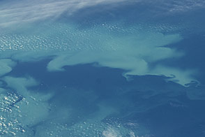
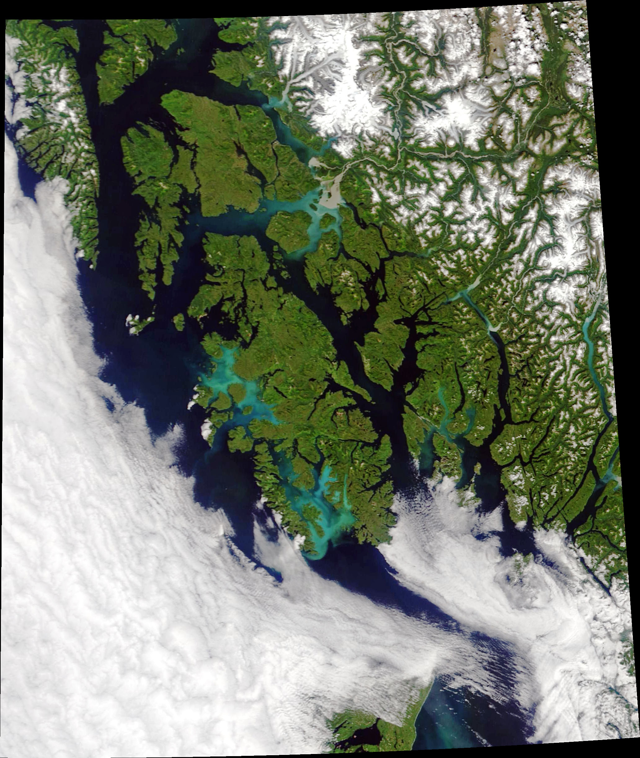
The image below shows a wider view of the area on July 21, as observed by Moderate Resolution Imaging Spectroradiometer (MODIS) on NASA's Terra satellite.
This year, the temperatures in southeast Alaska have been odd, said Jeanette Gann, an oceanographer at the NOAA Alaska Fisheries Science Center in Juneau, Alaska. “Spring was unusually cold, and it took a while for things to get going,” said Gann. Then, in July, warmer than normal temperatures hit parts of southeast Alaska.
Warming temperatures can create a new set of conditions that the ecosystem isn’t accustomed to, according to Suzanne Strom, a marine scientist at Western Washington University. “If it's unusually warm,” said Strom “that will create an opening in the ecosystem for a group that isn't normally there or abundant to take off.”
Emiliania huxleyi like warm, stratified, and low nutrient conditions. “It has been suggested in recent studies that there is a poleward movement of this type of phytoplankton,” said Aimee Neeley, an oceanographer at NASA’s Goddard Space Flight Center. For instance, E. huxleyi blooms have only appeared in the Bering Sea since the late 1970s, with research suggesting that warming and freshening of the Bering Sea have enabled the blooms.
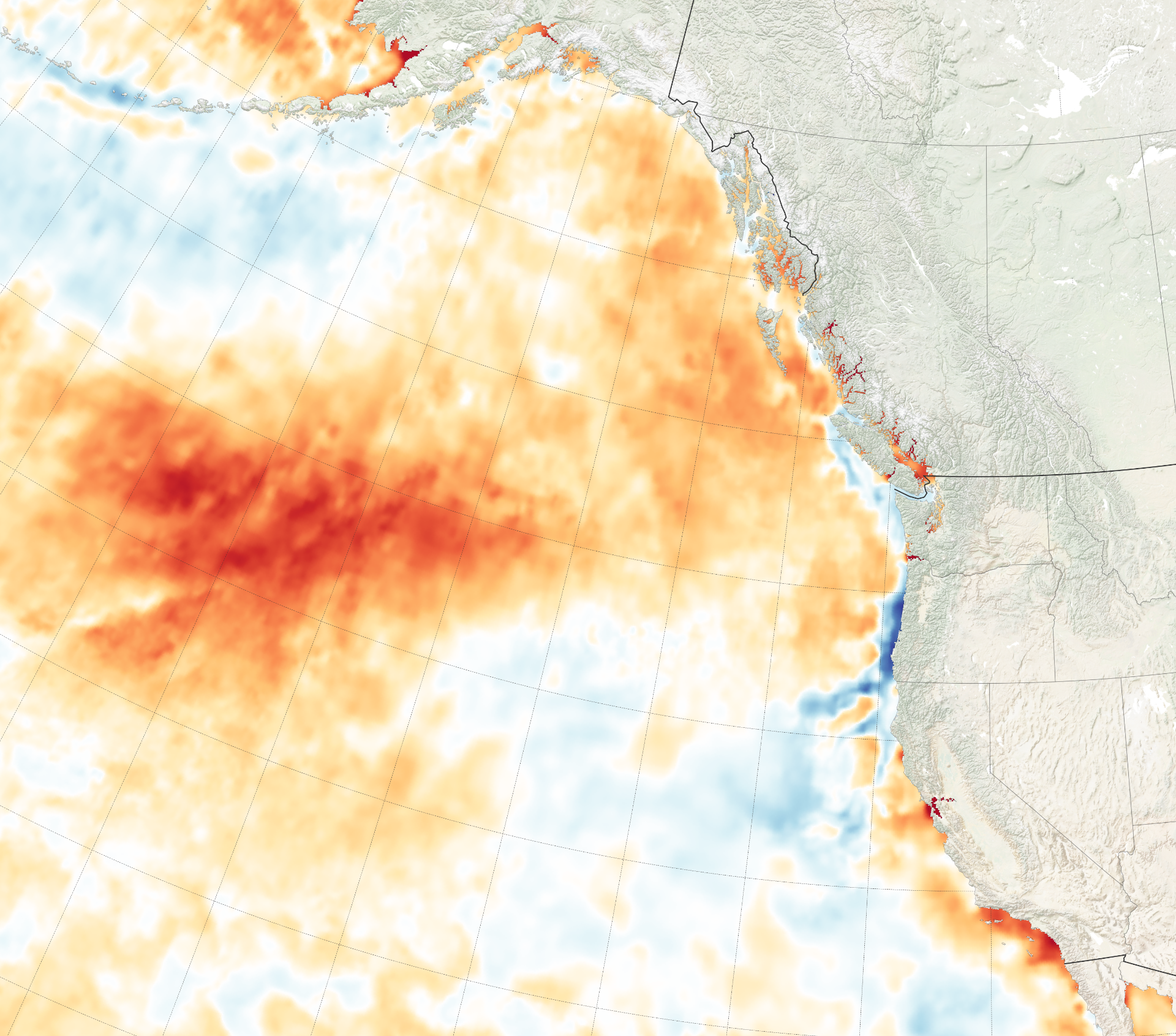
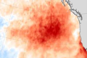
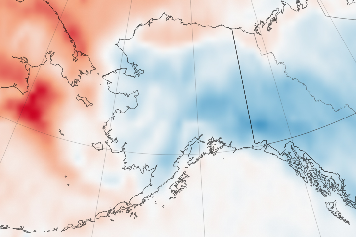
The visualization above shows sea surface temperature anomalies for July 20. The map does not show absolute temperatures. Instead, it shows how much the surface layer was above or below the long-term average temperature for this time of year. The data were compiled by Coral Reef Watch, which blends observations from the Suomi NPP, MTSAT, Meteosat, and GOES satellites with computer models.
The large, warm mass in the Pacific Ocean is the northeast side of the Kuroshio Current, which moves warm water from near Japan towards the polar region. Higher temperatures, probably a result of warmer than usual summer air temperatures, are also visible in the inlets of British Columbia.
NASA Earth Observatory images by Joshua Stevens, using MODIS data from LANCE/EOSDIS Rapid Response, sea surface temperature data from Coral Reef Watch, and modified Copernicus Sentinel data (2018) processed by the European Space Agency. Story by Kasha Patel.