
Drawing information from a combination of sources, including GPS tracking and hunting reports, wildlife experts in Wisconsin are improving their understanding of the size and location of the state’s deer population. But information about population and location can tell you only so much. How an animal behaves, and how animals are using specific locations, are also important to understand. That’s because animal behavior can be a good indicator of how the population will respond to future natural events and manmade changes.
“The bottom line is, we want to know how many deer are there,” said John Clare, a doctoral student at University of Wisconsin-Madison. “But it is equally important to understand why animals might be more or less abundant in certain areas.”
Previously, information on the behavior Wisconsin’s deer has been scarce. “In many cases, we have no idea why animals are in certain locations or what they’re doing in those locations,” Clare said.
To find out, Clare and colleagues are analyzing data acquired through a citizen science project called Snapshot Wisconsin. So far, more than 1,000 people in Wisconsin have volunteered to set up and monitor more than 1,100 trail cameras; they have collected more than 19 million images. Image classification is performed using crowd-sourcing: people around the world can view the snapshots at a web-based portal and help classify the wildlife in the images.
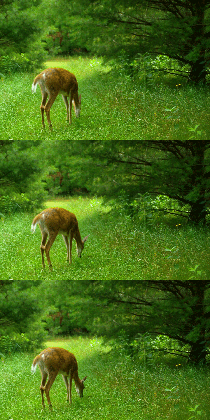
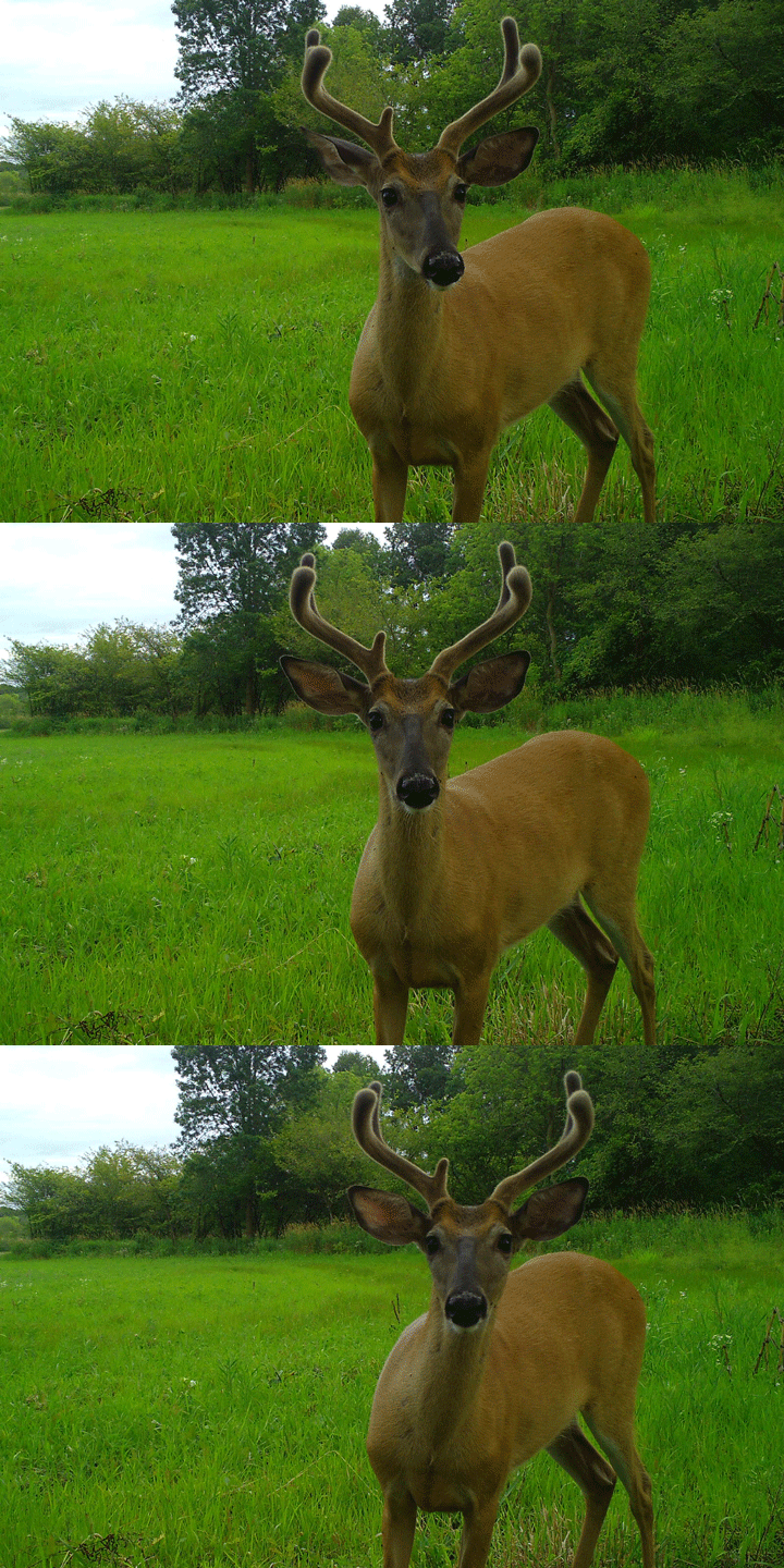
Beyond asking citizen scientists to identify the basics—animal species and the numbers of adults and offspring—the researchers added questions about behavior. Do the deer appear to be vigilant, foraging, moving, resting, or interacting? Or are they just staring at the camera?


Foraging and vigilance are two of the more important behaviors, and both are visible in these photographs captured by Snapshot Wisconsin cameras. The top sequence shows a foraging deer: its head is down below its shoulders, and it appears to be eating vegetation. The second image series shows a vigilant deer: head up, ears erect, alert posture.
“Animals need to forage to survive, but how frequently animals forage at specific locations can help pinpoint important habitats and provide insights into where animals might be facing energetic pressures,” Clare said. “Vigilance is a more selective behavior, but it gives us a sense of how animals perceive specific locations: they might be more vigilant in areas where they perceive greater risk or in food patches that are particularly valuable, where the relative cost of moving somewhere else to eat is pretty high.”
To better understand how deer behavior varies across the state, the scientists associated behaviors and geographic locations with environmental metrics, including some—like land surface temperatures and vegetation greenness (productivity)—that are detectable by NASA’s Terra and Aqua satellites. From these relationships, they have developed a model that predicts the likelihood of deer exhibiting these behaviors on any given day across Wisconsin.
The map at the top of the page shows modeled results for May 15 of a typical year. It shows where deer are most likely to be foraging (green) or vigilant (pink). Areas where deer are likely to exhibit both behaviors are teal; white depicts areas with no dominant behavior pattern. Notice that there are areas in northern Wisconsin with lots of pink—vigilant behavior and not much foraging. That could be because this part of the state is colder, has more predators, or less productive vegetation.
“We’re in the early stages here,” Clare said. “There’s a lot of theory linking behavior to populations, but it has been traditionally pretty difficult to examine these things at big scales. One critical piece we need to build into this is predicting where deer are physically present across the year. A predicted behavior doesn’t mean much if there’s no animal there to do it.”
A better grasp on details like these could one day help ecologists make better predictions of future deer locations and population changes. That information, in turn, could aid in wildlife management decisions.
“I don’t see Wisconsin deer managers making decisions on this particular map, but down the road, information about how animals perceive and use the landscape has the potential to work a little like an early warning system,” Clare said. “It’s one way to get a sense of how a population might respond without waiting for the population to take a hit.”
NASA Earth Observatory image by Joshua Stevens, using data courtesy of John Clare/University Wisconsin. Story by Kathryn Hansen.