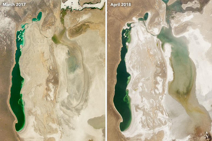
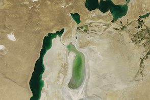
The basins of the Aral Sea were once part of a large, contiguous body of water. However, decades of intensive irrigation and declining water levels have caused it to separate into distinct lakes.
The North Aral Sea (sometimes called the Lesser Aral Sea) is the smallest by area and fed by the Syr Darya River. It split from the South Aral Sea in the mid-1980s and was dammed in 2005 to prevent all of its water from draining into the lower-elevation South Aral Sea.
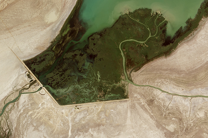
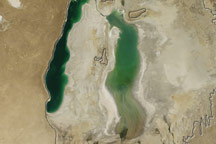
The larger South Aral Sea (sometimes called the Greater Aral Sea) is fed by the Amu Darya. It has two main parts—the lake in its eastern basin is larger by area, while the one in its western basin is deeper. The depth of the western basin prevents the lake area from fluctuating much, and water managers keep the size of the North Aral Sea roughly constant by controlling how much water the dam releases. In contrast, the lake in the eastern basin is prone to large fluctuations in area and is generally the quickest to respond to wet and dry periods or seasonal changes.
This pair of photographs, taken from the International Space Station, highlights this tendency. The image on the left was taken on March 8, 2017, when water levels in the eastern lobe were relatively low. At the time, much of the surface water in the region was spread across northern Kazakhstan as snow.
Over the summer of 2017, melting snow and seasonal rain caused the size of the lake in the eastern basin to expand considerably. It retained its size throughout fall and winter. By the spring of 2018, a new round of melting had expanded the lake even more. The photograph on the right shows the basin as it appeared on April 11, 2018.
Astronaut photograph ISS055-E-18638 was acquired on April 11, 2018, with a Nikon D5 digital camera using a 22 millimeter lens. Astronaut photograph ISS050-E-55556 was acquired on March 8, 2017, with a Nikon D4 digital camera using a 50 millimeter lens. Both images are provided by the ISS Crew Earth Observations Facility and the Earth Science and Remote Sensing Unit, Johnson Space Center. The images were taken by members of the Expedition 55 and Expedition 52 crews. The images have been cropped and enhanced to improve contrast, and lens artifacts have been removed. The International Space Station Program supports the laboratory as part of the ISS National Lab to help astronauts take pictures of Earth that will be of the greatest value to scientists and the public, and to make those images freely available on the Internet. Additional images taken by astronauts and cosmonauts can be viewed at the NASA/JSC Gateway to Astronaut Photography of Earth. Caption by Adam Voiland.
alert message


